Population and Housing Censuses Directorate - Midterm Review Mission Summary

The Population and Housing Censuses Directorate (PHCD) is actively involved in implementing various censuses, updating geographical databases, and conducting analytical studies. They are preparing for the next census in 2027 by learning from international experiences and modern methodologies. The directorate also publishes analytical studies and atlases, participates in data dissemination projects, and provides statistical and spatial data to meet public needs.

Population and Housing Censuses Directorate - Midterm Review Mission Summary
PowerPoint presentation about 'Population and Housing Censuses Directorate - Midterm Review Mission Summary'. This presentation describes the topic on The Population and Housing Censuses Directorate (PHCD) is actively involved in implementing various censuses, updating geographical databases, and conducting analytical studies. They are preparing for the next census in 2027 by learning from international experiences and modern methodologies. The directorate also publishes analytical studies and atlases, participates in data dissemination projects, and provides statistical and spatial data to meet public needs.. Download this presentation absolutely free.
Presentation Transcript
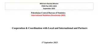
Midterm Review Mission 16-24 September 2023 Statistical / Non Statistical Directorates Presentations Directorate Name: Population and Housing Censuses Directorate (PHCD)
Statistical programs / Services covered under this domain Technical Operations department Implementation of different types of censuses Cartography & GIS Department Production of cartography and updating spatial data
Major projects (conducted in the past three years) Continuous updating of geographical databases (through agriculture Census, aerial photos, etc.) to support surveys and censuses. Interactive Maps Platform Statistical Agricultural Atlas Data Dissemination Projects Thematic Maps SDGs Platform Agricultural census project 2021: Participate in the training on questionnaire, preparing manuals, data processing, maps updating and data cleaning. Developing Establishments' Databases for Local Authorities (2021 present/in progress): Participate in the municipality staff training on questionnaire, preparing manuals, data processing, maps updating and data cleaning. Documentation and Autamatic Data Processing (ADP): The documentation of censuses data (1997, 2007, 2017) Analytical studies: Analyzing census 2017 data and produce analytical reports (3 analytical studies were completed and published on PCBS website in 2021). Provide statistical/spatial data that meet public users needs
Major projects (conducted in the past three years) Preparation and planning of the next census 2027: Review the latest experiences of countries in implementing censuses, and view the related international recommendations. Such as, the: 1. A technical committee was formed to study the administrative records 2021/2022, governmental and private institutions in Palestine that meeting with population census questionnaire, in order to study the status of the administrative registers meetings with local ministries and institutions were held to examine the related registers data in each one. 3. Participating in a series of workshops and training courses entitled Modern methodologies in the implementation of censuses using administrative records in addition to other online activities in different statistical topics. status in ministries in in Palestine. Several 2. A study visit to Oman in order to review their experience in implementing the last census using administrative records.
Main publications (paper, electronic) Analytical Studies: Labour Force Participation and Employment in the State of Palestine - in Arabic. Migration Atlas - in Arabic. Characteristics of Individuals with Disabilities - In Arabic. Agricultural Statistical Atlas of Palestine, 2021 Interactive Maps Platform & Geospatial Data Download Center
Data sources (list of data sources with reference to periodicity, readiness, quality where necessary) with focus on nontraditional sources (Statistical programs ONLY) Population, Housing and Establishments Census Data 1997, 2007,2017 Spatial Data (PCBS Surveys and Censuses, Ministries, partners)
Main partners (users, producers, joint publications, joint projects) including partners with MoU/agreements Users: Ministries (MoLG, MoA, etc.) Municipalities Universities Research centers Researchers Private sector Partners:
Representation in national / international committees/task force National Committee for the Spatial Data Infrastructure Project (SDI Palestine) - Working Group on Integration of Statistical and Geospatial Information - SDI Palestine Project - Technical Committee for Developing the Technical Framework for Geospatial Information- SDI Palestine Project National Committee of Geographical Names The main sectoral committee for the national geographical plan National Committee Manuals of Elections Authorities, 2021 & 2023
Modernization (latest improvement on survey methodology, production of statistics, dissemination Tools; data collection tools; work manuals; Framework etc.) Improvements in the dissemination of statistical/spatial data (continuous improvement on the dissemination Channels with new tools techniques. Improvements in the production and updating of spatial data (continuous update using new data collection methods in the office and in the field, updated aerial photos, tablets). and data visualization Work is underway to calculate some SDGs indicators through some innovative modern technologies (geographic data / remote sensing / satellite images, etc.)
Capacity development (non-traditional skills in need to meet new demands) -Participation in conferences, training workshops, and webinars related to GIS and analysis and dissemination of census data. (like virtual ESRI Annual Conference 2021-2023, Annual GIS Day in Palestine 2021-2022, etc. ) - Training course in using ArcGIS Pro. - Self - training on using ArcGIS Online to disseminate data through dashboards and interactive maps. - Capacity development in using GIS tools to calculate some SDGs indicators through spatial data, remote sensing, and satellite images. A training workshop will start to calculate indicators 11.3.1 and 11.7.1 through the Data for Now initiative.
Challenges (with focus on how you manage to overcome these challenges) The development of GIS System to support the statistical system need continuous updates/improvements on the hardware and software infrastructure. The Cartography &GIS Team are Keeps up with modernity, Well trained and Initiative Unable to implement a register - based census due to the lack of registration in the administrative records. The Israeli measures that limits the access to different data sources.
Vision 2030 (where you see your field in 2030) Developing an effective and powerful geographic information system that serves PCBS in implementing all stages of statistical work using the latest methods and technologies. Implementation of a successful population and housing census in 2027 following the latest international recommendations in this field.


")
")
")


")