Adaptive Grids Towards Interactive Tourist Map Deformation
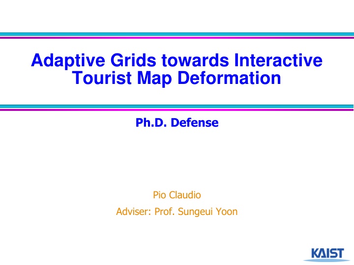
In this Ph.D. defense by Pio Claudio under the guidance of Prof. Sungeui Yoon, the study focuses on the optimization of tourist map layouts through adaptive grids for interactive exploration. The research delves into enhancing tourist map functionality, including content-aware grid developments and fast map deformation techniques. The evolution of tourist maps towards digital platforms and the integration of personalized, interactive elements are explored. Through a task-based approach, the goal is to create a dynamic, user-friendly tourist map application that optimizes topological networks for efficient route planning and point-of-interest discovery.

Download Presentation

Please find below an Image/Link to download the presentation.
The content on the website is provided AS IS for your information and personal use only. It may not be sold, licensed, or shared on other websites without obtaining consent from the author.If you encounter any issues during the download, it is possible that the publisher has removed the file from their server.
You are allowed to download the files provided on this website for personal or commercial use, subject to the condition that they are used lawfully. All files are the property of their respective owners.
The content on the website is provided AS IS for your information and personal use only. It may not be sold, licensed, or shared on other websites without obtaining consent from the author.
E N D
Presentation Transcript
Adaptive Grids towards Interactive Tourist Map Deformation Ph.D. Defense Pio Claudio Adviser: Prof. Sungeui Yoon 1
Outline Introduction Tourist Maps Approach Metro Transit-Centric Visualization for City Tour Planning A Content-Aware Non-Uniform Grid for Fast Map Deformation Summary and Future Work 2
Tourist Maps Close-up maps Overview map POI annotations Points-of-Interest (POI) list Metro map Streets 3 visitseoul.net
Tourist Map Functions Map Information POI Route Planning Discovery Are tourists satisfied with the map at hand? [Yan and Lee; Current Issues in Tourism 2015] 4
Map Tourist Map Functions Map Information Information POI Route Planning Discovery Provide essential information (digestible) Highlight significant elements Remove clutter 5 eng.bigbustours.com/paris/route-map.html
Map Tourist Map Functions POI Discovery Information POI Route Planning Discovery Show POI locations Updated POI information (online) Major POI are larger Minor POI are smaller 6 www.visitmoscow.co.uk
Map Tourist Map Functions Route Planning Information POI Route Planning Discovery Schematic layout of routes (octilinear) Memorable route representations How to reach POIs from route 7 www.phosphorart.com/multimap-abbey-road/
Tourist Maps: Going Digital Rise of mobile services and social media applications Personalization Updated information Interactivity 8
Research Statement Given an original map layout and a task, optimize the deformation of topological networks for task-based optimal viewing In this thesis, case is focused on optimizing tourist map layouts 9
Map Information Contributions POI Route Planning Discovery Propose a holistic, dynamic interactive map application combining the three functions Metro Transit-Centric Visualization for City Tour Planning Enable scalable transitions for changing functional map views through fast grid deformations A Content-Aware Non-Uniform Grid for Fast Map Deformation 10
Outline Introduction Tourist Maps Approach Metro Transit-Centric Visualization for City Tour Planning A Content-Aware Non-Uniform Grid for Fast Map Deformation Summary and Future Work 11
METRO TRANSIT-CENTRIC VISUALIZATION FOR CITY TOUR PLANNING Presented at EuroVis 2014 Computer Graphics Forum 2014 12
Goal Holistic visualization technique Provides digestible info POI discovery along metro map Effective route planning from octilinear metro layout Dynamic and interactive map application 13
Preview Lisbon 14
Approach INPUT: Metro Map INPUT: Tourist Destinations Octilinear Layout Map Warping Destinations Summary 15
Framework Trip Websites POI Data Map Warping Octilinear Layout Visual Worth Run-time Map Hierarchical Clustering 16
Determining Significant Regions: Visual Worth Kernel Density Estimation n vw(u)=1 1 2K POIi,u,hi ( ) hi ( ) n i=1 hi= k wrri+wrri ( ) 1.POI position 2.POI rank (rank r) 3.POI proximity to metro- stations (proximity ) : POI high low Visual Worth 17
Octilinear Layout Computation Mixed-Integer Programming [N llenburg et al. 2011] Apply variable edge lengths according to visual worth - more space to significant regions Input Uniform Variable Octilinear 18
Framework Trip Websites POI Data Map Warping Octilinear Layout Visual Worth Run-time Map Hierarchical Clustering 19
Results Default zoom level Zoomed-in view 20
Results Prague 21
Outline Introduction Tourist Maps Approach Metro Transit-Centric Visualization for City Tour Planning A Content-Aware Non-Uniform Grid for Fast Map Deformation Summary and Future Work 22
A CONTENT-AWARE NON- UNIFORM GRID FOR FAST MAP DEFORMATION Work under submission 23
Map Personalization Web & mobile services customized to each user Web maps different tasks, different maps Apply deformation to create (transitions for interactive) maps Map morphing 24 Personalizing maps [Ballatore et al. Communications of the ACM 2015]
Map Morphing Examples Tourist map Metro map 25 Map morphing: making sense of incongruent maps. [Reilly et al. GI 04]
Map Morphing Examples Street map Metro map Warped Map (zoomed-out) Original Map (zoomed-in) Map warping for the annotation of metro maps [Bottger et al. CG&A 08] 26
State-of-the-Art Optimization of Maps (1/2) Drawing Road Networks with Focus Regions [Haunert et al. TVCG 11] Deform roads by optimization Road edges as input ???? 2 ? = ?? More Slower Edge count Speed Less Faster 27
State-of-the-Art Optimization of Maps (2/2) Drawing Road Networks with Mental Maps [Lin et al. TVCG 14] Overlaid uniform grid used as medium to deform roads Instead of road edges, grid edges are input ???? 2 ? = ?? Finer More Slower Higher Subdivision Edge count Speed Accuracy Coarser Less Faster Lower 28
Contributions Adaptive grid for fast deforming maps for varying tasks Introduce support edges to preserve quad shapes Implement optimization method in GPU Demonstrate in different applications 29
Framework Non-uniform grid Optimization Applications 30
Non-uniform Grid Benefit Adaptive subdivision Consider significant areas Less quads, less edges = faster performance Challenge Cracks may not preserve quad shapes cracks 31
Non-uniform Grid Address Cracks - Support Edges Regularize grid Quad level of neighbors have at most difference of 1 Support edges Quads with smaller neighbors are triangulated support edges cracks 32
Non-uniform Grid Address Cracks - Support Edges Uniform grid Non-uniform grid w/o support edges Non-uniform grid w/ support edges 33
Framework Non-uniform grid Optimization Applications 34
Optimization Objective Formulation Similar to uniform grid deformation Grid edges as input ???? 2 ? = ?? Including support edges Minimize total residue? Solve using conjugate gradient method Iterative, fast 35
Optimization Stable Optimization As matrix size increases, results become unstable Apply association ???? = ??? ???? = ??? Original Unstable Stable An Introduction to the Conjugate Gradient Method Without the Agonizing Pain [Shewchuk] 36
Optimization GPU Implementation Residue , Edge Count As residue decreases, GPU shows a slower growth rate 37
Framework Non-uniform grid Optimization Applications 38
Application: Destination Maps Maps that show a sketch of a simplified route to a destination Automatic generation of destination maps [Kopf et al. SIGGRAPH Asia 2010] Drawing road networks with mental maps [Lin et al. TVCG 2014] 39
Application: Destination Maps Result 20x10 40x20 80x40 Ours 40
Application: Destination Maps Result Residue , Edge Count As residue decreases, ours shows a slower growth rate 41
Application: Destination Maps Result 42
Application: Mental Maps Deform map to conform to a specified shape pattern Drawing road networks with mental maps [Lin et al. TVCG 2014] 43
Application: Mental Maps Result Ours 20x20 40x40 80x80 44
Application: Mental Maps Result Residue , Edge Count As residue decreases, ours shows a slower growth rate 45
Application: Mental Maps Result 46
Application: Focus Region Maps Selected regions are enlarged for highlighting purposes Drawing road networks with focus regions [Haunert et al. TVCG 2011] Interactive focus maps using least-squares optimization[Van Dijk et al. IJGIS 2014] 47
Application: Focus Region Maps Result Road-edge Uniform grid Non-uniform grid 48
Application: Focus Region Maps Result Residue , Edge Count As residue decreases, ours shows a slower growth rate 49
Application: Focus Region Maps Result 50