Advanced Geologic Mapping System Development
Explore the future development of ArcPro with a focus on formalizing interactions between different databases, creating user guides for efficient database usage, and standardizing symbol descriptions and feature classifications. The project involves integrating various geologic mapping systems, providing guidance to mappers, and establishing comprehensive data relationships within the Alaska DGGS and GeMS platforms.
Download Presentation

Please find below an Image/Link to download the presentation.
The content on the website is provided AS IS for your information and personal use only. It may not be sold, licensed, or shared on other websites without obtaining consent from the author. If you encounter any issues during the download, it is possible that the publisher has removed the file from their server.
You are allowed to download the files provided on this website for personal or commercial use, subject to the condition that they are used lawfully. All files are the property of their respective owners.
The content on the website is provided AS IS for your information and personal use only. It may not be sold, licensed, or shared on other websites without obtaining consent from the author.
E N D
Presentation Transcript
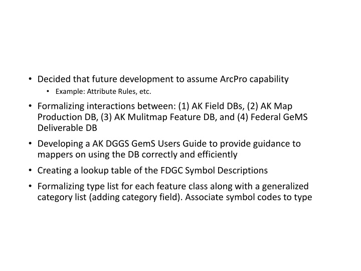
Decided that future development to assume ArcPro capability Example: Attribute Rules, etc. Formalizing interactions between: (1) AK Field DBs, (2) AK Map Production DB, (3) AK Mulitmap Feature DB, and (4) Federal GeMS Deliverable DB Developing a AK DGGS GemS Users Guide to provide guidance to mappers on using the DB correctly and efficiently Creating a lookup table of the FDGC Symbol Descriptions Formalizing type list for each feature class along with a generalized category list (adding category field). Associate symbol codes to type
Alaska DGGS Alaska DGGS GeMS GeMS focused Geologic Mapping System focused Geologic Mapping System Alaska DGGS Geologic Database Alaska DGGS Single Map GeMS Archive Database Federal Single Map GeMS Archive Database Geologic Field Collection System Geologic Map Production System Geologic Feature Services Geologic Features Multi Map GeMS Database Field Single Geologic Map Production Database Collection Database
Multi-Map GeMS Schema Integration Into AK DGGS System Publication Data Analytical Data project_id station_id project Table Station Points project_id Samples citation_id citation Table GERILA Geochem citation_id product Table Geochron Fossils product_id cartographic_polys cartographic_lines cartographic_points AK DGGS GeMS MM geologic_polys geologic_lines geologic_points product_id products_info contacts_and_faults orientation_points station_id feature_guid map_units_polys map_units_lines map_units_points Data Sources citation_id dmu_guid descr map units table Relationship Class for each table Many to Many AK DGGS geomaterials table GeMS Multi-Map
Example Category and Types category type Symbol List 01.01.01, 01.01.02., 01.01.03, 01.01.04, 01.01.05, 01.01.06, 01.01.07, 01.01.08 contact contact contact contact contact generic contact internal contact Gradational contact Uncomformable contact Incised-scarp sedimentary contact key bed key bed key bed key bed key bed key bed key bed key bed key bed generic key bed Clay Bed Bed of economically important commodity Coal bed Clinkered coal bed Area of clinkered coal bed Outcrop area of key bed Outcrop area of clay bed Outcrop area of coal bed dike dike dike dike generic dike Dike of variable thickness Dike intruding fault Dikes fault fault fault fault fault fault fault fault fault fault fault Faults fault generic fault vertical fault high-angle fault normal fault low-angle fault reverse fault rotational fault scissor fault strike-slip fault oblique-slip fault thrust fault Overturned thrust faults detachment fault


