Advanced Wind Detection and Verification Activities
Discover the cutting-edge methods and tools used in deriving motion winds for pre-launch and post-launch satellite products. Explore the validation strategies, algorithm enhancements, and testing processes involved in generating accurate wind data from proxy sources like SEVIRI and GOES-R. Witness real-time wind tracking and height assignment techniques for improved meteorological analysis.

Download Presentation

Please find below an Image/Link to download the presentation.
The content on the website is provided AS IS for your information and personal use only. It may not be sold, licensed, or shared on other websites without obtaining consent from the author. If you encounter any issues during the download, it is possible that the publisher has removed the file from their server.
You are allowed to download the files provided on this website for personal or commercial use, subject to the condition that they are used lawfully. All files are the property of their respective owners.
The content on the website is provided AS IS for your information and personal use only. It may not be sold, licensed, or shared on other websites without obtaining consent from the author.
E N D
Presentation Transcript
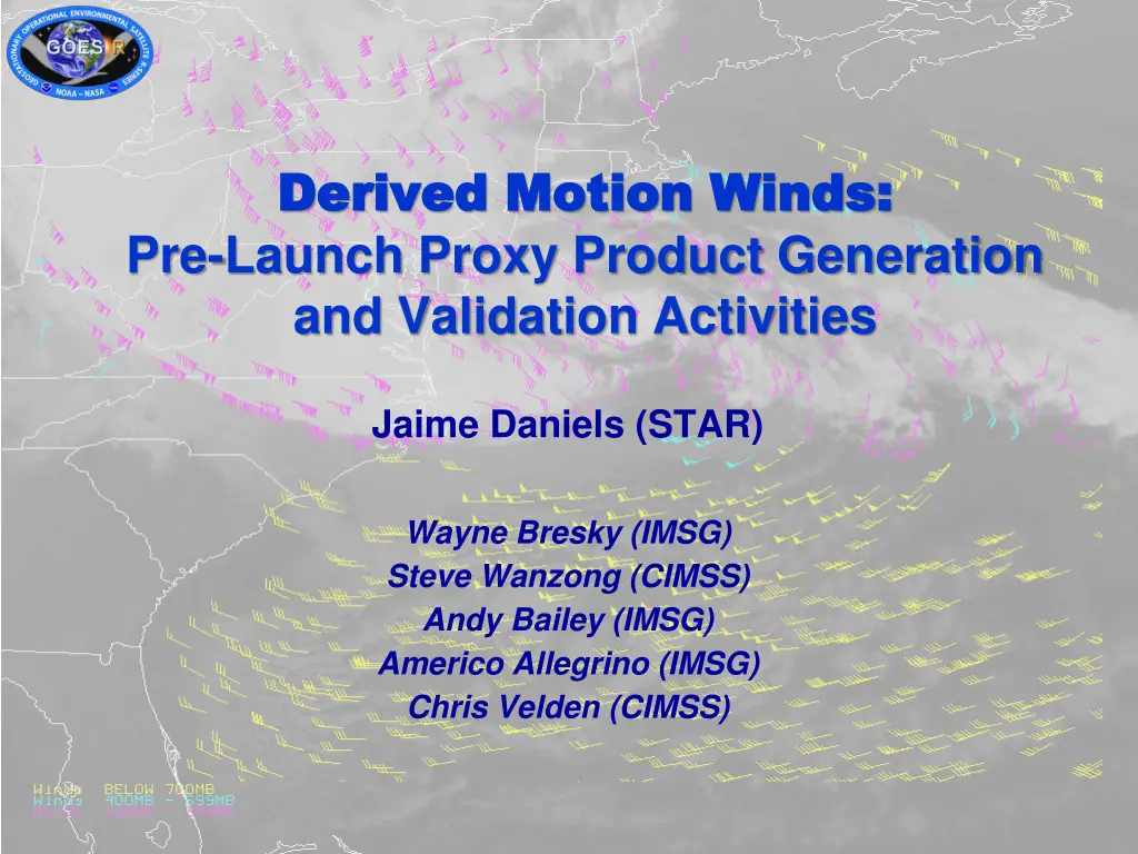
Derived Motion Winds: Derived Motion Winds: Pre-Launch Proxy Product Generation and Validation Activities Jaime Daniels (STAR) Wayne Bresky (IMSG) Steve Wanzong (CIMSS) Andy Bailey (IMSG) Americo Allegrino (IMSG) Chris Velden (CIMSS)
OUTLINE Derived Motion Wind Products Generated from Proxy Data Validation Strategies Validation Tools and DMW Product Assessments DMW Algorithm Enhancements Beyond Baseline Delivery Road to GOES-R Post-Launch Test (PLT) 2
OUTLINE Derived Motion Wind Products Generated from Proxy Data Validation Strategies Validation Tools and DMW Product Assessments DMW Algorithm Enhancements Beyond Baseline Delivery Road to GOES-R Post-Launch Test (PLT) 3
Meteosat-10/SEVIRI FD Winds January 6, 2013) LWIR (10.8um) WVCT (6.2um) New nested tracking algorithm introduced that makes use of a two- dimensional clustering algorithm to capture the dominant motion in each target scene Utilizes clear sky mask product Wind height assignment relies on the utilization of pixel level cloud heights generated upstream Running in real-time Low-Level >700 mb High-Level 100-400 mb Mid-Level 400-700 mb SWIR (3.9um) VIS (0.60um) 4
Using SEVIRI as a Proxy for the Future GOES-R ABI Loop of winds derived from hourly Full Disk Meteosat-9 SEVERI 10.8 m imagery (22 UTC Apr 24 08 UTC Apr 25, 2012 High-Level 100-400 mb Mid-Level 400-700 mb Low-Level >700 mb Experimental winds are being routinely generated from Meteosat-10/SEVIRI , GOES-13, GOES-15, and NPP/VIIRS using the GOES-R winds algorithm. 5
GOES-13 Winds Using GOES-R Clear-Sky Mask, Cloud and Derived Motion Winds (DMW) Algorithms Nor Easter Hurricane Sandy High-Level 100-400 mb Mid-Level 400-700 mb Low-Level >700 mb Cloud-drift winds derived from 15-min GOES-13 11um imagery 1000 UTC 22 April 2012 0800 UTC 23 April 2012 Significance: Early demonstration of GOES-R algorithms using current operational GOES imagers. Plans and work in place to replace existing operational GOES cloud and DMW algorithms with GOES-R algorithms. High-Level 100-400 mb Cloud-drift winds derived from 15-minute GOES-13 LWIR (11um) imagery over Hurricane Sandy (4-day loop) Mid-Level 400-700 mb Low-Level >700 mb 6
GOES-15 Winds Using GOES-R Clear-Sky Mask, Cloud and Derived Motion Winds (DMW) Algorithms GOES-15 LWIR Winds derived from 10.7 m image triplets on 28 October 2013 NHEM Sector PACUS Sector High-Level 100-400 mb Mid-Level 400-700 mb Low-Level >700 mb 7
GOES-15 Winds Using GOES-R Clear-Sky Mask, Cloud and Derived Motion Winds (DMW) Algorithms NHEM Sector GOES-15 Low-Level Visible Winds derived from 0.64um image triplets on 14 November 2013 PACUS Sector High-Level 100-400 mb Mid-Level 400-700 mb Low-Level >700 mb 8
NPP/VIIRS Winds Using GOES-R Cloud and Derived Motion Winds (DMW) Algorithms Highlight: STAR will deliver a VIIRS Polar Winds product processing capability to NDE in December 2013. This capability leverages the GOES-R AWG system framework and the GOES-R product Derived motion winds and cloud-top property algorithms. Accomplishments: The VIIRS polar winds (over both poles) are now being derived routinely at STAR by tracking cloud features observed in the VIIRS M15 (10.7um) band from overlapping NPP orbits Winds science team has validated the wind products and show they meet accuracy specifications STAR delivered an initial Delivered Algorithm Package (DAP) to NDE in October 2013. Significance: 1) Early demonstration of GOES-R algorithms using current operational VIIRS imager; 2) Demonstrates an enterprise approach for satellite processing and use of common Level- 2 product algorithms. 9
OUTLINE Derived Motion Wind Products Generated from Proxy Data Validation Strategies and Tools DMW Product Assessments DMW Algorithm Enhancements Beyond Baseline Delivery Road to GOES-R Post-Launch Test (PLT) 10
Validation Strategies Routinely generate Derived Motion Wind (DMW) product in real- time using available ABI proxy data Collocate DMW products to a number of different reference/ ground truth datasets Wind data from Radiosondes, Aircraft, GFS analysis, CALIPSO data/products Analyze and visualize data (imagery, GFS model, L2 products, intermediate outputs, reference/ground truth) using available and developed (customized) tools Measure/quantify performance, search for outliers, analyze and understand (case studies), Develop/test algorithm adjustments, as necessary 11
Validation Strategies Validation Strategies MET-9/10 SEVIRI, GOES-13/15, NPP/VIIRS Imagery GFS Radiosondes CALIPSO ACARS Derived Motion Wind Products Analyses Routine generation of L2 product chain (ACM, clouds, DMW) Collocate DMW product with reference/ground truth data Clear-Sky Mask & Cloud Products GFS forecast files (GRIB2) DMW/Radiosondes DMW / GFS Analyses Update L2 Product Algorithm(s), as necessary Analyze/ Visualize DMW / CALIPSO DMW/ACARS Deep Dive Tools Routine Tools Display Product & Ground Truth Data Compute comparison statistics Re-retrieve single DMW Perform Case Study Analysis Search for outliers 12
OUTLINE Derived Motion Wind Products Generated from Proxy Data Validation Strategies Validation Tools and DMW Product Assessments Comparisons to Radiosondes, Aircraft, GFS Analysis winds Case Study Examples Assessment of DMW impact in NCEP GFS (summary/highlights of GOES- R3 work; engagement with NCEP) DMW Algorithm Enhancements Beyond Baseline Delivery Road to GOES-R Post-Launch Test (PLT) 13
Routine Validation Tools Visualization Tools AMV product, upstream products, intermediate output, ancillary data, reference/ ground truth observations Customized code that Co-locates AMV product and reference data in space and time Enable the generation and visualization of comparison statistics Tabular form GOES-13 CD WIND RAOB MATCH ERROR STATISTICS Time series PRESSURE RANGE: 100 - 1000 LATITUDE RANGE: -90 - 90 RMS DIFFERENCE (m/s) 6.68 6.11 NORMALIZED RMS 0.34 0.31 AVG DIFFERENCE (m/s) 5.51 5.02 STD DEVIATION (m/s) 3.78 3.48 SPEED BIAS (m/s) -0.97 -1.32 |DIRECTION DIF| (deg) 14.85 15.06 SPEED (m/s) 18.55 18.20 19.52 SAMPLE SIZE 87100 SAT GUESS RAOB 14
Routine Validation Tools Product Visualization McIDAS-V McIDAS-X Heavy reliance on McIDAS to visualize DMW products, intermediate outputs, diagnostic data, ancillary datasets, and reference/ ground-truth 15
Met Met- -9/SEVIRI Winds (10.8um) 9/SEVIRI Winds (10.8um) vs vs Radiosondes Radiosondes 100-400 mb QI > 80 GOES-R AMV Algorithm Used Nov 2011 Stats: MVD = 5.05 m/s NRMS = 0.31 Speed Bias = -0.31 N = 7295 16
Met Met- -10/SEVIRI Winds (10.8um) 10/SEVIRI Winds (10.8um) vs vs Aircraft Winds Aircraft Winds GOES-R AMV Algorithm Used 17
Validation Strategies Validation Strategies MET-9/10 SEVIRI, GOES-13/15, NPP/VIIRS Imagery GFS Radiosondes CALIPSO ACARS Derived Motion Wind Products Analyses Routine generation of L2 product chain (ACM, clouds, DMW) Collocate DMW product with reference/ground truth data Clear-Sky Mask & Cloud Products GFS forecast files (GRIB2) DMW/Radiosondes DMW / GFS Analyses Update L2 Product Algorithm(s), as necessary Analyze/ Visualize DMW / CALIPSO DMW/ACARS Deep Dive Tools Routine Tools Display Product & Ground Truth Data Compute comparison statistics Re-retrieve single DMW Perform Case Study Analysis Search for outliers 18
Deep-Dive Validation Tools X-windows based (PGPLOT freeware) Allows user to display results from a single target scene Upper Left: Shows initial sample of local motion vectors (before cluster analysis) Upper Right: Shows final sample of local motion vectors (associated with largest cluster) Lower Left panel shows cloud-top pressure Lower Right panel shows cloud phase; We determined that we could use (one option) cloud phase to eliminate bad CTP values in thin cirrus Stand-alone DMW re-retrieval & visualization tool that enables the generation of a single derived motion wind vector for a single target scene and allows for the visualization of wind solution, tracking diagnostics, target scene characteristics . 19
Deep-Dive Validation Tools Outcome of clustering of local motion displacements Line Displacement Feature Tracking Diagnostics Correlation Surface Plots Element displacement Nearby Reference/Ground truth data Stand-alone re-retrieval & visualization tool : Other plots that can be generated that enable a more detailed analysis of the DMW algorithm performance. 20
Deep Dive Validation Tool McIDAS-V Utilities Under Development Interrogation of vertical structure of surrounding reference winds from model analysis and/or in-situ obs near location of selected AMV allows for easier visualization in error diagnosis. Slide courtesy of Tom Rink, UW-Madison/SSEC/CIMSS Profile of GFS winds (white) at selected AMV (magenta) location Plot of low-level AMVs color scaled by wind speed, with nearest-level GFS gridded wind field in magenta. Cooperative Institute for Meteorological Satellite Studies University of Wisconsin - Madison
Another Example of Deep Dive Validation Meteosat-9 AMVs vs CALIPSO September 15, 2011, 00 UTC Preliminary use of CALIPSO to assess AMV height assignments Piece of CALIPSO transect showing cross-section of backscatter signal from clouds Cooperative Institute for Meteorological Satellite Studies University of Wisconsin - Madison
Example Deep Dive Validation Meteosat-9 AMVs vs CALIPSO September 15, 2011, 00 UTC Plot of GOES-R proxy AMVs using Meteosat-9 along with track of CALIPSO pass near the time of the dataset Cooperative Institute for Meteorological Satellite Studies University of Wisconsin - Madison
Example Deep Dive Validation Meteosat-9 AMVs vs CALIPSO September 15, 2011, 00 UTC In this case we identify 29 AMVs with CALIPSO collocation criteria of 50 km and 30 minutes (yellow tick marks). The matches circled in yellow are examined in the next slide. Cooperative Institute for Meteorological Satellite Studies University of Wisconsin - Madison
Example Deep Dive Validation: CALIPSO Cloud-Top Heights vs. AMV Height Assignments AMVs (Meteosat-9) CALIPSO 5km CTH AMV height assignments shows good agreement with CALIPSO CTHs for low-level opaque water clouds. Cooperative Institute for Meteorological Satellite Studies University of Wisconsin - Madison
Example Deep Dive Validation Meteosat-9 AMVs vs CALIPSO September 22, 2011, 00 UTC Preliminary use of CALIPSO to assess AMV height assignments Piece of CALIPSO transect showing cross-section of backscatter signal from clouds Cooperative Institute for Meteorological Satellite Studies University of Wisconsin - Madison
Example Deep Dive Validation Meteosat-9 AMVs vs CALIPSO September 22, 2011, 00 UTC Plot of GOES-R proxy AMVs using Meteosat-9 along with track of CALIPSO pass near the time of the dataset Cooperative Institute for Meteorological Satellite Studies University of Wisconsin - Madison
Example Deep Dive Validation Meteosat-9 AMVs vs CALIPSO September 22, 2011, 00 UTC In this case we identify 30 AMVs with CALIPSO collocation criteria of 50 km and 30 minutes (yellow tick marks). The matches circled in yellow are examined in the next slide. Cooperative Institute for Meteorological Satellite Studies University of Wisconsin - Madison
Example Deep Dive Validation: CALIPSO Cloud-Top Heights vs. AMV Height Assignments AMVs (Meteosat-9) CALIPSO 5km CTH Instruments see different things, but comparisons are still useful Cooperative Institute for Meteorological Satellite Studies University of Wisconsin - Madison
Deep-Dive Validation Tools Visualization of reference/ ground truth data using McIDAS-V Done using McIDAS-V 30
Deep-Dive Validation Tools At what height does satellite wind best fit ? 31
Deep-Dive Validation Tools Level-of-Best-Fit Assessment of AMVs Uses AMVs together with collocated Radiosonde wind profiles over a period of time Use these data to characterize the quality of the height assignments Level of Best-Fit is defined to be the level at which vector difference between the satellite wind and the radiosonde wind is a minimum 32
Assessment of Proxy GOES-R DMW Impact in NCEP GFS Meteosat-10/SEVIRI 10.8um AMVs Assessing Winds, derived via the GOES-R DMW algorithm, in the NCEP GFS Data Assimilation System (GOES-R Risk Reduction Project) Using Meteosat/SEVIRI winds Derived initial data assimilation stats (O-B) and developed assimilation quality control procedures that make use of new information afforded by the GOES-R DMW algorithm (quality indicators, cluster size, cloud phase, cloud type, etc) Conducting forecast impact studies for two seasons (in progress) Deliver to NCEP an assimilation capability for GOES-R AMVs (2014) Developing a new AMV BUFR Winds Sequence in coordination with members of the International Winds Working Group (IWWG)
OUTLINE Derived Motion Wind Products Generated from Proxy Data Validation Strategies Validation Tools and DMW Product Assessments DMW Algorithm Enhancements Beyond Baseline Delivery Road to GOES-R Post-Launch Test (PLT) 34
DMW Algorithm Enhancements Beyond Baseline Delivery 1D-VAR cloud heights, instead of brightness temperatures, used to assign heights to the Water Vapor Cloud-Top (WVCT) winds PMAX cutoff of 350 mb implemented for WVCT winds Addition of additional cluster analysis variables to the DMW output that were found useful for quality control in the NCEP GFS data assimilation system Level of Best Fit pressure being computed (from UK Met Office) and added to the DMW output as diagnostic quantity Cloud Phase used to separate ice and liquid water pixels improves height assignment at cirrus cloud edges where pixels are misclassified as liquid (most prominent in tropics) A weighted pressure is computed using the local 5x5 correlation values of largest motion cluster and used as the AMV height assignment currently being evaluated Extension of DMW algorithm capability to GOES-N/OP and NPP/VIIRS Line prefix time used to compute time interval for GOES winds more accurate than nominal time interval
OUTLINE Derived Motion Wind Products Generated from Proxy Data Validation Strategies Validation Tools and DMW Product Assessments DMW Algorithm Enhancements Beyond Baseline Delivery Road to GOES-R Post-Launch Test (PLT) 36
Road to GOES-R Post-Launch Test (PLT) and Post-Launch Product Validation Prepared routine validation tool software that we can provide to OSPO Co-location and comparison statistics Accommodates NetCDF4 DMW product files Deep-dive tools are in place which will be needed to analyze DMW products and resolve any issues after launch Work to understand and become familiar with DMW product software written by Harris/AER Continue working closely with NCEP to ensure their readiness to assimilate GOES-R AMVs Coordinate with GOES-R Proving Ground (PG) for a future demonstration activity Work with the GOES-R Program to ensure ground system facilities (ie., GS Development Environment) are in place and configured in a way for STAR/AWG/CWG to test and execute updated product codes?
Summary GOES-R DMW algorithm is running routinely for a suite of different sensors (Meteosat/SEVIRI, GOES-N/O/P, VIIRS). In the process of transitioning this algorithm to OSPO for current GOES and VIIRS. Validation tools continue to be developed and used to analyze the performance of the DMW algorithm We have a list of DMW algorithm enhancements which will need to find their way in the ground system Getting familiar with Harris DMW product software is important Important that the ground system facilities (ie., GS Development Environment) are in place and configured in a way for STAR/AWG/CWG to test and execute updated product codes Important that a process is established to get updated software into the ground system