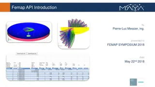
API Services Provided by Krishna Tadepalli
Explore the various API services offered by Krishna Tadepalli including details on API vs Download, delivery in JSON format, GeoJSON options, standardized URL patterns, rate limits, API discovery links, and other services like WMS/WMTS and Vector Tiles.

Download Presentation

Please find below an Image/Link to download the presentation.
The content on the website is provided AS IS for your information and personal use only. It may not be sold, licensed, or shared on other websites without obtaining consent from the author. If you encounter any issues during the download, it is possible that the publisher has removed the file from their server.
You are allowed to download the files provided on this website for personal or commercial use, subject to the condition that they are used lawfully. All files are the property of their respective owners.
The content on the website is provided AS IS for your information and personal use only. It may not be sold, licensed, or shared on other websites without obtaining consent from the author.
E N D
Presentation Transcript
API Krishna Tadepalli
API vs Download Platform independent API Download Platform independent (?) Internet access required No internet access required Updates are automatic Updates are manual(?) Command line access Command line access Access is through API calls Access is through an executable Backward compatibility Backward compatibility may not be guaranteed
API Delivered in JSON format { "geoidModel": "GEOID18", "station": "UserStation", "lat": 40.0, "latDms": "N400000.00000", "lon": -80.0, "lonDms": "W0800000.00000", "geoidHeight": -33.203, "error": 0.034 } GeoJSON option under consideration Easy to consume and parse
API Standardized URL patterns https://geodesy.noaa.gov/api/<product>/<request> Metadata available for keys used in JSON https://geodesy.noaa.gov/api/<product>/meta { "error": "Error, in meters, associated with Geoid Height computation", "geoidHeight": "Geoid Height in meters", "geoidModel": "An alphanumeric ID of the model used to compute Geoid Height", "lat": "Latitude, in decimal degrees, positive north of the equator", "latDms": "Latitude in Degrees-Minutes-Seconds with a 'N'orth or 'S'outh hemisphere prefix", "lon": "Longitude in decimal degrees; negative west of the prime meridian", "lonDms": "Longitude in Degrees-Minutes-Seconds with an 'E'ast or 'W'est hemisphere prefix", "station": "An alphanumeric name associated with a given lat-long" } Rate limits apply
Whats available as an API? API discovery link https://geodesy.noaa.gov/web_services/ or Navigate to Tools->Web Services The link provides: Available APIs Sample URL patterns Description of request parameters APIs for alpha products (under development)
Other Services WMS/WMTS WFS Vector Tiles