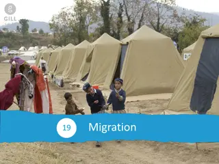
Approaches to Isolate Forced Changes
In the synthesis of group discussions, various approaches to isolate forced changes in models and observations are highlighted. Hurdles such as time-limited observations and sources of uncertainty in projections are discussed, along with the evaluation of models and attribution of extreme events. The content emphasizes the challenges and considerations in understanding forced changes and uncertainties in climate projections.

Download Presentation

Please find below an Image/Link to download the presentation.
The content on the website is provided AS IS for your information and personal use only. It may not be sold, licensed, or shared on other websites without obtaining consent from the author.If you encounter any issues during the download, it is possible that the publisher has removed the file from their server.
You are allowed to download the files provided on this website for personal or commercial use, subject to the condition that they are used lawfully. All files are the property of their respective owners.
The content on the website is provided AS IS for your information and personal use only. It may not be sold, licensed, or shared on other websites without obtaining consent from the author.
E N D
Presentation Transcript
Representing Uncertainty in Geospatial Visualizations Matthew L. Sisk GIS / Anthropology Librarian Navari Family Center for Digital Scholarship Eck Institute for Global Health
What is uncertainty? the state of being uncertain Anything that renders a measurement less than absolutely accurate Measurement error Measurement bias Missing components Ambiguously defined concepts Geospatial uncertainty Positional accuracy Geometry choices Model error terms Different scales of measurement Administrative differences
How do we represent uncertainty? Positional uncertainty Size or color of point locations represents the uncertainty of the location GPS or geocoding error term Fuzzyness / Opacity Opacity is used to represent an error term http://project-ukko.net/map.html Uncertainty in statistical measures e.g. American Community Survey
How do we teach people it is important? Incorporate into early GIS workshops / guest lectures Develop tools for instructors / independent learners to understand and effectively visualize the uncertainty in their data Libguide / github page of examples and techniques in major geospatial software