Atlantic Seabed Mapping Workshop
Workshop session on aligning mapping and ocean observation efforts to deliver societal, environmental, and industrial needs. Key issues, priorities, and mechanisms for improvement discussed by Stephen Locke from Natural Resources Canada.

Download Presentation

Please find below an Image/Link to download the presentation.
The content on the website is provided AS IS for your information and personal use only. It may not be sold, licensed, or shared on other websites without obtaining consent from the author.If you encounter any issues during the download, it is possible that the publisher has removed the file from their server.
You are allowed to download the files provided on this website for personal or commercial use, subject to the condition that they are used lawfully. All files are the property of their respective owners.
The content on the website is provided AS IS for your information and personal use only. It may not be sold, licensed, or shared on other websites without obtaining consent from the author.
E N D
Presentation Transcript
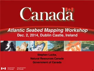
Atlantic Seabed Mapping Workshop Dec. 2, 2014, Dublin Castle, Ireland Stephen Locke, Natural Resources Canada Government of Canada 1
Session 5: Aligning Mapping & Ocean Observation Efforts: Deliver Societal, Environmental & Industrial Needs 2
Session 5: Aligning Mapping & Ocean Observation Efforts: Deliver Societal, Environmental & Industrial Needs SLIDE 1 How well are current/planned seabed mapping & ocean observation efforts being aligned to deliver Societal, Environmental, & Industrial needs? 1) Basic understanding of the value of seabed mapping is not there, as a public good. 2) Recognize that one map or dataset can be used for many purposes: environmental protection, safety, economic development, research, etc. 3) Cabled Observatories growing in scope, relevance and awareness, e.g. Ocean Networks Canada with NEPTUNE and VENUS. Stephen Locke, Director GSC Atlantic, Natural Resources Canada, Canada 3
Session 5: Aligning Mapping & Ocean Observation Efforts: Deliver Societal, Environmental & Industrial Needs SLIDE 2 What are the key issues /priorities that need to be addressed to improve the current situation? 1) Need to tell the story better on the value added of seabed mapping, ROI studies, cost benefit analysis, using real examples 2) Lack of coordination and communication internal to Canada and between Galway partner countries expertise and directions 3) Political will and funding government priority? Stephen Locke, Director GSC Atlantic, Natural Resources Canada, Canada 4
Session 5: Aligning Mapping & Ocean Observation Efforts: Deliver Societal, Environmental & Industrial Needs SLIDE 3 What mechanisms can be put in place to address these priorities ? 1) Establish a Working Group of senior science practitioners - share best practices, standard development, lessons learned 2) White paper or comprehensive study on seabed mapping and economic benefits 3) Need societal/industry pull on government that this is important, keep telling the story. Has to become a government priority. Improved ocean literacy/understanding. Stephen Locke, Director GSC Atlantic, Natural Resources Canada, Canada 5