Bachelor of Geospatial Science
The Bachelor of Geospatial Science program at the University of the South Pacific offers a comprehensive curriculum focusing on techniques, methods, and technologies in geography, geospatial computing, quantitative methods, GIS, remote sensing, geovisualization, and more. With a strong emphasis on field techniques and spatial analysis, this program equips students with the skills needed for careers as geospatial analysts, developers, and professionals in mapping, cartography, database management, and programming. Explore the evolving course details and opportunities provided by the Geospatial Science Unit within the School of Geography, Earth Science, and Environment.

Download Presentation

Please find below an Image/Link to download the presentation.
The content on the website is provided AS IS for your information and personal use only. It may not be sold, licensed, or shared on other websites without obtaining consent from the author.If you encounter any issues during the download, it is possible that the publisher has removed the file from their server.
You are allowed to download the files provided on this website for personal or commercial use, subject to the condition that they are used lawfully. All files are the property of their respective owners.
The content on the website is provided AS IS for your information and personal use only. It may not be sold, licensed, or shared on other websites without obtaining consent from the author.
E N D
Presentation Transcript
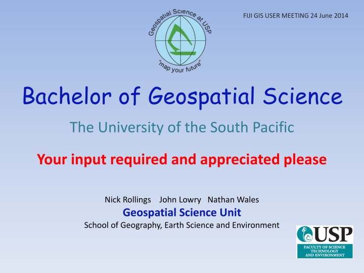
FIJI GIS USER MEETING 24 June 2014 Bachelor of Geospatial Science The University of the South Pacific Your input required and appreciated please Nick Rollings John Lowry Nathan Wales Geospatial Science Unit School of Geography, Earth Science and Environment
Geospatial Science at USP Offering awards since 1994 Certificate in Geospatial Science Diploma in Geospatial Science B Sc. Geography and Information Systems
Geospatial Science at USP Degree in GIS revisited Vice Chancellor Professor Rajesh Chandra Professional Degree in Geospatial Science Professional Certification of Graduates Emphasis on ICT Lever off investment
Geospatial Science at USP What do we want in a new Degree? Our ideas Canvas users at annual GIS RS Conference Talk to all levels of government and NGO s Body of Knowledge (used by GISCI and SSSI) Comparison to other awards and seek opinion Input still welcome
Geospatial Science at USP Bachelor Geospatial Science Geospatial Analyst Geospatial Developer Major in Geospatial Science Diploma Geospatial Science Certificate Geospatial Science Field Survey Mapping Cartography Geospatial Databases Programming Remote Sensing Image Interpretation Core GIS Spatial Analysis Foundations of Geospatial Science
Geospatial Science at USP What s new? Course Details Load GS100 Techniques and Methods in Geography Existing course 1 GS101 Geospatial Computing New course 1 GS200 Quantitative Methods in Geospatial Science New Course 1 GS201 Geographic Information Systems 1 Existing course 1 GS211 Remote Sensing 1 Existing course 1 GS231 Geovisualisation and Cartography New course 1 GS300 Pacific Islands Field Techniques and Methods New Course 1 GS301 Geographic Information Systems 2 Existing Course 1 GS311 Remote Sensing 2 New course 1 GS350 Geospatial Analytics Modified course 1 10.0
Course Details Maps, field measurement, survey, social survey, statistics, report writing GS100 Techniques and Methods in Geography Computers, programming with Python, databases, geodatabases, web apps GS101 Geospatial Computing Data collection, handling and analysis, statistics, numerical methods GS200 Quantitative Methods in Geospatial Science Core GIS, data models, data collection, map projections, databases, introduction to analysis and applications Principles of remote sensing, satellite and airborne imagery, multispectral and hyperspectral, enhancement and analysis GS201 Geographic Information Systems 1 GS211 Remote Sensing 1 Mapping and cartography, geovisualisation, internet mapservers, geodatabases GS231 Geovisualisation and Cartography Field surveying, sampling, GPS mapping, geodesy, geodatabases, data analysis GS300 Pacific Islands Field Techniques and Methods Vector and raster spatial analysis, geodatabases, Internet and Cloud GIS GS301 Geographic Information Systems 2 Enhancement and interpretation of high resolution image data, UAV s, Lidar, Feature extraction, integration with GIS Problem based scenarios. Risk Assessment - Hazard Modelling - Site Location Natural Areas Planning - Coastal Monitoring . . . GS311 Remote Sensing 2 GS350 Geospatial Analytics
Bachelor in Geospatial Science: Geospatial Developer Year 1 Semester 1 Semester 2 UU100 Comms and Information Literacy GS100 Methods & Techniques in Geography IS121 Information Systems I One of GE101, MA161, ST130 UU114 English for Academic Purposes LM113 Introduction to Geomatics GS101Geospatial Computing One of GE102, IS122, ST130 Year 2 Semester 1 Semester 2 UU200 Ethics and Governance GS200 Geospatial Data Analysis GS201 Geographic Information Systems 1 IS222 Database Management Systems UU204 Pacific Worlds GS211 Remote Sensing 1 GS231 Geovisualisation and Cartography CS240 Software engineering Year 3 Semester 1 Semester 2 GS300 Pac Is Field Techniques and Methods SC356 Research Skills GS301 Geographic Information Systems 2 GS350 Geospatial Analytics Any two of CS324 Distributed Computing IS328 Data Mining IS323 Info Systems Analysis and Design GS311 Remote Sensing II IS333 Project Management
Bachelor in Geospatial Science: Geospatial Analyst Year 1 Semester 1 Semester 2 UU100 Comms and Information Literacy GS100 Methods & Techniques in Geography IS121 Information Systems I GE101 Physical Geography UU114 English for Academic Purposes LM113 Introduction to Geomatics GS101Geospatial Computing GE102 Human Geography Year 2 Semester 1 Semester 2 UU200 Ethics and Governance GS200 Geospatial Data Analysis GS201 Geographic Information Systems 1 One of GE202, GE205 UU204 Pacific Worlds GS211 Remote Sensing 1 GS231 Geovisualisation and Cartography One of GE201, GE203, GE207, ES203 Year 3 Semester 1 Semester 2 GS300 Pac Is Field Techniques and Methods SC356 Research Skills GS301 Geographic Information Systems 2 Any two of GS311, GE301, ES301, ES302, ES303, GE303, GE304 GS350 Geospatial Analytics Any two of GE302, GE304, GE306, ES301, ES302, ES303
Major in Geospatial Science Year 1 Semester 1 Semester 2 UU100 Comms and Information Literacy GS100 Methods & Techniques in Geography UU114 English for Academic Purposes LM113 Introduction to Geomatics Year 2 Semester 1 Semester 2 UU200 Ethics and Governance GS200 Geospatial Data Analysis GS201 Geographic Information Systems 1 UU204 Pacific Worlds GS211 Remote Sensing 1 GS231 Geovisualisation and Cartography Year 3 Semester 1 Semester 2 GS301 Geographic Information Systems 2 or GS311 Remote Sensing II SC356 Research Skills GS350 Geospatial Analytics
Staffing Associate Professor Senior Lecturer Lecturer Fellow (teaching support and technical)
Geospatial Science at USP Bachelor of Geospatial Science - timeline Faculty Quality Committee July Senate August USP Council Late October 2015 Deployment Still time for input!
SSSI President Professor John Trinder comments on the 2014 Australian Federal Budget. "Current studies reveal that . there will be insufficient graduates in surveying and spatial sciences this decade." source: http://www.spatialsource.com.au/2014/05/20/sssi-comments-on-the-federal-budget/ Anything missing let us know Comments and Idea to: Nick Rollings: rollings_n@usp.ac.fj 3232620 John Lowry: lowry_j@usp.ac.fj 3232549