Carlsbad GIS Overview: Services, Software, and Applications
Dive into the world of GIS in Carlsbad with a comprehensive look at their services, software, and related applications. Explore their background, current projects, funding model, and data distribution practices.

Download Presentation

Please find below an Image/Link to download the presentation.
The content on the website is provided AS IS for your information and personal use only. It may not be sold, licensed, or shared on other websites without obtaining consent from the author. If you encounter any issues during the download, it is possible that the publisher has removed the file from their server.
You are allowed to download the files provided on this website for personal or commercial use, subject to the condition that they are used lawfully. All files are the property of their respective owners.
The content on the website is provided AS IS for your information and personal use only. It may not be sold, licensed, or shared on other websites without obtaining consent from the author.
E N D
Presentation Transcript
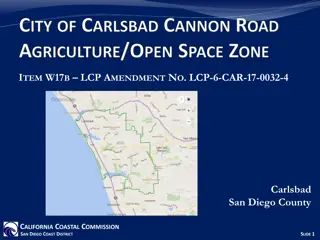
City of Carlsbad GIS Karl von Schlieder, GIS Manager October 12, 2011
Background 1991 to 2005 in Community Development Since 2006 now a division within IT Serve the GIS needs of all City departments Provide GIS services to outside entities on time & materials basis
GIS in Carlsbad Core GIS division in IT 3 staff members Public works inventory group in Transportation Dept. 3 data entry techs Planning & Econ Dev low-level ArcView users (< 3 staff) All other staff use GIS division services and intranet mapping applications
GIS Software All Esri products: ArcGIS for: Desktop, Server, Mobile Rolta OnPoint mapping software Intranet apps for general users, public works- oriented uses, DMS input, addressing Internet app for zoning and general development information
Related Applications - Dependent Hansen CMMS Marshall GeoResults for Hansen GBA Pavement Management system Granite XP CCTV Pipeline Inspection system Coming soon! Constituent Relationship Management (CRM) system
Related Applications - Linked Permits Plus Future: Water utility billing Business license
Funding for GIS IT chargeback to all departments Based on number of pcs/dept Additional charge back amounts for dedicated COTS software maintenance, custom applications
Data Distribution Currently we distribute all our non-proprietary data at no charge for data, charging only for labor to extract, format and deliver. Done as response to Public Records Act requests
Current Projects GIS strategic plan Creating a standard address file More internal OnPoint map services Enhance internet e-zoning Create lightweight Silverlight-based internet maps for individual departments Embed GIS into CRM application
Current Issues Outsourcing What s a commodity that can be sourced? Internal cost vs. sourced cost A continuum of services available Managed Competition IT (w/GIS) or GIS as separate entity? Internal cost vs. competition Where s the value?