Explore a study that investigates the factors contributing to the drying up of wetlands in Iran, using a combination of climatic and non-climatic drivers. The study focuses on various water bodies like Gorgan Bay, Urmia Lake, and more, analyzing hydro-climatic data to understand the changes over time.
Please find below an Image/Link to download the presentation.
The content on the website is provided AS IS for your information and personal use only. It may not be sold, licensed, or shared on other websites without obtaining consent from the author. If you encounter any issues during the download, it is possible that the publisher has removed the file from their server.
You are allowed to download the files provided on this website for personal or commercial use, subject to the condition that they are used lawfully. All files are the property of their respective owners.
The content on the website is provided AS IS for your information and personal use only. It may not be sold, licensed, or shared on other websites without obtaining consent from the author.
E N D
Presentation Transcript
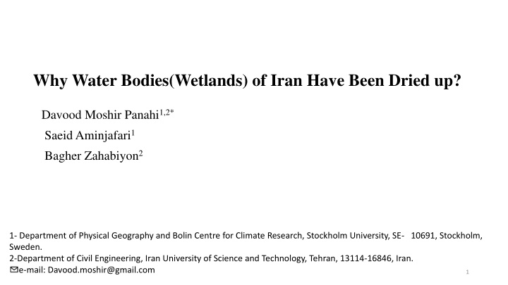
Why Water Bodies(Wetlands) of Iran Have Been Dried up? Davood Moshir Panahi1,2* Saeid Aminjafari1 Bagher Zahabiyon2 1- Department of Physical Geography and Bolin Centre for Climate Research, Stockholm University, SE- 10691, Stockholm, Sweden. 2-Department of Civil Engineering, Iran University of Science and Technology, Tehran, 13114-16846, Iran. e-mail: Davood.moshir@gmail.com 1
Aims of this study : Detecting and Separating the portion the climatic and non-climatic drivers on drying up of wetlands by using budyko space diagram and formulation. 2
The study Area and Case study : Gorgan Bay Urmia lake Gavkhouni wetland HorAlzim Wetland Maharlou Lake Parishan Lake 3 Fig1 :The study Area
Methodology : 1- Comparing the time series of Runoff and Area of wetland time series by using their time series and 5 years moving average. 2- Develop the Formulation based on Budyko space diagram to detect the change driver portion ( climate or non- climate) and their portion. 4
Data and Methodology: Hydro climatic data : Hydro climatic Variables comes from Moshir Panahi etal.,2020 Wetland Area the Global Surface Water Dataset (GSWD) (Pekel et al. 2016) is used to estimate the time series of surface water extent of the lakes Moshir Panahi, D., Kalantari, Z., Ghajarnia, N. et al. Variability and change in the hydro-climate and water resources of Iran over a recent 30-year period. Sci Rep 10, 7450 (2020). https://doi.org/10.1038/s41598-020-64089-y Pekel, Jean-Fran ois, Andrew Cottam, Noel Gorelick, and Alan S Belward. 2016. High-Resolution Mapping of Global Surface Water and Its Long-Term Changes. Nature 540 (7633): 418. 5
300 60000 300 70000 Gavkhoni Wetland Gorgan Bay R(mm/yr) R(mm/yr) Lake Area(Ha) Lake Area(Ha) 60000 250 50000 250 Fig2 :Time Series of Wetland Area (Ha) and Upper Basin Runoff(mm/yr), (A) Gavkhoni wetland, (B)Gorgan Bay, (C) HorAlzim Wetland, (D)Parishan Lake, (E) Urmia Lake , and (F) Maharlou Lake 50000 200 40000 200 40000 150 30000 150 30000 100 20000 100 20000 50 10000 50 10000 (A) (B) Year Year 0 0 0 0 1986 1990 1994 1998 2002 2006 2010 2014 2018 1986 1990 1994 1998 2002 2006 2010 2014 2018 300 300000 300 5000 Wetland Area (Ha) Runoff(mm/yr) HourAlAzim Wetland Parishan Lake R(mm/yr) R(mm/yr) Lake Area(Ha) Lake Area(Ha) 4500 250 250000 250 4000 3500 200 200000 200 3000 150 150000 150 2500 2000 100 100000 100 1500 1000 50 50000 50 500 (C) (D) Year Year 0 0 0 0 1986 1990 1994 1998 2002 2006 2010 2014 2018 1986 1990 1994 1998 2002 2006 2010 2014 2018 300 700000 300 30000 Urmia Lake Maharlou Lake R(mm/yr) R(mm/yr) Lake Area(Ha) Lake Area(Ha) 600000 250 250 25000 500000 200 200 20000 400000 150 150 15000 300000 100 100 10000 200000 50 50 5000 100000 (E) (F) 6 Year Year 0 0 0 0 1986 1990 1994 1998 2002 2006 2010 2014 2018 1986 1990 1994 1998 2002 2006 2010 2014 2018
300 60000 300 70000 R(mm/yr) R(mm/yr) Gavkhoni Wetland Gorgan Bay Lake Area(Ha) Lake Area(Ha) 60000 Fig3 :5 Years Moving Average of Wetland Area (Ha) and Upper Basin Runoff(mm/yr), (A) Gavkhoni wetland, (B)Gorgan Bay, (C) HorAlzim Wetland, (D)Parishan Lake, (E) Urmia Lake , and (F) Maharlou Lake 250 50000 250 50000 200 40000 200 40000 150 30000 150 30000 100 20000 100 20000 50 10000 50 10000 (A) (B) Year Year 0 0 0 0 1986 1990 1994 1998 2002 2006 2010 2014 2018 1986 1990 1994 1998 2002 2006 2010 2014 2018 5 Years Moving Average Wetland Area (Ha) 5 Years Moving Average Runoff(mm/yr) 300 300000 300 4500 R(mm/yr) R(mm/yr) HourAlAzim Wetland Parishan Lake Lake Area(Ha) Lake Area(Ha) 4000 250 250000 250 3500 200 200000 200 3000 2500 150 150000 150 2000 100 100000 100 1500 1000 50 50000 50 500 (C) (D) Year Year 0 0 0 0 1986 1990 1994 1998 2002 2006 2010 2014 2018 1986 1990 1994 1998 2002 2006 2010 2014 2018 300 700000 300 30000 Lake Area(Ha) Urmia Lake R(mm/yr) R(mm/yr) Maharlou Lake Lake Area(Ha) 600000 250 250 25000 500000 200 200 20000 400000 150 150 15000 300000 100 100 10000 200000 50 50 5000 100000 7 (E) (F) Year Year 0 0 0 0 1986 1990 1994 1998 2002 2006 2010 2014 2018 1986 1990 1994 1998 2002 2006 2010 2014 2018
Separating the impacts of climate and Non-Climate on runoff change: Formulation: R= Rclim+ Rnon-climate Eq(1) Eq(2) Rclim= P - ETclimate Use the Budyko space to find the ET-climate changes. From data % ??? ???????= 100 ???? ??????? 1.2 ET/P ? Eq(3) % ???????= 100 ???????? 1.0 Eq(4) ? B 0.8 (ET/P)Non-Climate to this aim Fu function was used. C (ET/P)climate 1 ? Limit Line A ? ? ?= 1 +?? ?? ? 0.6 Budyko (PET/P) Fu: ? 1 + Initial Curve 0.4 W is an empirical parameter that has not been ascribed a specific physical meaning, but is generally conceptualized as an integrated catchment property that reflects characteristics such as land cover, soil properties, topography and seasonality (Zhang et al., 2004). A : position of Basin in First time span B : position of Basin in Second time span C : estimated position of Basin in First time span on same curve as first time span 0.2 PET/P 0.0 0 1 2 3 4 5 Fig 4 : Schematically representation of the parameters of change used along the manuscript describing movement of a basin from Point A to Point B in Budyko space 8
Result : Table 1 : Distinguishing the main Drivers on Runoff Change ( Climate or Non-Climate) P(mm) ET(mm) R(mm) ET-climatic ET-NON- climate(mm) 17.98 29.22 58.65 51.35 8.90 25.21 R- R-Non- climate(mm) -18.47 -24.44 -40.14 -50.60 -15.42 -10.10 Main Driver% ??????? Non-Climate Non-Climate Non-Climate Non-Climate Non-Climate Climate % ??? ??????? 28.5% 31.2% 34.1% 27.0% 17.1% 56.0% Basin Code W (mm) -19.28 -40.55 -32.58 -9.31 -3.33 -43.26 climate(mm) -7.35 -11.10 -20.78 -18.74 -3.17 -12.88 Gorgan Bay HorAlzim Wetland Parishan Lake Urmia Lake Gavkhoni weland Maharlou Lake 2.22 2.68 1.67 1.74 1.98 2.43 -26.63 -51.65 -53.36 -28.05 -6.50 -56.14 -1.30 -11.32 26.07 42.04 5.57 -18.05 -25.82 -35.55 -60.93 -69.35 -18.59 -22.98 71.5% 68.8% 65.9% 73.0% 82.9% 44.0% 90% 83% % (Non-climate) % (climate) 80% 73% 72% 69% 70% 66% 60% 56% 50% 44% 40% 34% 31% 29% 30% 27% 20% 17% 10% 0% Gorgan Bay HorAlzim Wetland Parishan Lake Urmia Lake Gavkhoni weland Maharlou Lake Fig 5 : Portion od Drivers (climatic and non-climatic) charts on Iran Wetlands. 9
Conclusion : 5 of 6 wetlands and their upper basin(cases of this study) have experienced decrease. Main driver of changes is Non-climatic variables. 90% 83% % (Non-climate) % (climate) 80% 73% 72% 69% 70% 66% 60% 56% 50% 44% 40% 34% 31% 29% 30% 27% 20% 17% 10% 0% Gorgan Bay HorAlzim Wetland Parishan Lake Urmia Lake Gavkhoni weland Maharlou Lake 10


 of Iran Have Been Dried up?")