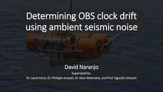
Challenges in Distributing OBS Data: Data and Metadata Creation, Useful Data Improvement
Creating and distributing OBS data pose challenges like lack of standard tools for logger information, clock drift documentation, and defining channel names. Improvements include reorienting sensors, verifying clock corrections, and removing noise to enhance data usability for studying crustal structure.
Download Presentation

Please find below an Image/Link to download the presentation.
The content on the website is provided AS IS for your information and personal use only. It may not be sold, licensed, or shared on other websites without obtaining consent from the author.If you encounter any issues during the download, it is possible that the publisher has removed the file from their server.
You are allowed to download the files provided on this website for personal or commercial use, subject to the condition that they are used lawfully. All files are the property of their respective owners.
The content on the website is provided AS IS for your information and personal use only. It may not be sold, licensed, or shared on other websites without obtaining consent from the author.
E N D
Presentation Transcript
OBS services develpments in EPOS ORFEUS Annual Workshop & Open EPOS Seismology meeting Lisbon, 25 - 27 October 2017
No OBS web services (yet) Our goal is to make OBS data as compatible as possible with standard seismological data. Use standard seismological web services. OBS-specific web services? Depends on OBS-specific properties. We are working on contours of these properties and ways to communicate/store them.
What is different about OBSs? Recording Non-standard loggers (minimize volume and power consumption, completely autonomous in energy, operation and time base) Proprietary data formats Clock is synchronized only at beginning and end of deployment Sensors Horizontal channels generally not geographically oriented Pressure sensors Noise Seafloor currents Motion under ocean waves Strong sea-surface reflections
What is different about OBSs? Blackman et al., 1995, BSSA
Challenges in distributing OBS data 1: Creating the data and metadata. Standard tools such as NRL do not have OBS data logger information Most OBS parks are not ready to create NRL libraries/templates NRL libraries (based on RESP files) do not completely inform StationXML Mobile instrument problem: For each deployment, same instrument must be combined with new location, station and network information Clock drift must be documented (and corrected?) Standard channel names must be defined and documented Horizontals = {H,L}1,2 GSN definition, left-handed: geometrically 1 corresponds to N and 2 to E Others say 2 and 3 should be used for horizontals, but IRIS DC is full of horizontal OBS channels named 1 and 2 Pressure: DH (hydrophones), DO (absolute pressure gauge) DH or DF ? (differential pressure gauge)
Challenges in distributing OBS data 2: Making the data as useful as possible Reorienting the horizontal sensors Verifying clock corrections Removing current and ocean wave noise Teaching seismologists about using pressure sensors. Remove noise Remove surface reflections Studying crustal structure with seafloor-specific techniques
Creating the data and metadata We are developping a system to generate clock-corrected data from basic miniSEED data Facilities must convert their data to miniSEED, but do not need to have final network/station names, nor correct the clock drift Eases the load on parks, assures the clock drift is documented and always treated the same way. We are developing a three-part information system for informing the data and metadata creation: 1: Instrument information (provided by OBS facilities) 2: Network/stations information (provided by OBS facilities after campaign) 3: Campaign information (provided by the reference scientist)
Creating the data and metadata Future: make web-service and graphical interface Could enter information graphically or through formatted information files Database behind is invisible to users, but would allow previously- declared instruments/components to be selected Present: information files using a standard machine- and human-readable format Should be easily readable into common programming data structures (lists and associative arrays [also known as maps or dictionaries ]) Currently using YAML Easy to read Efficient specification of values common to all instruments
Campaign information file format_version: 0.9 campaign: information_version: 2017-10-31 WCC reference_name: EMSO-MOMAR2016 reference_scientist: name: Albert Einstein" institution: "Institut de Physique du Globe de Paris" email: einstein@ipgp.fr telephone: ~ OBS_providers: "INSU-IPGP OBS park": email: parc-obs@insu.fr representative: "Wayne Crawford <crawford@ipgp.fr> network: code: 4G start_date: 2007-07-01 end_date: 2025-12-31 FDSN_registered: True verification: waveform_samples: - date: ~ duration: ~ title: ~ - .... ancillary: expeditions: - name: ~ ship: Nina start_date": ~ end_date": ~ comments: "Deployment" - name: ~ ship: Pinto .... One file per campaign Filled in by reference scientist Indicates Reference scientist information OBS facilities used network information Verification tool information (currently time windows in which to plot waveforms) Ancillary information Expeditions .... Is not needed to create data or metadata, but allows verification of
Instrumentation information file One YAML file plus directory of response files per OBS facility Provides StationXML compatible equipment/response information Can be combined with network.yaml file to create StationXML Largest (but least modified) of the information files Can also be used to generate RESP files for NRL 1: Global information and variables instrumentation: information_version: "2017-09-15 WCC" facility: reference_name: "INSU-IPGP" full_name: "INSU-IPGP OBS Park" email: "obs_ipgp@insu.cnrs.fr" website: "http://parc-obs.insu.cnrs.fr" director: "Wayne Crawford" chief_engineer: "Romuald Daniel" phone_number: "" response_format: "DBIRD" response_directory: "DBIRD_OBS_INSU-IPGP" variables: # VARIABLES TO BE SPECIFIED IN THE NETWORK FILE # AND THEIR DEFAULT VALUES sample_rate: "62.5" serial_number: ~ digitizer_serial_number: "generic" analog_filter_serial_number: ~ pressure_serial_number: ~ pressure_manufacturer: ~ dpg_calibration_code: "generic" seismometer_serial_number: ~ seismometer_calibration_code: "1-399" # THESE ARE FOR MULTIPLE HYDROPHONES ON A STATION (HYDROCTOPUS) pressure_serial_number_1: ~ pressure_serial_number_2: ~ pressure_serial_number_3: ~
Instrumentation information file One YAML file plus response files/directory per OBS facility Reproduces StationXML logger and sensor fields Can be combined with network.yaml file to create StationXML Can also be used to generate RESP files for NRL 2: Building blocks: dataloggers dataloggers: LC2000: digitizer: type: "delta-sigma A/D converter" description: "CS5321 delta-sigma A/D converter" manufacturer: "Cirrus Logic" vendor: ~ model: "CS5321" DBIRD_file: "digitizer/Scripps#LCPO2000_CS5321##theoretical#" serial_number: "{digitizer_serial_number}" digital_filter: type: "FIR digital filter chip" description: "CS5322 digital FIR filter" manufacturer: "Cirrus Logic" vendor: ~ model: "CS5322" DBIRD_file: "dig_filter/Scripps#LCPO2000_CS5322#{sample_rate}sps#theoretical#" serial_number: "{digitizer_serial_number}"
Instrumentation information file One YAML file plus response files/directory per OBS facility Reproduces StationXML logger and sensor fields Can be combined with network.yaml file to create StationXML Can also be used to generate RESP files for NRL 3: Building blocks: analong filters analog_filters: DPG_CARD: type: "DPG_Card" description: "Differential Pressure Gauge Card" manufacturer: "SIO-LDEO" vendor: ~ model: ~ DBIRD_file: "ana_filter/SIO_LDEO#DPG_Card##theoretical#" serial_number: "{analog_filter_serial_number}" BBOBS_CARD_0P225X: type: "Analog gain card" description: "INSU BBOBS gain card :0.225x" manufacturer: "SIO or IPGP" vendor: ~ model: ~ serial_number: "{analog_filter_serial_number}" DBIRD_file: "ana_filter/INSU#BBOBS#gain0.225#theoretical#" BBOBS_CARD_1X: type: "Analog gain card" description: "INSU BBOBS gain card : 1x" manufacturer: "SIO or IPGP" vendor: ~ model: ~ serial_number: "{analog_filter_serial_number}" DBIRD_file: "ana_filter/INSU#BBOBS#gain1.0#theoretical#" HYDRO_GAIN_16X: type: "Analog gain/filter card" description: "SIO gain/filter card, hydro channel (16x)" manufacturer: "SIO or IPGP" vendor: ~ model: ~ serial_number: "{analog_filter_serial_number}" DBIRD_file: "ana_filter/Scripps#SPOBS#HydroL22x16#theoretical#"
Instrumentation information file One YAML file plus response files/directory per OBS facility Reproduces StationXML logger and sensor fields Can be combined with network.yaml file to create StationXML Can also be used to generate RESP files for NRL 4: Building blocks: sensors sensors: VELOCITY_TRILLIUM_T240_SS: type: "Broadband seismometer" description: "Trillium T240 single-sided, serial number {seismometer_calibration_code}" manufacturer: "Nanometrics, Inc" vendor: "Nanometrics, Inc" model: "Trillium T240" serial_number: "{seismometer_serial_number}" DBIRD_file: "sensor/Trillium#T240#SN{seismometer_calibration_code}400- _singlesided#theoretical#" PRESSURE_DPG: type: "Differential Pressure Gauge" description: "Differential Pressure Gauge" manufacturer: "{pressure_manufacturer}" vendor: ~ model: "DPG" serial_number: "{pressure_serial_number}" DBIRD_file: "sensor/SIO- LDEO#DPG#{dpg_calibration_code}#theoretical#" PRESSURE_HTI_90U: type: "Hydrophone" description: "HiTech HTI-90-U hydrophone with integrated preamp, 0.05-2500 Hz" manufacturer: "HiTech, inc" vendor: ~ model: "HTI-90-U" serial_number: "{pressure_serial_number}" DBIRD_file: "sensor/HiTech#HTI-90U#SIO_preamp#theoretical#
Instrumentation information file One YAML file plus response files/directory per OBS facility Reproduces StationXML logger and sensor fields Can be combined with network.yaml file to create StationXML Can also be used to generate RESP files for NRL 3: Final product: instruments by model models: "BBOBS1_2": equipment: type: "Broadband Ocean Bottom Seismometer" description: "LCHEAPO 2000 Broadband Ocean Bottom Seismometer, configuration 2: vertical channel preamp gain = 1.0. valid from 2012-11 on" manufacturer: "Scripps Inst. Oceanography - INSU model: "BBOBS1_2" serial_number: "{serial_number}" channels: "BDH:00": datalogger: LC2000 ana_filter: DPG_CARD sensor: PRESSURE_DPG azi_dip: AZIDIP_DPG "BH1:00": datalogger: LC2000 ana_filter: BBOBS_CARD_0P225X sensor: VELOCITY_TRILLIUM_T240_SS_A azi_dip: AZIDIP_SEISMOMETER_12 "BH2:00": datalogger: LC2000 ana_filter: BBOBS_CARD_0P225X sensor: VELOCITY_TRILLIUM_T240_SS_A azi_dip: AZIDIP_SEISMOMETER_12 "BHZ:00": datalogger: LC2000 ana_filter: BBOBS_CARD_1X sensor: VELOCITY_TRILLIUM_T240_SS_A azi_dip: AZIDIP_SEISMOMETER_Z
Instrumentation information file One YAML file plus response files/directory per OBS facility Reproduces StationXML logger and sensor fields Can be combined with network.yaml file to create StationXML Can also be used to generate RESP files for NRL 3: Final product: instruments by model models: SPOBS2": equipment: type: Short Period Ocean Bottom Seismometer" description: "LCHEAPO 2000 short period Ocean Bottom Seismometer: 4 channels, L-28 3C geophone and HiTech HYI-90U 30s hydrophone" manufacturer: "Scripps Inst. Oceanography - INSU model: SPOBS2" serial_number: "{serial_number}" channels: "BDH:00": datalogger: LC2000 ana_filter: HYDRO_GAIN_16X sensor: PRESSURE_HTI-90U azi_dip: AZIDIP_HYDROPHONE SH1:00": datalogger: LC2000 ana_filter: GEOPHONE_GAIN_128X sensor: VELOCITY_SERCEL_L28 azi_dip: AZIDIP_SEISMOMETER_12 SH2:00": datalogger: LC2000 ana_filter: GEOPHONE_GAIN_128X sensor: VELOCITY_SERCEL_L28 azi_dip: AZIDIP_SEISMOMETER_12 SH3:00": datalogger: LC2000 ana_filter: GEOPHONE_GAIN_128X sensor: VELOCITY_SERCEL_L28 azi_dip: AZIDIP_GEOPHONE_Z
Instrumentation information file One YAML file plus response files/directory per OBS facility Reproduces StationXML logger and sensor fields Can be combined with network.yaml file to create StationXML Can also be used to generate RESP files for NRL 4: Alternative Final product: Logger definitions for NRL loggers_NRL: # Convenience definitions for creating Nominal Reference Library # loggers. The {sample_rate} variable will affect the # choice of DBIRD files in the "datalogger" item LC2000_DPG_{sample_rate}: datalogger: LC2000 ana_filter: DPG_CARD LC2000_HYDROPHONE_{sample_rate}: datalogger: LC2000 ana_filter: HYDRO_GAIN_16X LC2000_GEOPHONE_{sample_rate}: datalogger: LC2000 ana_filter: GEOPHONE_GAIN_128X LC2000_BBOBSx1_{sample_rate}: datalogger: LC2000 ana_filter: BBOBS_CARD_1x LC2000_BBOVBSx0p225_{sample_rate}: datalogger: LC2000 ana_filter: BBOBS_CARD_0P225X
network: information_version: "0.4 (20170906_WCC) network_code: 4G instrumentation_file: "INSU-IPGP.instrumentation.yaml stations: LSVNI": site: Lucky Strike volcano North start_date: "2015-04-23T10:00:00Z" end_date: "2016-05-26T23:00:00Z sample_rate: 62.5 comment_list: [] station_location: 00 instrument: model: BBOBS1_1 serial_number: 04" pressure_serial_number: "IP004" pressure_manufacturer: "IPGP" seismometer_serial_number: "138" seismometer_calibration_code: "1-399" locations: "00": latitude: 37.31960 longitude: -32.27909 elevation: -1798 lat_uncert_m: 20 lon_uncert_m: 20 elev_uncert_m: 20 depth: 0 geology: unknown vault: Sea floor non-standard: localization_method: Acoustic survey non-standard: original_name: I1 clock_correction_linear: time_base: "Seascan MCXO, ~1e-9 nominal drift reference: GPS start_sync_reference: "2015-04-22T09:21:00Z" start_sync_inst: "0 end_sync_reference: "2016-05-28T22:59:00.1843Z" end_sync_instrument: "2016-05-28T22:59:02Z" LSVNC": .... Network information file References to instrumentation information file One file per OBS facility and campaign Information with no corresponding place in StationXML are placed under the key non-standard Includes OBS-specific information (clock synchronisation , station localization method...)
Network information file YAML repeated nodes streamline station descriptions network: information_version: "0.4 (20170906_WCC) code: 4G instrumentation_file: "INSU-IPGP.instrumentation.yaml stations: LSVNI": <<: *DEFAULT_STATION site: Lucky Strike volcano North start_date: "2015-04-23T10:00:00Z" end_date: "2016-05-26T23:00:00Z instrument: model: BBOBS1_1 serial_number: 04" pressure_serial_number: "IP004" pressure_manufacturer: "IPGP" seismometer_serial_number: "138" seismometer_calibration_code: "1-399" locations: "00": <<: &LOC_DEFAULTS <<: &LOC_ACOUSTIC latitude: 37.31960 longitude: -32.27909 elevation: -1798 non-standard: clock_correction_linear: <<: *LINEAR_CLOCK_DEFAULTS start_sync_reference: "2015-04-22T09:21:00Z end_sync_reference: "2016-05-28T22:59:00.1843Z" end_sync_instrument: "2016-05-28T22:59:02Z" LSVNC : ... Repeated node definitions (at file top) station: &DEFAULT_STATION sample_rate: 62.5 comment_list: [] station_location: 00 Location_defaults: &LOC_DEFAULTS depth: 0 geology: unknown vault: Sea floor location_methods: loc_acoustic: &LOC_ACOUSTIC lat_uncert_m: 5 lon_uncert_m: 5 elev_uncert_m: 10 non-standard: localization method: Acoustic Survey linar_clock_defaults: &LINEAR_CLOCK_DEFAULTS time_base: "Seascan MCXO, ~1e-8 nominal drift" reference: "GPS" start_sync_instrument: "0
Limiting factor: lack of standards How to handle clock drift in data: Three basic ideas, surprising level of discord Correct the clock for each miniSEED record and indicate the correction used in the same header Indicate the correction to use but do NOT apply it Resample the data to the originally desired sampling rate We can t make a standard software if no-one agrees on what it should create! If you have an opinion (or alternative), please provide it at: https://goo.gl/forms/zcDEAPj4n7kljjAt2 How to specify OBS-specific metadata
Limiting factor: lack of standards How to put OBS-specific info into Station XML How the clock correction was determinedand implemented How the instrument position was determined How the horizontal component orientation was determined Options: Use <Comment> tags, Unstructured, text will often be very long Make new <CommentList> tag: Subject: Comments (list) Make new specific tags: <Timebase>, <Horizontal_Orientation>, <Localization>, ... Also may add a double-precision sampling rate blockette to miniSEED which will allow the true sampling rate to be specified Standard OBS clocks have ~1e-8 drift (~1 second / year) Chip-scale atomic clocks have ~1e-9.5 drift (~0.02 seconds/year) Current single precision sampling rate blockette (B100) has 1e-7 precision (22-bit mantissa)
OBS-specific tools (outside EPOS) Orientation Several software tools have been developed, based on earthquake arrivals, whale songs and ship tracks Noise removal Software exists to remove noise from vertical channel at low (<0.1 Hz frequencies), can reduce noise levels to broadband land station levels. Clock correction verification Can be done using noise correlation between stations, changes in earthquake location time residuals over the course of the experiment These tools are generally written/used by individual researchers. By making standard versions that work on data center data publically available, these three significant problems can be greatly reduced. OBSIP already makes one orientation code available online: http://www.obsip.org/data/obs-horizontal-orientation/
Validation services (with CNRS engineer) Before send to data center To instrument park(s) Station Instrument responses (sub)Network Data availability To principal scientist Network data availability Event Waveforms Station PPSDs Network map
Other concerned groups FDSN WG5 (mobile stations) working to develop standards OBSIP (US) Have made most available OBS data Their decisions have become de facto standards Still room for improvement ENVRIplus EMSO Non-Europe and non-US countries Taiwan has expressed interest Japan has large fleet of OBSs and much data China is developing an OBS fleet
