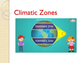
Climatic Regionalization Criteria
The regionalization of climates involves grouping similar weather and climatic characteristics based on factors like insolation, temperature, atmospheric circulation, humidity, and precipitation. This process helps in understanding the influences on vegetation, soil, and fauna in different regions of the world. Climatic regionalization seeks answers to questions about spatial scale and approach, leading to a classification scheme based on the size of areal units and methodology.

Download Presentation

Please find below an Image/Link to download the presentation.
The content on the website is provided AS IS for your information and personal use only. It may not be sold, licensed, or shared on other websites without obtaining consent from the author.If you encounter any issues during the download, it is possible that the publisher has removed the file from their server.
You are allowed to download the files provided on this website for personal or commercial use, subject to the condition that they are used lawfully. All files are the property of their respective owners.
The content on the website is provided AS IS for your information and personal use only. It may not be sold, licensed, or shared on other websites without obtaining consent from the author.
E N D
Presentation Transcript
Criteria for Climatic Regionalization
The climatic classification involves the groupings of identical weather and climatic characteristics in terms of insolation and temperature, atmospheric circulation and pressure, humidity and precipitation and their influences on vegetation, soil and fauna, of different regions of the world. , , ,
The Regionalization of climates also seeks answers of two questions: (i) what should be the spatial scale for a definite climatic region? ? (ii) what should be approach to the Regionalization? ? Thus, the scheme of classification of world climates involves two aspects: (1) Size of Areal (spatial) Units (spatial scale). ( ) ( )I (2) Methodology of classification.
Spatial scales for climatic regions The study of weather and climatic elements in an area having uniform conditions of these elements is called regional climatology wherein the size of areal unit grades from vegetable gardens and crop fields to villages, cities, forest covers, deserts, mountains, plains, countries and even to continents. Thus the spatial unit of a climatic region varies from micro spatial scale (e.g. vegetable garden and cropfield) to macro scale (e.g. a continent or part thereof). Regional climates Variety of different scales of climatic investigations macroclimate- largest area of study, area extends for 4 x 10⁸ m2, up to 6000 m vertically (continental in scale) mesoclimate- 103 m2 up to 4 x 10⁸ m2 in area (sub continental in scale) Local climate - a group of microclimates that characterize a specific region; 103 to 108 m2 in size Microclimate - the smallest category 1 to 104 m2 in area An individual field or park
Based on spatial scale of areal unit M.M. Yoshino has divided the world climates into four principal types e.g. (1) Micro Climate, (2) Local Climate, (3) Meso climate, and (4) Macro climate. (1) Micro Climate: I. Smallest areal unit II. Horizontal extent from less than one meter to 100 meters III. vertical extent from the ground surface to 100 Meters IV. Single crop field or a single household or the area around a single tree) is termed as microclimate. V. data of climatic variables are not available in published climatological data records and hence such data are always obtained through fieldwork by the individual (investigator). VI. Microclimate is related to weather conditions at ground surface level- (ranging from bare surface to grass covers, crop covers, tree covers, human structure covers etc.) VII. Microclimate as part of applied climatology.
(2) Local Climate: It comprises a few microclimatic areas and hence its dimension in terms of areal coverage is larger than microclimate. Areal unit of local climate has the horizontal extent from 100 meters to 1000 meters and vertically. The area extends from ground surface up to 1000 meters. It may be mentioned that in the study of local climate of an area (having different characteristics, namely a forest cover, an orchard, a village, an urban area etc.) the horizontal differences in climatic conditions are given more importance than the vertical differences. Local climate varies even in forest covers depending upon the nature of forest canopy, density of trees, ground cover, vertical structure, seasonality etc.
(3) Meso climate: The meso climate incorporates several local climatic areas. It has horizontal extent from 100 meters to 20 km. Vertical extent from the ground surface to 6 km in the atmosphere. Topographically the mesoclimatic area is homogeneous which is characterized by similar physical controls of climate e.g. the Ganga Delta, Konkan coastal plain, middle Ganga plain, Sundarban, Rewa plateau, Tarai region of Uttar Pradesh, Godavari Delta, Sardar Sarovar area etc. In the beginning spatial scales (i.e. scales of area) were used to determine the areas for meso climatic studies but recently the scales of atmospheric motions (super cyclones, severe tornadoes and hurricanes, pattern of precipitation in a physical unit, heat w a v e areas, cold wave areas etc.) are given more importance.
(4) Macro climate: Macroclimate also known as geoclimate or geographical climate covers largest area of all the other three types. The horizontal distance is more than 20 km, it may be several hundred kilometers and vertical extent from ground surface may be more than 6 km. Macroclimatic area may cover even the whole continent or a large country like the USA, China, Russia, Brazil, India etc. During the climatic study of macro climatic area, average atmospheric circulation pattern are used for the general study of long period climatic condition. Small scale (spatial/temporal) phenomena (Loo, breezes, local winds ets.) are not considered for regionalization.
Reference: Internet sources Savindra Singh (2011) Climatology, Prayag Pustak bhawan., Allahabad. Savindra Singh (2015) Physical Geography, Prayag Pustak bhawan., Allahabad. Websites: https://www.pmfias.com YouTube: https://www.youtube.com/c/poormansfriend Costas G. Helmis l Panagiotis T. Nastos Editors (2012) Advances in Meteorology, Climatology and Atmospheric Physics. Springer, New York. Rachita G., Climatology: Development, Division and Climatic Data. Available at https:// www. Your article library. com/ climatology/ climatology-develo - pment division -and-climatic-data/88757, accessed on 27-05-21. Thank You


 Local Climate:")
 Meso climate:")
 Macro climate:")