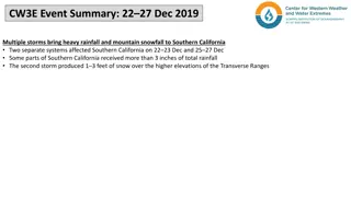
Coastal Storms and Impacts Evaluation
Workshop examining changes in coastal storms and their impacts, evaluating existing models linking nearshore and terrestrial components, collecting vertical datum with tidal benchmarks, utilizing community observations for storm surge, tide height, and general ice observations, and establishing coastal sentinel sites for monitoring.

Download Presentation

Please find below an Image/Link to download the presentation.
The content on the website is provided AS IS for your information and personal use only. It may not be sold, licensed, or shared on other websites without obtaining consent from the author.If you encounter any issues during the download, it is possible that the publisher has removed the file from their server.
You are allowed to download the files provided on this website for personal or commercial use, subject to the condition that they are used lawfully. All files are the property of their respective owners.
The content on the website is provided AS IS for your information and personal use only. It may not be sold, licensed, or shared on other websites without obtaining consent from the author.
E N D
Presentation Transcript
TAMRALIPTA MAHAVIDYALAYA SUB: BOTANY(HONS) SEMESTER:IV PAPER: C9T(UNIT- 3) TOPICS:Ground Water Submitted by ARGHYA PAL
Importance of ground Water Geological role of groundwater As an erosion agent Groundwater serves as an equalizer of streaflow. Groundwater is water found in the pores of soil and sediment, plus narrow fractures in bedrock. Ground water is the largest reservoir of fresh water that is readily available to human
Distribution of ground water: Zone of saturation: Formation: -Water reaches a zone where all of the open spaces in sediment and rock are completely filled with water. -Water within the pores is called groundwater. Water table: Theupper limit of the zone of saturation. . Capillary fringe: Extends upwards from the water table. Ground water is held by surface tension in tiny passage between grains of soil or sediment Zone of aeration: Area above the water table Includes the capillary fringe and the belt of soil moisture. Water cannot be pumped by wells.
The water table The water table is the upper limit of the zone of saturation. Variations in the water table Depth is highly variable Varies seasonably and from year to year Shape is usually a replica of the surface topography Factors that contribute to the irregular surface of the water table Water tends to pile up beneath high areas Variations in rainfall. Variations in permeability from place to place.
The water table Interaction between ground water and streams Constitutes a basic link in the hydrologic cycle. Two types of interactions - Gaining streams- Gain water from the inflow of groundwater through the streambed. - Losing streams- Lose water to the groundwater system by outflow through the streambed. Interaction between groundwater and streams Interaction -Acombination of the first to- a stream gains in some sactions and loses in other areas.
Factors influencing the storage and movement 0f groundwater Porosity: Percentage of total volume of rock or sediment that consists of pore spaces. Determines how much groundwater can be stored. Variation can be considerable over short distances. Permiability, aquitards and aquifers: Permeability- The ability of a material to transmit a fluid. Aquitard- An impermeable layer that hinders or prevents water movement(such as clay). Aquifer- Permeable rock strate or sediment that transmits groundwater freely( such as sands and gravels).
Movement of Ground water Exceedingly slow- Typical rate of movement is a few centimeters per day. Energy for the movement is provided by the force of gravity. Darcy s Law- If permeable remains uniform, the velocity of groundwater ill increase as the slope of the water table increases. Darcy s Law Hydraulic gradient- The water table slope, determined by dividing the vertical defference beytween the recharge and discharge points by the length of flo between these points. Hydraulic head- The vertical difference between the recharege and discharge points.
Features associated with groundwater Hot Springs Water is 6-9 C warmer than the mean annual air temperature of the locality. The water for most hot springs is heated by colling of igneous rock. Geysers Intermittent hot springs. Water erupts with great force. Occur where extensive underground chambers exist within hot igneous rock. Groundwater heats, expands, changes to steam and erupts. Wells To ensure a continuous supply of water, a well must penetrate below the water table. Pumping of wells can cause -Drawdown(lowering) of the water table -Cone of depression in the water table.
Features associated with groundwater Artesian Well- A situation in hich groundater under pressure rises above the level of the aquifer. Types of artesian wells. -Flowing pressure surface is above the ground. -Non flowing- pressure surface is below ground level. Not all artesian syatems are ells, artesian spring also exist.
Problems associated with ground water withdrawal Treating groundwater as a non renewable resource. In many places the water available to recharge the aquifer falls significantly short of the amount being withdrawn. Subsidence Ground sinks when water is pumped from wells faster than natural recharge processes can replace it( San joaquin Valley of California). Saltwater contamination Excessive groundwater withdrawal causes saltwater to be drown into wells, thus contaminating the fresh water supply This is primary a problem is coastal areas.
Fig.6: Saltwater contamination due to excessive well pumping
Groundwater contamination One common source is sewage Extremely premeable aquifers, such as coarse gravel, have such large openings that ground water may travel long distance without being cleaned. Sewage often becomes purified as it passes through a few dozen meters of an aquifers composed of sand or permeable sandstone. Sinking a well can lead to groundwater pollution problems. Other sources and types of contamination include substances such as Highly salt. Fertilizers Pesticides. Chemical and industrial materials.
Geological work of Ground water Groundwater dissolves rock Ground water is often mildly acidic -Contains weak carbonic acid. -Forms when rainwater dissolves carbon dioxide from the air and from decaying. Carbonic acid reacts with calcite in limestone to form calcium bicarbonate, a soluble material. Karst topography Landscape that to a large extent have been shaped by the dissolving power of groundwater. Some common features include -Irregular terrain, Sinkhole or sinks(formed by groundwater slowly dissolving the bedrock often accompanied by collapse), Striking lack of surface drainage(streams).