Coastal Vulnerability Assessment and Infrastructure Analysis in Curacao
Coastal vulnerability and resilience factors in Curacao, Netherlands Antilles, through a comprehensive audit tool. Assess the physical and human systems, engineering infrastructure, and recommended resiliency action plans. Dive into the regional and local hazards, population demographics, notable cultural resources, and more to understand the coastal dynamics of this tropical setting.

Download Presentation

Please find below an Image/Link to download the presentation.
The content on the website is provided AS IS for your information and personal use only. It may not be sold, licensed, or shared on other websites without obtaining consent from the author.If you encounter any issues during the download, it is possible that the publisher has removed the file from their server.
You are allowed to download the files provided on this website for personal or commercial use, subject to the condition that they are used lawfully. All files are the property of their respective owners.
The content on the website is provided AS IS for your information and personal use only. It may not be sold, licensed, or shared on other websites without obtaining consent from the author.
E N D
Presentation Transcript
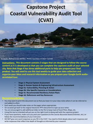
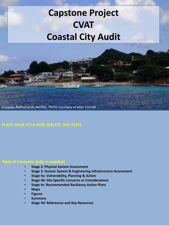
Capstone Project CVAT Coastal City Audit Curacao, Netherlands Antilles, Photo Courtesy of Sean Cornell PLACE YOUR TITLE HERE (DELETE THIS TEXT) Table of Contents: (edit as needed) Stage 2: Physical System Assessment Stage 3: Human System & Engineering Infrastructure Assessment Stage 4a: Vulnerability, Planning & Action Stage 4b: Site Specific Concerns or Considerations Stage 4c: Recommended Resiliency Action Plans Maps Figures Summary Stage 4d: References and Key Resources
Coastal Vulnerability Audit Tool (CVAT) Stage 2: Physical System Assessment City/Location Name Country State/Province Site Location (city center) Lat. Long. Coastal Setting Describe the coastal setting, shore orientation, types of landforms present, etc. Climatic Setting Tropical, Sub-Tropical, Arid, Temperate, sub-Polar, Polar, etc. Tectonic Setting Proximity to tectonic plate boundaries, active tectonic features, passive margin, etc. Topographic Profile (from inland to offshore) Use Google Earth to produce a profile as in Module 1 Lab.
Coastal Vulnerability Audit Tool (CVAT) Stage 2: Physical System Assessment (continued) Coastal Geomorphology Features present. Barrier islands, barrier reefs, sounds, estuaries, mangroves, etc. Emergent/ Submergent? Coastal Processes Wave or tide dominated? common storm trajectories, etc.) Common Local Coastal Hazards Coastal flooding, storm surge, water table positions, wave run- up, storm waves, shoreline erosion rates, landslides, etc.. Regional Coastal Hazards Tsunami, cyclone, Sea Level Rise etc. Coastal Vulnerability & Exposure Hazard (e.g., hurricane recurrence interval(s), rate of sea- level rise/fall.
Coastal Vulnerability Audit Tool (CVAT) Stage 3a.: Human System Assessment Coastal Population Population Size, Demographics, Distribution, Per Capita Density. Income Distribution. Residential Housing Shanties, Apartments/Condos, Single/Multi-story Single Family Homes, Density of housing, etc. Commercial Buildings Hotels, industrial buildings, manufacturing plants, retail, hotels, high-rise buildings etc. Notable Cultural Resources Churches, museums, monuments, etc. Built Infrastructure Bridges, Roads, Highways, Piers, Docks, Seawalls, Groins, Levees, Jetties, etc. Utilities Infrastructure (Water lines, electrical supply, waste water, etc.).
Coastal Vulnerability Audit Tool (CVAT) Stage 3b.: Engineering Infrastructure Assessment Risk Assessment(s) Low-Medium-High Risk Hazards Shoreline Engineering Existing and potential shoreline engineering strategies - offensive and defensive options. Flood Control Existing and potential projects Coastal Regulations Zoning, regulations, land use plans, building codes, etc. Insurance / Risk Reduction Flood, Surge, Wind, Fire, etc. Beach Management Existing or potential for re- nourishment etc. Non-traditional shoreline protection Hardened dunes, dewatering systems, geotubes, bioengineering, resource restoration activities, etc.
Coastal Vulnerability Audit Tool (CVAT) Stage 4a: Vulnerability, Planning and Action (continued) Smart Engineering Retrofit, improve coastal engineering, develop flood resiliency, rezone land use, etc. Ecological Restoration Wetlands, SAV restoration, Reef/Living shorelines, dune restoration, etc. Preparedness/ Response / Recovery Planning
Coastal Vulnerability Audit Tool (CVAT) Stage 4a: Vulnerability, Planning and Action Sensitivity of the Population Adaptive Capacity (Access to transportation, educational attainment, income/wealth, community preparedness, strength of social institutions, etc.) Adaptation to Climate Change Relocation, sustainable building practices, managed retreat, etc.
Coastal Vulnerability Audit Tool (CVAT) Stage 4b: Site Specific Concerns or Considerations Item 1 Item 2 Item 3 Item 4 Item 5 Item 6
Coastal Vulnerability Audit Tool (CVAT) Stage 4c: Recommended Resiliency Action Plans Additional things to consider: Likelihood of success factoring in: poverty, access to resources, natural geologic concerns, Relative expense, timeline consideratio ns, pros and cons of the action item, etc. Highest Priority: Action 1 Action 2 Action 3 Action 4 Lowest Priority: Action 5
Coastal Vulnerability Audit Tool (CVAT) Stage 4d: References and Key Resources Include web links , newspaper articles, citations to primary literature, databases, personal communicati ons, etc. Item 1 Item 2 Item 3 Item 4 Item 5

")
")
")
")
")
")
")
")
")