Comprehensive Least Squares Adjustment Engine for Modernized NSRS - History & Tools
Explore the rich history and tools of least squares adjustment software at NGS, including INERT1, HOACOS, HAVAGO, ADJUST, GPSCOM/LLSOLV, ASTA, NETSTAT, APOGEE, CALIBRATE, PAGES, and more. Learn about the evolution and applications of these tools in the geospatial domain at the 2021 Geospatial Summit on the Modernized NSRS.

Download Presentation

Please find below an Image/Link to download the presentation.
The content on the website is provided AS IS for your information and personal use only. It may not be sold, licensed, or shared on other websites without obtaining consent from the author. If you encounter any issues during the download, it is possible that the publisher has removed the file from their server.
You are allowed to download the files provided on this website for personal or commercial use, subject to the condition that they are used lawfully. All files are the property of their respective owners.
The content on the website is provided AS IS for your information and personal use only. It may not be sold, licensed, or shared on other websites without obtaining consent from the author.
E N D
Presentation Transcript
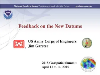
A new, comprehensive least-squares adjustment engine for the Modernized NSRS Dru Smith NSRS Modernization Manager NOAA s National Geodetic Survey May 4, 2021 2021 Geospatial summit on the Modernized NSRS 1
Outline History and motivation for change Current status Future work May 4, 2021 2021 Geospatial summit on the Modernized NSRS 2
History and motivation for change May 4, 2021 2021 Geospatial summit on the Modernized NSRS 3
A (probably incomplete) history of LSA software at NGS INERT1 (1982) HOACOS (1979) HAVAGO (1979) ADJUST GPSCOM/LLSOLV ASTA NETSTAT APOGEE CALIBRATE Additionally, LSAs are encompassed within this NGS software tool: PAGES Also, there is the following stand-alone set of matrix manipulation subroutines: Heart Of Gold (1984) May 4, 2021 2021 Geospatial summit on the Modernized NSRS 4
A (probably incomplete) history of LSA software at NGS INERT1 (1982) For Inertial Surveying Systems (NOAA TR NOS 97 NGS 26) HOACOS (1979) A precursor to ADJUST (NOAA TM NOS NGS 19 & 25) HAVAGO (1979) A precursor to ADJUST for 3-D adjustments (NOAA TM NOS NGS 17) ADJUST Initially built for horizontal observation adjustments, but modified over the years to allow for 3-D GPS-based vectors and Height Mod style GPS adjustments. Serves as the primary LSA tool in current Bluebooking of GPS projects. Can also be used to adjust classical surveying, but hasn t been used that way, with the exception of the 2013 Washington Monument project, in a decade or more. Works in a DOS environment as an EXE file. Recently enveloped into the OP2IDB project. Initially documented in NOAA TM NOS NGS 47. GPSCOM/LLSOLV -- Helmert blocking program designed to work with the output of PAGES, and thus as the core of OPUS-Projects (before the OP2IDB project) ASTA The leveling adjustment software, used in Bluebooked leveling projects and also the (unnamed) engine behind LOCUS. NETSTAT Developed for NGS to perform the NSRS2007 adjustment of GPS vectors, and used again in the 2011 national adjustment of GPS vectors. The primary reason for developing this, rather than relying on ADJUST, was efficiency and Helmert Blocking to handle the tens of thousands of vectors in the national adjustment. Generally unused at NGS with the exception of large national adjustments. APOGEE Developed in MATLAB for adjustment of relative gravity surveys, but has no direct connection to the NGS IDB. CALIBRATE Used to process data from calibrating an EDMI at a CBL Additionally, LSAs are encompassed within this NGS software tool: PAGES While PAGES is thought of predominantly as a GPS processor, it has inherent LSA functions coded inside of it. Also, there is the following stand-alone set of matrix manipulation subroutines: Heart Of Gold (1984) Sparse matrix package called by ADJUST (NOAA TM NOS NGS 39) May 4, 2021 2021 Geospatial summit on the Modernized NSRS 5
Concerns: General Inconsistency Different languages, different variable names, and different times lead to inconsistency in code Some programs might be perfectly compatible, but it s difficult to know with such a vast number of authors and code over the years. Lack of generality Code written to adjust only one type of geodetic observation has limited usefulness to other applications Languages: FORTRAN, C++, MATLAB are all in use today Scalability May 4, 2021 2021 Geospatial summit on the Modernized NSRS 6
Concern: Approximations NGS uses many approximations in our various LSA programs which are less than optimal, relative to more robust approaches Downweighting of observations rather than mathematical removal of them from the normal equations Upweighting of constraints rather than using the fixed constraint equation Hold a mark fixed/minimally constrained adjustment instead of a true inner constraint adjustment Many others May 4, 2021 2021 Geospatial summit on the Modernized NSRS 7
Solution Start from first principles and develop an entirely new LSA code library C++ Generalized (Effectively) all geodetic observation types Scalable Including Helmert Blocking if necessary Most common LESS approaches Gauss-Markov Models Variance Component Models (Partial) MINOLESS (i.e., minimally constrained adjustments using inner constraints) Pre- and post-adjustment data snooping Bias determination, outlier detection, hypothesis testing Up-to-date with recent research Colored noise, as applicable Insert this code into all NGS tools which use LSA May 4, 2021 2021 Geospatial summit on the Modernized NSRS 8
Current Status May 4, 2021 2021 Geospatial summit on the Modernized NSRS 9
LASER Least squares Adjustments: Statistics, Estimates and Residuals This is a working title only for now Contract began in August 2020 and runs until July 2021 (with the possibility of a 1 year extension) About halfway done (of 2 years work), but already Solves many LSA problems Has been tested on historic NGS archives Uses the pre-existing Eigen library of linear algebra routines May 4, 2021 2021 Geospatial summit on the Modernized NSRS 10
LASER accomplishments Experiments with the NA2011 national adjustment Primary and secondary combined 79,546 points = 238,638 unknowns 1,148 CORSs and secondary points constrained = 3,444 constraints 398,792 vectors = 1,196,376 observations Redundancy = 961,182 Successfully (automatically) identified and treated 13 independent networks within the overall network Successfully (automatically) identified vectors of questionable quality Performed the entire adjustment: On a desktop computer with 6 cores (12 logical processors) Without Helmert Blocking In under 2 hours (1 hour 54 minutes) May 4, 2021 2021 Geospatial summit on the Modernized NSRS 11
Future Work May 4, 2021 2021 Geospatial summit on the Modernized NSRS 12
Future Work Test a large or nationwide leveling adjustment Incorporate: Variance Component Model Colored noise, e.g., for time-series analysis Mixed constraints Sequential Adjustments Training Documentation May 4, 2021 2021 Geospatial summit on the Modernized NSRS 13
Thank you! May 4, 2021 2021 Geospatial summit on the Modernized NSRS 14
Questions? May 4, 2021 2021 Geospatial summit on the Modernized NSRS 15


 history of LSA software at NGS")
 history of LSA software at NGS")