Crustal Extension and Faulting in the Southern Great Basin
Explore the magnitude of crustal extension and strike-slip faulting in the southern Great Basin region as presented by Brian Wernicke, Jon E. Spencer, B. Clark Burchfiel, and Peter L. Guth in 1982. The study discusses estimates of total Cenozoic extension, assumptions for liberal estimates, strike-slip faulting impact, stable blocks, and detailed analyses of the Garlock Fault's left-lateral offsets.
Uploaded on | 0 Views
Download Presentation

Please find below an Image/Link to download the presentation.
The content on the website is provided AS IS for your information and personal use only. It may not be sold, licensed, or shared on other websites without obtaining consent from the author. If you encounter any issues during the download, it is possible that the publisher has removed the file from their server.
You are allowed to download the files provided on this website for personal or commercial use, subject to the condition that they are used lawfully. All files are the property of their respective owners.
The content on the website is provided AS IS for your information and personal use only. It may not be sold, licensed, or shared on other websites without obtaining consent from the author.
E N D
Presentation Transcript
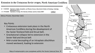
Magnitude of crustal extension in the southern Great Basin Brian Wernicke, Jon E. Spencer, B. Clark Burchfiel, Peter L. Guth 1982 Presentation by James McNeil
Introduction Amount of total Cenozoic extension in B&R has been extremely challenging to constrain 10-100% (70-400 km) in northern B&R Conservative estimate 10-30% (Thompson, 1960) Assumes normal faults where extension & rotation are proportional 20-30% for entire B&R (modern B&R) (Stewart, 1980)
Assumptions for Liberal Estimates 1. Relative crustal thickness between B&R, S.N., and Co. Plateau 20-30% (Hamilton, 1978) Current 25-35 km B&R vs. 45-50 km Co. Plateau 2. Palinspastic reconstruction of Mesozoic Cordillera 50- 100% (Hamilton and Meyers, 1966; Hamilton, 1969) Sierran batholith Idaho batholith 3. Cenozoic clockwise rotation of western Cascades 74% (340 km) in northern B&R and 140% (210 km) at latitude of Las Vegas (Magill and others, 1981) Could be as low as 36% (210 km) and 33% (80 km) respectively based on uncertainty
Strike-Slip Faulting Restoring offset linear features across strike- slip faults between areas of differential extension (Hamilton and Myers, 1966; Wright and Troxel, 1970; Davis and Burchfiel, 1973; Guth, 1981) Provides a minimum for sub-regional extension Distribution of strike slip faults in southern Great Basin @ latitude of Las Vegas provide accurate estimation for regional extension
Stable Blocks Sierra Nevada, Mojave + Spring Mtns. Block, Colorado Plateau
Garlock Fault 64 km left-lateral offset of Independence dike swarm (Smith, 1962) 64 km
Garlock Fault 48-64 km left-lateral offset of Paleozoic Garlock Formation (Smith and Ketner, 1970) 48-64 km
Garlock Fault 56-64 km left-lateral offset of Layton Well thrust (Smith, 1962) 56-64 km
Garlock Fault Minimum estimate of 60 km net crustal extension north of Garlock Fault (assuming no crustal shortening to the south) Min. 60 km
Las Vegas Valley Shear Zone Oroflex - Large scale bending (Albers, 1967)
Las Vegas Valley Shear Zone Initial estimate of 23 km right lateral offset of Glass Peak thrust and Wheeler Pass thrust(Longwell, 1974) 23 km
Las Vegas Valley Shear Zone 23 km (faulting) plus 21-25 km (bending) [Total = 44-69 km] right lateral offset of Glass Peak thrust and Wheeler Pass thrust (Longwell, 1974; Stewart and others, 1968) 44-69 km
Lake Mead Fault System 20 km left lateral offset of 12.7 m.y. Hamblin Cleopatra stratovolcano and speculated 65 km cumulative displacement (Anderson, 1973) 20 km
Lake Mead Fault System 65 km left lateral offset of Frenchman Mountain and South Virgin Mountains (Bohannon, 1979) 65 km
Lake Mead Fault System 40 km left lateral offset of River Mountains with volcano- plutonic rocks in the northern Black Mountains (b b) (Smith, 1981) 40 km
Discussion 80-100% total extension is possible Uncertainty tends to increases the estimate 140 km Northern B&R has similar crustal thickness and likely 60-80% (300-500 km) net extension
Discussion Extension of lithosphere by 2x without forming OC crust may be common Stable terrains possibly underlain by low-angle normal faults 140 km Relating timing and kinematics of individual extended terrains relative to strike-slip faulting is still needed
Takeaway point: Minimum of 65% extension (140 km) occurring between the southern Sierra Nevada and the Colorado Plateau.

