Earth Observations for Infrastructure and Disaster Management
Apply NASA Earth observations to support infrastructure planning, disaster forecasting, urban development, water resource management, and ecological forecasting. Enhance decision-making with data-driven insights to address environmental challenges and promote sustainability.

Download Presentation

Please find below an Image/Link to download the presentation.
The content on the website is provided AS IS for your information and personal use only. It may not be sold, licensed, or shared on other websites without obtaining consent from the author. If you encounter any issues during the download, it is possible that the publisher has removed the file from their server.
You are allowed to download the files provided on this website for personal or commercial use, subject to the condition that they are used lawfully. All files are the property of their respective owners.
The content on the website is provided AS IS for your information and personal use only. It may not be sold, licensed, or shared on other websites without obtaining consent from the author.
E N D
Presentation Transcript
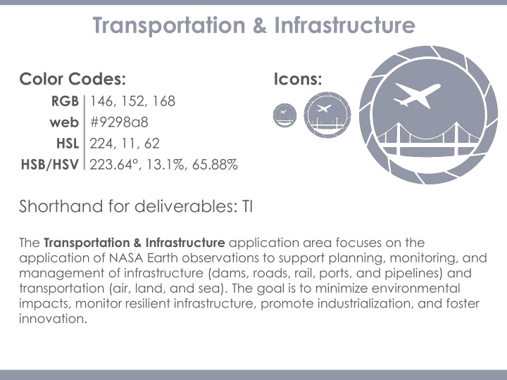
Transportation & Infrastructure Color Codes: Icons: 146, 152, 168 #9298a8 224, 11, 62 223.64 , 13.1%, 65.88% RGB web HSL HSB/HSV Shorthand for deliverables: TI The Transportation & Infrastructure application area focuses on the application of NASA Earth observations to support planning, monitoring, and management of infrastructure (dams, roads, rail, ports, and pipelines) and transportation (air, land, and sea). The goal is to minimize environmental impacts, monitor resilient infrastructure, promote industrialization, and foster innovation.
Disasters Color Codes: Icons: 62, 66, 104 #3e4268 234, 40.38, 40.78 234.29 , 40.38%, 40.78% RGB web HSL HSB/HSV Shorthand for deliverables: Disasters The Disasters application area applies NASA Earth observations to improve natural disaster forecasting, mitigation, and response. The projects contribute to improved understanding of the natural processes that produce hazards, the vulnerability of local communities, and development of hazard mitigation technologies while providing decision makers with information where and when it is needed.
Urban Development Color Codes: Icons: 27, 87, 175 #1b57af 216, 73, 40 215.68 , 84.57%, 68.63% RGB web HSL HSB/HSV Shorthand for deliverables: Urban The Urban Development application area focuses on the application of NASA Earth observations to enhance urban planning, monitoring of land change over time, assessment of urban footprints, and the development of sustainable and resilient urban environments. The goal is to support sustainability, resilience and safety of cities and human settlements through informed planning and management of climate and disaster risks.
Water Resources Color Codes: Icons: 117, 170, 219 #75aadb 148, 149, 168 208.82 , 46.58%, 85.88% RGB web HSL HSB/HSV Shorthand for deliverables: Water The Water Resources application area addresses concerns and decision processes that are related to water availability, water forecasting, and water quality. The goal is to apply NASA satellite data to improve the Decision Support Tools (DSTs) of user groups that manage water resources.
Ecological Forecasting Color Codes: Icons: 46, 134, 82 #2e8652 102, 125, 90 144.55 , 65.67%, 52.55% RGB web HSL HSB/HSV Shorthand for deliverables: Eco The Ecological Forecasting application area supports decision makers with access to science-based tools in order to understand and predict the impacts of environmental change on the ecosystems that support the existence of life on Earth. The goal is to apply NASA remote sensing and technologies to topics like conservation, habitat health and suitability, land use practices and planning, and invasive species. Note: Proposals must include a forecasting piece!
Agriculture & Food Security Color Codes: Icons: 126, 183, 97 #7eb761 71, 95, 140 99.77 , 46.99%, 71.76% RGB web HSL HSB/HSV Shorthand for deliverables: Ag The Agriculture & Food Security application area promotes innovative use of NASA Earth observations to assist with agricultural management such as enhanced monitoring of crops and rangeland. The goal is to support the maximization of production while preserving ecosystems and biodiversity to counter food insecurity.
Energy Color Codes: Icons: 233, 161, 74 #e9a14a 33, 78, 91.37 218 , 69%, 59% RGB web HSL HSB/HSV Shorthand for deliverables: Energy The Energy application area promotes the application of NASA Earth observations and model products for societal benefit through improved techniques in locating and utilizing energy sources. The goal is to support decision makers with information to help increase efficiency, use of non- traditional energy sources, and best energy practices.
Cross-Cutting Color Codes: Icons: 233, 120, 69 #e97845 13, 201, 151 18.66 , 70.39%, 91.37% RGB web HSL HSB/HSV Shorthand for deliverables: CC The Cross-Cutting theme is assigned to tech projects (ex. projects funded by the CALIPSO Science Team) and other projects that don t fit within one of the 8 application areas.
Health & Air Quality Color Codes: Icons: 150, 64, 53 #964035 7, 48, 40 6.8 , 64.67%, 58.82% RGB web HSL HSB/HSV Shorthand for deliverables: HealthAQ The Health & Air Quality application area utilizes NASA Earth observations to support air quality and public health management and policy making. The goal is to improve global health by enhancing the prediction and monitoring of environmental phenomena that effect human health such as air quality, extreme heat, and infectious disease.
Agriculture Ecological Forecasting Water Resources RGB web HSL 126, 183, 97 #7eb761 71, 95, 140 99.77 , 46.99%, 71.76% RGB web HSL 46, 134, 82 #2e8652 102, 125, 90 144.55 , 65.67%, 52.55% RGB web HSL 55, 156, 196 #379CC4 197, 56, 49 197.02 , 71.94%, 76.86% HSB/HSV HSB/HSV HSB/HSV Energy Urban Development Transportation & Infrastructure RGB web HSL 233, 161, 74 #e9a14a 33, 78, 60 32.83 , 68.24%, 91.37% RGB web HSL 27, 87, 175 #1B57AF 216, 73, 40 215.68 , 84.57%, 68.63% RGB web HSL 146, 152, 168 #9298a8 224, 11, 62 223.64 , 13.1%, 65.88% HSB/HSV HSB/HSV HSB/HSV Cross Cutting Disasters Health & Air Quality RGB web HSL 62, 66, 104 #3e4268 234, 25, 33 234.29 , 40.38%, 40.78% RGB web HSL 233, 120, 69 #e97845 13, 201, 151 18.66 , 70.39%, 91.37% RGB web HSL 150, 64, 53 #964035 7, 48, 40 6.8 , 64.67%, 58.82% HSB/HSV HSB/HSV HSB/HSV


