Effective Framework for Monitoring and Evaluation Strategies
Enhance project performance with a comprehensive monitoring and evaluation framework focusing on tracking results, implementation progress, and performance indicators. Support decision-makers with valuable insights and demonstrate project value to stakeholders.

Download Presentation

Please find below an Image/Link to download the presentation.
The content on the website is provided AS IS for your information and personal use only. It may not be sold, licensed, or shared on other websites without obtaining consent from the author. If you encounter any issues during the download, it is possible that the publisher has removed the file from their server.
You are allowed to download the files provided on this website for personal or commercial use, subject to the condition that they are used lawfully. All files are the property of their respective owners.
The content on the website is provided AS IS for your information and personal use only. It may not be sold, licensed, or shared on other websites without obtaining consent from the author.
E N D
Presentation Transcript
Four track - results based system to: Trackresults against the agreed project results framework Track implementation progress against the PIP and the agreed annual work programs Track theperformance of each IA, based on progress towards the agreed results and on implementation progress Carry out three major assessments of project performance, results and emerging impacts
Help implementation progress; agency performance make improvements and corrections managers at all levels track results; Show achievements and emerging issues to managers, decision makers and supervisors Demonstrate the value of the project to politicians and the general public
M&E staffing AnM&E Cell in the National PMU M&E Focal Points in SPMU / CPMU / RBPMU Support will be provided by theTAMC team Preparing the M&E set-up An M&E strategy and plan An M&E implementation. work plan for the first three years of
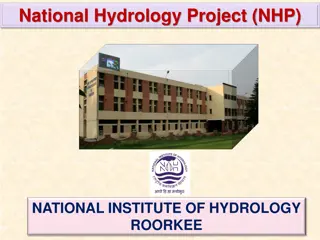
NHP NHP C. Water Resources Operation and Planning Systems C. Water Resources Operation and Planning Systems D. Institutional Capacity Enhancement D. Institutional Capacity Enhancement A. Water Resources Monitoring Systems A. Water Resources Monitoring Systems B. Water Resources Information Systems B. Water Resources Information Systems C1. Development of Analytical tools & Decision Support Platforms A1. Hydromet Observation Network D1. Water Resources Knowledge Centres B1. National WRIS A2. SCADA Systems for Water Infrastructure B2. Regional / Sub National WRIS C2. Purpose Driven Support D2. Professional Development A3. Establishment of Hydro Informatics Centres C3. Piloting innovative knowledge products D3. Project Management D4. Operational Support
At the level of the project as a whole, we measure how far we have achieved the overall PROJECT DEVELOPMENT OBJECTIVE At the level of each of the four components, we measure the OUTCOMES (the change or benefit as a result of the project) At the level of each of the twelve sub-components, we measure the OUTPUTS (the products, services or facilities produced by the project) All indicators should be SMART = Specific, Measurable, Attributable, Relevant, Time-bound
Element of the PDO Improve the extent of water resources information Improve the quality of water resources information Improve the accessibility of water resources information SMART Indicator Number of operational Hydromet stations % of data that are digitized and validated Hydromet stations are integrated with on-line state and central databases Water resources institutions achieving benchmark performance levels strengthen the capacity of targeted water resources management institutions in India
Description: This indicator measures the number of stations providing accurate data for at least 80 percent of the operational time. Online data will be at the centralized data center at the state or central levels. The accuracy will be validated using the database management software already available for quality control. Update Frequency: Annual Data Source/ Methodology: WRIS/e-SWIS Responsibility for Data Collection: NPMU/NWIC Project Component: A1 , B1 & B2
1a) Surface water stations Surface stations include stations for monitoring stream flow, water body levels, water quality, and sediments. 1b) Groundwater stations Groundwater stations include groundwater level recorders, water quality, and tube well discharge monitoring stations. 1c) Meteorology stations Meteorology stations include rain gauges, automated weather stations, and snow gauging stations. Update Frequency: Annual Data Source/ Methodology: e-SWIS Responsibility for Data Collection: NPMU/PMUs Project Component: A1, B1 & B2
Description: The types of knowledge products included in this indicator are topographic surveys, digitized maps, earth observation data products, ensemble forecast products, web-based analytical tools, forecasting materials, and water accounting reports. Information products are deemed to be made available to the stakeholders if the products are easily accessible to the relevant stakeholder (including being posted online, mobile, disseminated through e-mail, or disseminated in events). The relevant stakeholder is the user for whom the product is intended. Update Frequency: Annual Data Source/ Methodology: WRIS Responsibility for Data Collection: NWIC Project Component: B1, B2 & C1
Description: Water resources institutions would refer to central- and state- level water resources departments groundwater, water resources department training centers, and concerned societies. Benchmark performance level would mean a score of 50% or more on predefined benchmark standards Update Frequency: Annual Data Source/ Methodology: MIS Responsibility for Data Collection: NPMU Project Component:A, B C and D project Benchmark Standards Institutional setup (25%) with required setup for modeling and monitoring and core staff in place with limited turnover Training arrangements (25%) with range of courses offered, facilitated with modern training setup, trained staff, and trainers Arrangements to provide services (50%) including reports on flood forecasting, river basin assessment, collaboration and information exchange with other institutes, ease of accessibility to tools and applications developed under the including irrigation,
Description: This indicator would provide additional information about the number of institutions upgraded against their current levels. The score obtained by institutions would be classified into 10 categories or notches , with each notch representing a performance level. The notches shall be categorized in a nonlinear scale to account for baseline levels of various institutions including HP-II and new agencies. Update Frequency: Annual Data Source/ Methodology: MIS Responsibility for Data Collection: NPMU & IAs Project Component: A, B C and D
Description: A survey will be introduced at WRIS for online users and the responses that are rated as aboveaverage will be considered satisfactory Update Frequency: MTRs and ICRR Data Source/ Methodology: Online survey, WRIS Responsibility for Data Collection: NPMU/NWIC Project Component: B
Description: Measures the performance of the state and national water data centers established or upgraded under Component A. Benchmark standards include : Required infrastructure for database management Trained staff Data-sharing process with center and public Ease of access Update Frequency: MTRs and ICRR Data Source/ Methodology: MIS, rating criteria Responsibility for Data Collection: NPMU / IAs Project Component: A & B
Unique visitors No of Visits Unique pages Description: Number of page views shall measure the accessibility of information systems by new and old users at central as well as state-WRIS. Update Frequency: Annual Data Source/ Methodology: India-WRIS, State- WRIS Responsibility for Data Collection: NPMU/NWIC Project Component: B & C
Description: Measures the number of river sub-basins (CWC definition) publishing dynamic (monthly/seasonal) accounting for storages, inflow forecast, and projected demands Update Frequency: Annual Data Source/ Methodology: MIS Responsibility for Data Collection: Central and state IAs Project Component: B & C
Description: Number of stations/reservoirs where flood forecast is improved with increase in lead time at least by one day. This will be primarily achieved through integration of forecast models with weather forecast and real-time data acquisition systems. Update Frequency: Annual Data Source/ Methodology: MIS/e-SWIS Responsibility for Data Collection: IAs / NPMU Project Component: C1
Description: Number of participants who benefit from structured training over the project period. Minimum threshold for majority of formal trainings would be 20 days to capture only those who are extensively trained. Update Frequency: Annual Data Source/ Methodology: MIS Responsibility for Data Collection: IAs Project Component: D
Institutional Benchmarking Water Data Center Benchmarking MIS based Indicators and result chain Linkage of Indicators with AWP in MIS
A Institutional Setup (25 marks) A1 Hydrological Divisions A2 Staff devoted to WRM B Training (25 marks) B1 Training arrangements B2 Staff trained C Outcomes (50 marks) C1 Dynamic River basin assessment C2 Flood forecasting C3 Inter agency exchange C4 Accessibility of services Insitutional Setup 25% Insitutional Setup 25% Outcome 50% Outcome 50% Training 25% Training 25%
Parameter Parameter Description Description marking criteria 4 for Yes, 0 for No marking criteria Max Marks 4 Max Marks A1a) Do you have dedicated Hydrology Division? Hydrology division/equivalent Cell which is responsible for collecting Hydrological data. A1b) Do you have access to Modern Training facilities? Ranked from 0 to 3 3 Modern means web leaning, webinars etc. It can be either in house or regular collaboration with training institute / academic institutes etc. A cell/division which has modelling facility and operational: Flood center, knowledge center or design centers. For the purpose of sustainability of the project after 8 years A1c) Do you have cell for Water Resources Modeling 3for yes, 0 for no 3 A1d) State's own annual investment for project related activities (Rs Crores) To be decided 5
Parameter Parameter Description Description marking criteria Ratio of available vs desired* marking criteria Max Marks 5 Max Marks A2a) Percent of required staff in place Percentage of staff (regular or contractual) in place w.r.t. minimum required Number of Officials assigned to Hydro- meteorological monitoring Number of officials in water and modeling centers A2b) No of above staff not transferred during last three years (devoted to project) Including field officials Including contractual staff To make sure continuity of the system, staff should stay with project for at least three years Ratio of devoted staff to total staff 5 *Desired would be calculated based on size of state and number of basins *Desired would be calculated based on size of state and number of basins
Parameter Parameter Description Description marking criteria Ratio of available vs desired* marking criteria Max Marks 5 Max Marks B1a) Number of trainings offered by organization Climate Forecast, IWRM and planning, Database management, Irrigation planning, Hydrological and hydraulic modeling, Geo-physical mapping, Groundwater modeling, GIS, other relevant courses The courses for which signed up and using regularly. B1b) Number of courses attended through web learning system / online training modules in a year? 1 point per 2 courses 5 *Desired would be calculated based on size of state and number of basins *Desired would be calculated based on size of state and number of basins
Parameter Parameter Description Description marking criteria Ratio of trained vs desired* marking criteria Max Marks 10 Max Marks B2a) Percentage of staff trained Procurement procedures, Water management and modeling, Hydro- meteorological monitoring, other appropriate Procurement procedures, Water management and modeling, Hydro- meteorological monitoring, other appropriate B2b) Number of trainers developed Ratio of developed vs desired* 5 *Desired would be calculated based on size of state and number of basins *Desired would be calculated based on size of state and number of basins
Parameter Parameter Description Description marking criteria Ratio of assessed vs. total basins Ranked 0 to 5 based on features marking criteria Max Marks 5 Max Marks C1a) Percent of sub-basins with dynamic river basin assessment system Regular river basin assessment including water balance updated at least after 2 years Linked with climate, providing lead time, information on web, mobile and sms features, linkage with disaster authorities Monthly or other routine reports, such as hydromet data, reservoir report, GW monthly report, water availability report, trends of various parameters in map/charts C1b) Flood forecasting system 5 C1c) Number of regular assessments and reports provided on web-portal Publishe d vs. desired, number will change by state 10
Parameter Parameter Description Description marking criteria Ratio of man days vs. desired* One mark per agency, max 5 One mark per agency, max 5 marking criteria Max Marks 5 Max Marks C2a) Number of training man days offered to other agencies For cross learning and knowledge sharing, trainings imparted to other agencies Agencies such as IMD, drinking water supply and GW, agriculture C2b) Number of organization from whom regular data is imported 5 C1c) Number of departments with whom regular information is shared Information disseminated such as disaster, agriculture, revenue 5 *Desired would be calculated based on size of state and HP *Desired would be calculated based on size of state and HP- -1 HP 1 HP- -2 Status 2 Status
Parameter Parameter Description Description marking criteria Ranked from 0 to 5 marking criteria Max Marks 3 Max Marks C3a) Level of accessibility of products and services Formats of data, ease of download, support to users etc C3b) User friendliness Ranked from 0 to 5 3 Design and layout, user intuitive interface, search features etc C3c) Number of mobile applications developed Mobile applications for reaching out to stakeholders One mark per applicatio n, up to 4 Ratio of current to desired 4 C3d) Number of users of your services The number would be based on targeted users 5
A Infrastructure and Data (20 marks) A1 Data digitization and storage (10) A2 Physical facilities (10) B Trained staff (30 marks) C Outcomes (50 marks) C1 SWRIS and Data Sharing (25) C2 Ease of access (25)
Parameter Parameter Description Description marking criteria % multiplied by full marks % multiplied by full marks % multiplied by full marks marking criteria Max Marks 4 Max Marks A1a) Percent of station years digitized Percentage calculated based on total station years for which data is available Percentage calculated based on total station years and available in database A1b) Percent of stations years available in Centralized database 3 A1c) Percent of stations with real time data acquisition system Percentage based on total stations and real time stations 3
Parameter Parameter Description Description marking criteria Full marks for yes, 0 for no marking criteria Max Marks 3 Max Marks A2a) Do you have required servers available with the agency? Physical servers for all data storage and management A2b) Do you have video conferencing facility with multi-users? Full marks for yes, 0 for no 3 Video conferencing system with connectivity to multiple users and regional centers Regular backup system with backup storage in different location Usage of cloud services for data storage, management and backup A2c) Do you have regular backup system for your data? A2d) Do you use cloud server for data management? Full marks for yes, 0 for no Full marks for yes, 0 for no 2 2
Parameter Parameter Description Description marking criteria Ratio of available vs desired* marking criteria Max Marks 30 Max Marks B1) Trained Staff Availability of trained staff with the organization B1a) Number of staff practicing Hydro- meteorological monitoring B1b) Number of staff conversant with Real Time Equipment B1c) Number of officials using GIS applications Staff who is competent to design/ supervise installation. Using to generate various output reports B1d) Number of officials using Excel for Data digitization / management *Desired would be calculated based on size of state and number of basins *Desired would be calculated based on size of state and number of basins
Parameter Parameter Description Description marking criteria marking criteria Max Marks 5 Max Marks C1a) Do you have web- based State WRIS or equivalent Independent state WRIS system or developed by NRSA as state chapter C1b) Percent of state WRIS shared with India- WRIS % multiplied by full marks % multiplied by full marks 10 Layers on surface, groundwater and geo- spatial data C1c) Percent of data integrated with e- SWIS/central database Percentage integrated vs total available in database 10
Parameter Parameter Description Description marking criteria based on time range marking criteria Max Marks 5 Max Marks C2a) Time taken to share the data with the public Not shared, >1 month, 1 month, 5 days, real time C2b) Does your system allow Download of Historical Data? Full marks for yes, 0 for no 5 Download of old data available in website C2c) Do you use Mobile app for Data dissemination? Mobile apps for sharing data with public in processed form Number of different data services offered like groundwater, reservoir etc Regular exchange of data with other agencies like agricultural, drinking water etc Full marks for yes, 0 for no One mark per service, max 5 One mark per service, max 5 5 C2d) Number of services statewide 5 C2e) Number of agencies with whom regular exchange of data is in place 5


 Surface water stations")


")


")