"Explore the significance of Inner Areas in Europe with a focus on Italy's strategies to address challenges through sustainable development and innovation. Learn about the criteria to identify Inner Areas, their average altitude classification, and the national strategy to foster territorial cohesion and demographic reinforcement."
Please find below an Image/Link to download the presentation.
The content on the website is provided AS IS for your information and personal use only. It may not be sold, licensed, or shared on other websites without obtaining consent from the author. If you encounter any issues during the download, it is possible that the publisher has removed the file from their server.
You are allowed to download the files provided on this website for personal or commercial use, subject to the condition that they are used lawfully. All files are the property of their respective owners.
The content on the website is provided AS IS for your information and personal use only. It may not be sold, licensed, or shared on other websites without obtaining consent from the author.
E N D
Presentation Transcript
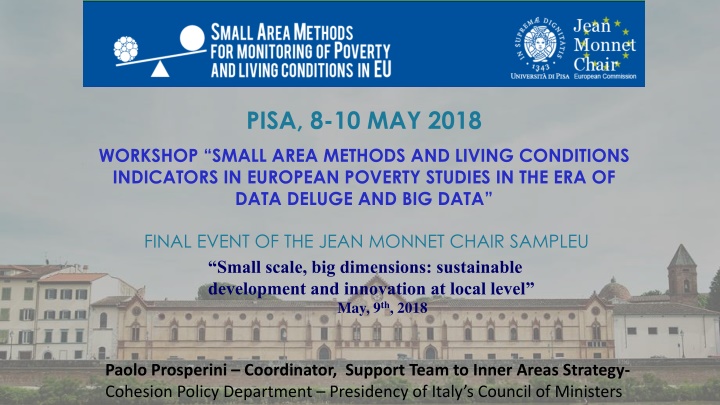
PISA, 8-10 MAY 2018 WORKSHOP SMALL AREA METHODS AND LIVING CONDITIONS INDICATORS IN EUROPEAN POVERTY STUDIES IN THE ERA OF DATA DELUGE AND BIG DATA FINAL EVENT OF THE JEAN MONNET CHAIR SAMPLEU Small scale, big dimensions: sustainable development and innovation at local level May, 9th, 2018 Paolo Prosperini Coordinator, Support Team to Inner Areas Strategy- Cohesion Policy Department Presidency of Italy s Council of Ministers
Inner Area: what does it mean? Inner Areas are those territories characterized by: a NOT adequate offer of/access to essential services to assure citizen s rights; being rich in natural assets (water resources, agricultural systems, forests, natural landscapes) and cultural resources (archaeological settlements, abbeys, small museums, craft centres); low population density; often: high seismic risk. In Italy inner areas cover almost 60% of the whole national territory embracing about 23% of its total population and more than 4,000 municipalities
Methodology to identify Inner Areas Service Centres have been defined as those municipalities that offer: an exhaustive range of secondary schools; at least a 1st level DEA (highly specialised) hospital; at least a Silver-type railway station (RFI). NO DEMOGRAPHIC CRITERIA HAVE BEEN APPLIED Areas have been mapped according to the distance (travel time) from these Service Centres as: Belt areas up to 20 minutes; Intermediate areas from 20 to 40 minutes; Remote areas from 40 to 75 minutes; Ultra remote areas over 75 minutes. Inner Areas
Italys Inner Areas Average Altitude 2 Classification of Municipalities N. % Population % % KM Single-Municipality Service Centre 217 2.7 148 20,993,647 35.3 28,987 9.6 Multi-Municipality Service Centre 123 1.5 195 3,008,676 , 5.1 8,736 2.9 Belt areas 3,571 44.1 219 22,150,877 37.3 84,235 27.9 Intermediate areas 2,371 29.3 399 8,773,390 , 14.8 88,461 29.3 Remote area 1,520 , 18.8 601 3,869,379 6.5 72,541 24.0 Ultra-remote areas 290 3.6 666 637,765 1.1 19,113 6.3 Total 8,092 100 358 59,433,734 100 302,073 100.0 Source: CTAI elaboration Istat - Census 2011 Inner Areas Source: UVAL-UVER-ISTAT elaboration on data from the Ministry of Health, Ministry of Education and RFI (Italian Railway Network)
Why a National Strategy for Inner Areas? Territorial Cohesion Objective To give true content to the EU Cohesion Policy Territorial Objective; To overcome the rural- urban dichotomy; To empower territories and people to restore growth and well-being over marginalised areas, recognising their diversity; To recover not enhanced natural and cultural assets, reducing territories depopulation and consequent abandonment costs. Ultimate Goal: Reinforce Inner Areas demographic structure National Government Department for Development Policy Territorial Cohesion Inner Areas Regions Local territories Multilateral coordination and technical support/ Technical Committee EAFRD, ERDF, ESF Vertical integration Project planning Local Stability Law development
Inner Areas Selection Criteria The Open Inner Areas method: over 100 indicators and filed work to detect: Territories with people living mainly in Inner Areas; Inner Areas losing populations; Inner Areas with consistent elderly characteristics; Inner Areas with good project implementation capacities; Inner Areas with strong local leadership and municipalities capacity to work in association.
Open Method & Criteria for Area Selection Two-step assessment process: Desk analysis (Inner Areas Open Kit) Each pre-selected area is thoroughly analysed with respect to a series of demographic and socio-economic indicators (116): e.g. Population losses and demographic structure, Utilized Agricultural Area (UAA) trends, deforestation, hydrological risk, entrepreneurship, tourism and cultural heritage, quality of education, mobility and healthcare services, Digital Divide Field analysis (National Committee s selected areas) A number of focus groups are organised at local level aiming at meeting territories e.g. local authorities, mayors, public officers in charge of services delivery, school directors, teachers, students, hospital managers and physicians . visits to pre-
Open Kit extract ABRUZZO Inner Areas ITALY Inner Areas BASSO SANGRO VALFINO VESTINA VALLE ROVETO ALTO ATERNO VAL A. General indicators ITALY ABRUZZO SUBEQUANA a.1 33 19 12 24 15 230 4185 305 8092 Municipalities a.4 22,568 26,680 24,529 9,358 35,568 484,35 13,328,750 1,307,309 59,433,744 Resident populationat 2011 a.7 100.0 100.0 82.4 100.0 42.7 100.0 100.0 37.0 22.4 % of population inner areas b.3 % population aged 2011 65 and over at 32.0 26.3 23.8 32.5 24.5 23.4 21.2 21.7 20.8 b.5 Change in total population between 1971 and 2011 -43.8 -28.4 -13.6 -46.5 -24.2 -4.0 4.6 12.1 9.8 b.6 Change in total population between 2001 and 2011 -13.7 -6.7 -5.2 -10.5 -2.1 -0.5 2.3 3.6 4.3
Open Kit extract ABRU ZZO Inner Areas ITALY Inner Areas BASSO SANGRO VALFINO VESTINA VALLE ROVETO ALTO ATERNO VAL F. Health (2014) ITALY ABRUZZO SUBEQUANA f.1 Specialistica Prestazioni erogate x 1000 residenti ambulatoriale - 1,388 46 3,000 79 1,020 2,439 2,430 4,194 4,223 f.2 136.6 160.1 160.9 145.7 153.1 153.0 145.9 153.7 170.0 Tasso di ospedalizzazione(LEA=170,0) f.3 Tasso popolazione ultra 75enne di ospedalizzazione della 309.8 379.0 366.4 326.9 323.4 356.3 348.6 372.8 336.9 f.4 Rate of avoidable (LEA=570,0) hospitalization 789.3 758.2 759.0 794.4 590.4 712.6 617.3 574.9 570.0 f.5 Percentuale residenti Domiciliare Integrata (ADI) Percentuale di parti in cui la prima visita effettuata a partire dalla dodicesima settimana di gestazione Time (in minutes ) between the start of the telephone call to the monitoring station and the arrival of the first rescue vehicle on the spot. ( - Target Eemrgency ). anziani trattati >=65 Assistenza anni 1.2 3.4 5.0 7.0 4.9 3.1 4.5 3.4 4.2 in f.6 3.4 3.6 3.9 8.1 9.5 4.8 9.9 6.1 9.3 f.7 45 38 28 43 34 26 23 23 16
Open Kit extract ABRUZZO Inner Areas ITALY Inner Areas BASSO SANGRO VALFINO VESTINA VALLE ROVETO ALTO ATERNO VAL H. Scuola (2014-2015) ABRUZZO ITALY SUBEQUANA N. medio scuole sede di erogazione del servizio per istituto scolastico h.1 12.3 8.0 9.3 14.0 8.4 6.3 5.9 5.6 4.7 h.2 Numero di scuole 15 16 10 8 19 211 5,113 434 16,929 h.3 % comuni dotati di scuola primaria 45.5 73.7 75.0 33.3 80.0 71.3 78.3 77.0 82.7 h.4 N. medio alunni per scuola 40.8 56.8 80.2 28.5 61.7 89.6 113.4 131.4 165.0 h.5 % alunni con cittadinanza non italiana Rapporto alunni disabili-docenti di sostegno % alunni residenti nello stesso comune della scuola Tasso di mobilit dei docenti 5.2 6.4 13.7 21.9 12.5 7.7 8.3 7.7 10.3 h.6 2.0 1.8 1.9 1.6 1.7 2.1 1.7 2.0 1.8 h.7 76.5 85.0 83.3 53.9 90.1 86.6 89.4 86.7 88.7 h.8 3.5 8.6 10.8 25.9 5.8 7.7 6.3 6.4 5.8 h.9 % classi con numero di alunni fino a 15 81.3 59.7 64.9 90.5 61.4 43.3 35.3 28.2 19.4 h.10 % pluriclassi su totale classi 37.5 24.2 3.5 57.1 8.8 10.2 5.0 4.1 1.7 h.11 % classi a tempo pieno 18.8 6.5 8.8 14.3 0.0 11.8 24.3 13.9 32.2 h.12 % docenti a tempo determinato 14.4 13.4 11.5 13.8 15.0 11.2 10.7 9.0 11.5 Test Invalsi: punteggio medio ( e dev. standard) del test di Italiano - Classe V primaria Test Invalsi: punteggio medio ( e dev. standard) del test di matematica - Classe V primaria 53.8 (16,4) 53.0 (16.2) 55.2 (15.8) 54.8 (15.8) 54.8 (15.8) 54.2 (16.0) 55.1 (16.2) 56.5 (15.2) 56.6 (16.0) h.13 50.6 (17.0) 53.4 (17.2) 52.8 (17.0) 53.2 (16.6) 52.2 (16.0) 52.5 (16.8) 53.6 (17.6) 53.8 (16.8) 54.6 (17.8) h.14
Selected project areas At the current stage, selected areas within the Strategy are: 72 project areas with about 2mln. total residents and 1,077 municipalities; on average: 15 municipalities and 29,000 residents per project area; about 3% of Italian population and 16.7% of Italian territory; 55% of those 2 mln. live in remote and ultra-remote areas; 4.4% population drop among selected areas between 2001 and 2011, and 2.3% between 2011 and 2016. *Source: Inner Area Strategy
Inner Areas National Strategy Method The Technical Committee along with Regions analyse Inner Areas through a desk-analysis and a field-analysis process Quantitative data and qualitative information are used to identify and select weakest Inner Areas Each selected area define its local development strategy A local development strategy is an integrated path aimed at development and growth It is based on local essential services improvements and local development projects support
How do we monitor results? an example Result Indicators to measure healthcare improvements: Actions: Reduce the time (in minutes) between the start of the emergency telephone call made and first aid vehicle s arrival at the site Increase transport organisation and efficiency that influence inhabitants access to healthcare services Percentage increase in population aged 65 and over treated via Integrated Home Care (ADI) services Promote social inclusion, fight against poverty and all forms of discrimination Increase specialist outpatient services provided per 1,000 residents Increase/Enhancement of care services and healthcare and social service infrastructure.
Panel open questions 1. Potential and effective use of data at local scale for policy address and / or evaluation 2. What difficulties have been encountered and whether innovative solutions and strategies have been proposed 3. What information needs I consider to be the most urgent to comply our meet for your work, what data at a local level I miss most