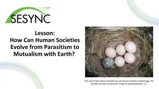
Explore how NASA satellite data is revolutionizing farming practices by optimizing freshwater resources. Understand the vital role of water in agriculture and the challenges faced in ensuring equal access globally.
Please find below an Image/Link to download the presentation.
The content on the website is provided AS IS for your information and personal use only. It may not be sold, licensed, or shared on other websites without obtaining consent from the author. If you encounter any issues during the download, it is possible that the publisher has removed the file from their server.
You are allowed to download the files provided on this website for personal or commercial use, subject to the condition that they are used lawfully. All files are the property of their respective owners.
The content on the website is provided AS IS for your information and personal use only. It may not be sold, licensed, or shared on other websites without obtaining consent from the author.
E N D
Presentation Transcript
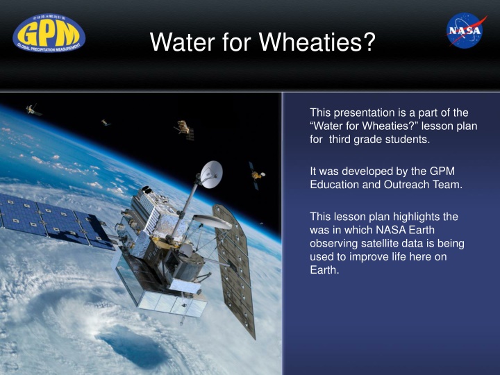
Water for Wheaties? This presentation is a part of the Water for Wheaties? lesson plan for third grade students. It was developed by the GPM Education and Outreach Team. This lesson plan highlights the was in which NASA Earth observing satellite data is being used to improve life here on Earth.
Engage Make a list of the things that you had to eat yesterday. Put a star by the things that were grown by farmers. Share your list with your partner and circle foods that have ingredients which were grown by farmers. "Food" by Anthony Acosta D.Sc is licensed under CC BY-NC-SA 2.0
Engage What do farmers need to grow crops? "North Downs 01" by Matthew-Millen is licensed under CC BY-NC-ND 2.0
Engage As you probably figured out, water is essential for farming. Let s begin by learning a little bit about Earth s freshwater resources. Earth is known as the water planet How much of Earth s surface is covered by water? Water droplet on leaf "Archive: The Blue Marble" by NASA's Marshall Space Flight Center
Engage About how much freshwater is used by farmers in the U.S. to irrigate their crops? About how much freshwater is used by farmers in developing countries to irrigate their crops? What is the difference between needing to irrigate crops versus letting them get their water directly from precipitation? Measuring precipitation before a storm.
Engage Read the article Precious Freshness . Why are freshwater resources limited? Why don t regions all over the world have equal access to freshwater resources? How are freshwater resources used around the world? Gathering water
Explore How do farmers water their crops? "IA_Farm_1" by Zonie_Zambonie is licensed under CC BY 2.0 "IMG_0779 EDIT" by Rowley Taylor is licensed under CC BY-NC-ND 2.0 Precipitation will water crops, but it has to be falling where the crops are and long enough to water them effectively. If there is no precipitation, farmers need to irrigate their crops by spraying or flooding their fields with freshwater.
Explore The last time you ate pizza, a tortilla, a bagel, wheat bread, pasta, crackers, and many other food products, you were probably enjoying wheat. Wheat is a very important crop all over the world! "Wheat / Farm / Field" by Farhan Ahmad.me is licensed under CC BY 2.0 "Pizza" by cgurholt is licensed under CC BY-NC 2.0
Explain Now you will work in one of four Expert Groups to become a specialist in one of the following topics. You will learn about two main wheat growing regions in the world, and comparing and contrasting their weather and climate. Growing Wheat Weather and Climate in Sargodha, Pakistan Weather and Climate in Gypsum, Kansas Pakistan s Freshwater Resources
Explain Locations of Two Wheat Growing Regions in Kansas and Pakistan Developed using Google Maps
Explain Expert Groups As you read your article and then discuss it with your team, use the notetaking organizer to take notes and have when you meet with your Project Team. Project Teams will have a specialist from each expert group. They will share in what they learned about their topic and will work with NASA data to help predict when farmers might need to use freshwater resources to irrigate their crops.
Explain In your expert groups, be looking for the information that answers the following questions: - How much freshwater does wheat need to grow? - When is the wheat growing season in Pakistan? - When is the wheat growing season in Kansas? - How do farmers water their wheat crops in these two locations? - Are there any problems having enough freshwater in either of these locations?
Explain In your Project Teams, you will be analyzing data from NASA s Global Precipitation Measurement mission. Let s learn a little bit about this satellite and how and why it measures precipitation from space. The GPM Core Satellite/ Image credit: NASA
Explain In your Project Teams, you are going to look at GPM data for the two wheat growing regions that the Expert Groups explored. This data will be a bit confusing at first, but you will work together to unpack it. As a Project Team, you will use this data to answer some questions about the data and to figure out whether or not the wheat farmers would need to irrigate their crops during their growing season.
Explain Locations of Two Wheat Growing Regions in Kansas and Pakistan Developed using Google Maps
Explain This data shows how much precipitation has fallen over Gypsum, Kansas between 2000 and 2019.
Explain This data shows how much precipitation has fallen over Sargodha, Pakistan between 2000 and 2019.
Explain Each Project Team will be responsible for answering the questions below: 1. How does the amount of precipitation that falls during wheat growing season in each of these two locations impact the usage of freshwater resources? 1. What are some suggestions for how to reduce the amount of freshwater needed to irrigate wheat crops?
Explain What do you think the wheat farmers in Pakistan are doing in the picture below?
Explain Take a look at these pictures and brainstorm about how the farmers are using technology to assist them in reducing the amount of freshwater resources they need to irrigate their wheat crop. Images credits: Faisal Hossain of University of Washington and PCRWR of Pakistan.
Explain Faisal Hossain is a Professor of Civil and Environmental Engineering. He has developed a way to help take data from NASA s Earth observing satellites and use it to help wheat farmers in Pakistan reduce the amount of freshwater resources they use. Read the Interview with Faisal Hossain to find out about his career and how he uses his position to improve life around the world.
Explain As you read the interview, try to find the answers to these questions: - What kinds of things does he do for his job? - How does he help wheat farmers know when to use freshwater resources to irrigate the wheat crops? - How could someone get a job like his? - How does he use NASA data to help him do his work?
Explain If you could ask Faisal Hossain questions about his career or the work he does, what are some questions you would have?
Evaluate An important part of everyone s job is to be able to communicate their findings to others. Scientists and engineers need to do this regularly to share what they have learned and to learn from each other.
Evaluate Your task is to select a method to use that will share what you learned about growing wheat, freshwater resources, the impact of weather and climate on growing wheat, and the impact of not having enough freshwater to meet the needs of the population. You will also explain how NASA data and technologies are being used to help reduce the use of freshwater. Your teacher will discuss the various options for you to use to communicate your results to others.
Extend You might be surprised to know that NASA has many Earth observing satellites that give us a lot of meaningful information about our home planet. NASA s Earth observing satellites Image credit: NASA
Extend You might wonder how a satellite above Earth is able to measure things that are on Earth. That is actually a great question, and it involved something called remote sensing . Think about when you use a television remote. You use it to point it at your television and it turns it on! Like magic! It actually uses light energy to move from the remote to the sensor on your television. "irony" by michelebandgeek is licensed under CC BY-NC-SA 2.0 Tv Remote" by charles.cla is licensed under CC BY-NC 4.0
From Satellites to Your Backyard Find out how much precipitation GPM measured for your backyard! By following these directions in this activity, you can get the data for anywhere in the world.
Extend Would you like to find out how you can help to save our precious fresh water resources in your daily life?
Extend Read this article, Earth s Water Delivery: No Passport Required to learn more about our precious freshwater resources and how they are distributed around the world.
Credits and Resources This work has been completed by the GPM Outreach Team. You can learn more about the GPM mission here. Special thanks to Faisal Hossain and the Pakistan Council of Research in Water Resources (http://www.pcrwr.gov.pk) for contributing to this work. You can learn more about Faisal Hossain and the work he is doing here. Here is a Scientists as Storytellers story about Faisal Hossain. See more about the work being done by SASWE (Sustainability, Satellites, Water, and Environment) Here is a story from NASA s Earth Observatory about the research and efforts that formed the basis of this lesson plan.