Enhancing Ocean Model Forecast Evaluation with Spatial Verification Methods
Explore the High-resolution model Verification Evaluation (HiVE) project, focusing on using neighbourhood techniques for assessing ocean model forecast skill. Learn how spatial verification methods can improve accuracy and skill in forecasting events or features of interest in space and time.

Download Presentation

Please find below an Image/Link to download the presentation.
The content on the website is provided AS IS for your information and personal use only. It may not be sold, licensed, or shared on other websites without obtaining consent from the author. If you encounter any issues during the download, it is possible that the publisher has removed the file from their server.
You are allowed to download the files provided on this website for personal or commercial use, subject to the condition that they are used lawfully. All files are the property of their respective owners.
The content on the website is provided AS IS for your information and personal use only. It may not be sold, licensed, or shared on other websites without obtaining consent from the author.
E N D
Presentation Transcript
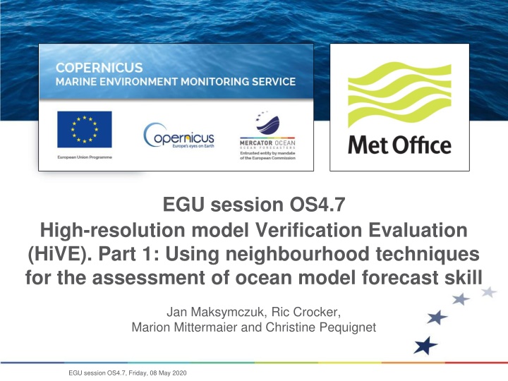
EGU session OS4.7 High-resolution model Verification Evaluation (HiVE). Part 1: Using neighbourhood techniques for the assessment of ocean model forecast skill Jan Maksymczuk, Ric Crocker, Marion Mittermaier and Christine Pequignet EGU session OS4.7, Friday, 08 May 2020
Objectives of the HiVE project The High-resolution model Verification Evaluation (HiVE) project considered CMEMS forecast products applicable to regional domains and aimed to demonstrate, for the first time, the utility of spatial verification methods (originally developed to evaluate km-scale forecasts from atmospheric models), for verifying km-scale ocean model forecasts. It was undertaken to address the need for new metrics adapted to the increased resolution in both observations and models, as identified in the CMEMS Service Evolution Strategy. Cliquez et modifiez le titre The project had two key objectives relating to the ongoing assessment protocols for ocean forecast models, and how they could be evolved to cope with future modelling systems. 1. To understand the accuracy of CMEMS products at specific observing locations using neighbourhood methods and ensemble techniques 2. To understand the skill of CMEMS products in forecasting events or features of interest in space and time - see High-resolution model Verification Evaluation (HiVE). Part 2: Using object-based methods for the evaluation of algal blooms EGU session OS4.7, Friday, 08 May 2020
Context Understand the accuracy of CMEMS products at specific observing locations using neighbourhood methods and ensemble techniques Cliquez et modifiez le titre Several CMEMS products covering the same locations, from both global and regional TACs, are available to users but are not necessarily assessed in a similar way. Trial a spatial verification methodology (HiRA - High Resolution Assessment framework) which uses ensemble and probabilistic scores to equitably compare these models with regards to their accuracy and predictive skill. Help inform CMEMS model developers and users on the basic accuracy and skill of ocean forecasts at a given location when comparing lower resolution models with their next generation evolutions (for example, the European NWS AMM7 and AMM15). EGU session OS4.7, Friday, 08 May 2020
Why spatial verification methods? Traditional verification requires an exact match between forecasts and observations at every grid point or observing location. This means that in a categorical sense (threshold) the forecast and observed region of interest must overlap. fcst obs fcst obs 10 10 3 10 In high-res forecasts the detail looks realistic but may not be in the right place at the right time. Hi res forecast RMS ~ 4.7 POD=0, FAR=1 TS=0 Low res forecast RMS ~ 2.7 POD~1, FAR~0.7 TS~0.3 This leads to the so-called "double penalty" - event predicted where it did not occur, event not predicted where it did occur In this example the low-res fcst has the smallest error and is the only fcst with non- zero POD Traditional scores do not say very much about the source or nature of the errors fcst obs 10 10 (Probability of Detection (POD); False Alarm Rate (FAR); Threat Score (TS)) EGU session OS4.7, Friday, 08 May 2020
High Resolution Assessment The High Resolution Assessment (HiRA) framework (Mittermaier 2014, Mittermaier and Csima 2017) was designed to overcome difficulties encountered using traditional verification in proving model skill when assessing high-resolution models, or when comparing deterministic and probabilistic models. The assessment does not rely on direct point-to-point comparison, but rather uses increasing sized neighbourhoods to the forecast field to generate a pseudo ensembles or a probabilistic value (based on the spatial fractional exceedance of a specified threshold) which can then be compared to an observed value. Different statistics, parameters, thresholds and neighbourhood sizes can be selected in order to assess two (or more) models. The technique used is one example of a single observation - neighbourhood forecast verification approach (SO- NF). This assumes that the observation is a true value and not only representative of the exact location at which it observes, but also has the characteristics of a surrounding area as well. This serves to mitigate the 'double- penalty' effect which can occur when comparing at the grid scale. The user can look at different sized areas to see how the skill of models varies within the area around the model. If the area becomes too big the representativity of the point observation may be lost, depending on the variable. This imposes a maximum neighbourhood size on the evaluation framework, since any skill at a given location could be deemed entirely random. EGU session OS4.7, Friday, 08 May 2020
Spatial sampling Make use of spatial verification methods which compare single observations to a forecast neighbourhood around the observation location probabilistic framework Represents a fundamental departure from traditional verification where the emphasis is on extracting the nearest grid point or bilinear interpolation to get matched forecast-ob pair. Cliquez et modifiez le titre x Traditional interpolate/nearest Observation Create distribution NOT upscaling/ smoothing! Forecast neighbourhood Ob EGU session OS4.7, Friday, 08 May 2020
Model-specific v user-relevant Probabilistic Forecast / Binary Observation Modeller interested overall performance or pdf Users interested in specific thresholds: e.g. defining a decision point or hazard obs 1 1 obs CDF CDF fcst 0 1 0 N 1 N = k x 2 i BS (p o ) i ( ) = i 1 2 = CRPS P ( x ) P ( x ) dx CDFobs- CDFfcst fcst obs pi= forecast probability oi= observed occurrence (0 or 1) Perfect score = 0 Perfect score = 0 0 k 1 K = 2 RPS ( CDF CDF ) fcst , k obs , k K 1 = k 1 K = discrete threshold categories Perfect score = 0 EGU session OS4.7, Friday, 08 May 2020
Model Domains Assessments were made using forecast products from the CMEMS catalogue Cliquez et modifiez le titre NWS - AMM7 (1/10 ) NWS - AMM15 (1.5km) EGU session OS4.7, Friday, 08 May 2020
High Resolution Assessment AMM15 vs AMM7 Daily mean SST Continuous Ranked Probability Score (CRPS) (lines) as a function of lead time (x-axis) for a range of neighbourhood sizes in grid-squares: 1 x 1(1), 3 x 3 (9), 5 x 5 (25), etc This equates to 9, 25, 49, 81, pseudo ensemble members. Note that you can equalize on ensemble members or on area. When comparing models at very different resolutions it is better to compare scores for equivalent areas. Results for January - December 2019. Here, the matching line styles represent the equivalent neighbourhood sizes that should be compared For the CRPS the smaller the score the better. EGU session OS4.7, Friday, 08 May 2020
High Resolution Assessment AMM15 vs AMM7 CRPS decreases with increasing neighbourhood size, suggesting that some spatial mismatches exist. Overall, the higher resolution AMM15 consistently has lower errors when equivalent neighbourhood extents were compared. The bars are included here to illustrate the differences in the CRPS between the two configurations, where a positive bar implies AMM7 has better (lower) CRPS, and a negative bar implies AMM15 is better. For the CRPS the smaller the score the better. EGU session OS4.7, Friday, 08 May 2020
High Resolution Assessment AMM15 vs AMM7 On-shelf Sub-setting the data demonstrates that different signals can be obtained by isolating different components of the domain. On-shelf the neighbourhoods decrease in error when moving from grid scale to assessment as small-scale variability becomes encompassed in the scores. AMM15 has consistently errors. Both models exhibit a worsening of CRPS as the forecast increases application shows of a large neighbourhood spatial smaller On-shelf lead time EGU session OS4.7, Friday, 08 May 2020
High Resolution Assessment AMM15 vs AMM7 Off-shelf CRPS scores are better (lower) for neighbourhoods in the off-shelf sub- domain, where temperatures spatially smoother. AMM15 has consistently errors. Both models exhibit a worsening of CRPS as the forecast lead time increases, which is more rapid for the off-shelf assessment. are smaller Off-shelf EGU session OS4.7, Friday, 08 May 2020
Conclusions High Resolution Assessment: It has been demonstrated statistically that higher-resolution models can be assessed equitably against lower resolution configurations Spatial methods counteract the impact of the double-penalty effect, which acts to destroy the positive signal obtained from the qualitative benefits of km-scale models Assessments have also been undertaken for the overlapping domains of AMM7 vs IBI and AMM15 vs IBI, giving similar results Applications of HiRA could be limited in some cases due to sparsity of observation coverage, as the number of available observations decreases with increasing neighbourhood size (this is mostly an issue for sites closer to the coast) Future comparative assessments of ocean models with different resolutions would benefit from using HiRA as part of the evaluation process, as it gives a more equitable and appropriate reflection of model performance at higher resolutions EGU session OS4.7, Friday, 08 May 2020
Questions and discussion Cliquez et modifiez le titre Further detail at: Ocean Science paper, submitted in February 2020 - Crocker R., Maksymczuk J., Mittermaier M., Tonani M., Pequignet C. An approach to the verification of high-resolution ocean models using spatial methods This work has been carried out as part of the Copernicus Marine Environment Monitoring Service (CMEMS) HiVE project. CMEMS is implemented by Mercator Ocean International in the framework of a delegation agreement with the European Union. Verification was performed using the Point-Stat tool, which is part of the Model Evaluation Tools (MET) verification package, that was developed by the National Center for Atmospheric Research (NCAR), and which can be configured to generate CRPS results using the HiRA framework. MET is free to download from GitHub at https://github.com/NCAR/MET. EGU session OS4.7, Friday, 08 May 2020