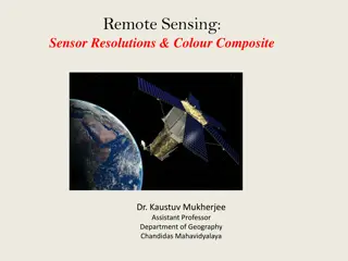
Enhancing Weather and Environmental Security Using Remote Sensing Capabilities
Using GOES-R and JPSS remote sensing capabilities to enhance weather, climate, water, and environmental security involves detecting and characterizing fires, analyzing heavy precipitation, and more. NOAA plays a crucial role in the operational use of satellite information, with upcoming launches and short courses planned to further satellite applications in meteorology and climatology.

Download Presentation

Please find below an Image/Link to download the presentation.
The content on the website is provided AS IS for your information and personal use only. It may not be sold, licensed, or shared on other websites without obtaining consent from the author.If you encounter any issues during the download, it is possible that the publisher has removed the file from their server.
You are allowed to download the files provided on this website for personal or commercial use, subject to the condition that they are used lawfully. All files are the property of their respective owners.
The content on the website is provided AS IS for your information and personal use only. It may not be sold, licensed, or shared on other websites without obtaining consent from the author.
E N D
Presentation Transcript
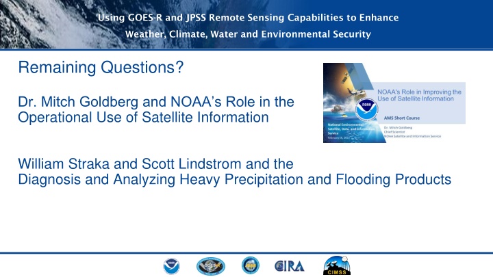
Using GOES-R and JPSS Remote Sensing Capabilities to Enhance Weather, Climate, Water and Environmental Security Remaining Questions? Dr. Mitch Goldberg and NOAA s Role in the Operational Use of Satellite Information William Straka and Scott Lindstrom and the Diagnosis and Analyzing Heavy Precipitation and Flooding Products
Using GOES-R and JPSS Remote Sensing Capabilities to Enhance Weather, Climate, Water and Environmental Security Day 2 of 2 Detection and Characterization of Fires & Smoke from ABI and VIIRS - Ivan Csiszar, Branch Chief, Satellite Meteorology and Climatology Division, NOAA/NESDIS/STAR Downloading, Using and Processing ABI and VIIRS Level 2 Data Files - Amy Huff, IMSG at NOAA/NESDIS/STAR Linking the Topics - all instructors
Using GOES-R and JPSS Remote Sensing Capabilities to Enhance Weather, Climate, Water and Environmental Security CIRA VISIT Website for Retrieving Presentation Slides: https://rammb.cira.colostate.edu/training/visit/links_and_tutorials/2022_AMS_Satellite_Short_Course.asp Upcoming Launches: GOES T: 1 March 2022 (virtual, Kennedy Space Center) JPSS-2: 30 September (Vandenburg AFB) Future AMS Satellite Applications Short Courses: AMS Committee on Satellite Meteorology, Oceanography and Climatology virtual training on satellite data applications 4 topics to be covered in May, June, and July AMS Short Course on GOES-R and JPSS at the Collective Madison Meeting in Madison, WI on 7 August
Using GOES-R and JPSS Remote Sensing Capabilities to Enhance Weather, Climate, Water and Environmental Security CIRA VISIT Website for Retrieving Presentation Slides: https://rammb.cira.colostate.edu/training/visit/links_and_tutorials/2022_AMS_Satellite_Short_Course.asp Upcoming Launches: GOES T: 1 March 2022 (virtual, Kennedy Space Center) JPSS-2: 30 September (Vandenburg AFB) Future AMS Satellite Applications Short Courses: AMS Committee on Satellite Meteorology, Oceanography and Climatology virtual training on satellite data applications 4 topics to be covered in May, June, and July AMS Short Course on GOES-R and JPSS at the Collective Madison Meeting in Madison, WI on 7 August
Using GOES-R and JPSS Remote Sensing Capabilities to Enhance Weather, Climate, Water and Environmental Security Thank you for participating in Day 1! See you tomorrow, February 17, 2022 11:00 AM - 3:00 PM Eastern Time (Virtual) Same Zoom link, same time, both days