Exploring Earthquake History in Ghana with Dr. Patrick Asamoah Sakyi
Delve into the earthquake history of Ghana with Dr. Patrick Asamoah Sakyi from the Department of Earth Science at the University of Ghana. Discover significant earthquakes, modern seismographs, earthquake risk assessments, epicenters, geological structures, and active faults in Ghana. Get insights into the earthquake risk map and recommended reading materials for a comprehensive understanding.
Download Presentation

Please find below an Image/Link to download the presentation.
The content on the website is provided AS IS for your information and personal use only. It may not be sold, licensed, or shared on other websites without obtaining consent from the author. If you encounter any issues during the download, it is possible that the publisher has removed the file from their server.
You are allowed to download the files provided on this website for personal or commercial use, subject to the condition that they are used lawfully. All files are the property of their respective owners.
The content on the website is provided AS IS for your information and personal use only. It may not be sold, licensed, or shared on other websites without obtaining consent from the author.
E N D
Presentation Transcript
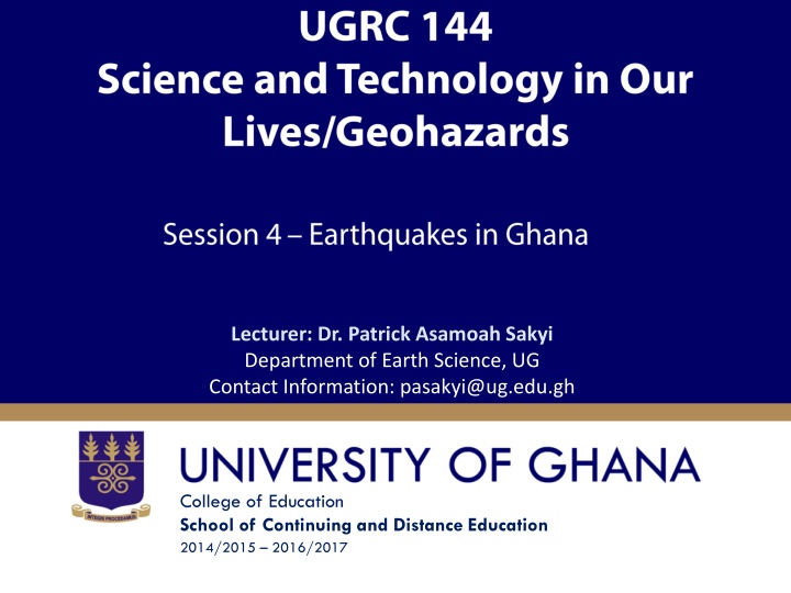
Lecturer: Dr. Patrick Asamoah Sakyi Department of Earth Science, UG Contact Information: pasakyi@ug.edu.gh College of Education School of Continuing and Distance Education 2014/2015 2016/2017
Session Overview This session introduces students to earthquake history in Ghana, including past occurrences and locations. Most people living in Ghana today have never experienced an earthquake, and Ghanaians may find it difficult to associate earthquake disasters with Ghana. However, evidence based on the history of the Gold Coast/Ghana, modern day seismograph recordings and the geology of Ghana indicates a high earthquake disaster risk for Ghana. Slide 2 Dr. Patrick A. Sakyi, Dept. of Earth Science
Session Outline The key topics to be covered in the session are as follows: Topic One History of Earthquakes in Ghana Topic Two Modern Seismographs in Ghana Topic Three Earthquake Risk in Ghana Topic Four - Earthquake Epicenters and the Regional Geological Structures of Ghana Topic Five Active Faults in Ghana Topic Six - Earthquake Risk Map of Ghana Slide 3 Dr. Patrick A. Sakyi, Dept. of Earth Science
Reading List Unit 1, Section 4 of UGRC 140 II Geohazards Institute of Continuing and Distance Education Slide 4 Dr. Patrick A. Sakyi, Dept. of Earth Science
Topic One HISTORY OF EARTHQUAKES IN GHANA Slide 5 Dr. Patrick A. Sakyi, Dept. of Earth Science
History of Earthquakes in Ghana The most significant earthquakes (magnitude 6.0 and above) which caused severe damage are: Elmina (1615) Axim (1636) Accra (1882) Ho (1906) Accra (1939). Slide 6 Dr. Patrick A. Sakyi, Dept. of Earth Science
History of Earthquakes in Ghana 1939 EARTHQUAKE The 1939 earthquake which was located 40 km offshore to the southwest of Accra shook most of West Africa. Slide 7 Dr. Patrick A. Sakyi, Dept. of Earth Science
History of Earthquakes in Ghana Minor Historic Earthquakes Notable minor tremors were also felt in: 1858 1863 1883 1911 1918 1919 1925 1930 1933 1907 1923 1935 Slide 8 Dr. Patrick A. Sakyi, Dept. of Earth Science
History of Earthquakes in Ghana Recent Significant Earthquakes Since 1939, no earthquake has caused any major destruction in Ghana. Events that have caused concern since independence have all been centered on Accra. Slide 9 Dr. Patrick A. Sakyi, Dept. of Earth Science
History of Earthquakes in Ghana Recent Significant Earthquakes They were of Magnitude 4.5 or less recorded in 1964 1967 1969 1978 1985 1995 Slide 10 Dr. Patrick A. Sakyi, Dept. of Earth Science
History of Earthquakes in Ghana Recent Significant Earthquakes A recent notable event was a magnitude 4.4 earthquake which occurred on Independence Day 6th March1997. Slide 11 Dr. Patrick A. Sakyi, Dept. of Earth Science
Topic Two MODERN SEISMOGRAPHS IN GHANA Slide 12 Dr. Patrick A. Sakyi, Dept. of Earth Science
Modern Seismographs in Ghana Modern day recording of earthquakes begun in Ghana when a 6-component World Wide Standard Seismograph Station (WWSSS) was commissioned in Kukurantumi in the Eastern Region in March 1973. Later, many more seismographs were installed in south eastern Ghana for the monitoring of earthquakes. Since 1973 scores of earthquakes, some of magnitude as low as one (1) have been recorded in southern Ghana, and their epicentres determined Slide 13 Dr. Patrick A. Sakyi, Dept. of Earth Science
Topic Three EARTHQUAKE RISK IN GHANA Slide 14 Dr. Patrick A. Sakyi, Dept. of Earth Science
Earthquake Risk in Ghana Earthquake hazard means the probability of occurrence of an earthquake of sufficient Magnitude capable of causing damage to the weakest man-made structure. Risk means the measure of the likelihood of harmful consequences arising from the interaction of a hazard, vulnerable community elements and the environment. Slide 15 Dr. Patrick A. Sakyi, Dept. of Earth Science
Topic Four EARTHQUAKE EPICENTERS AND THE REGIONAL GEOLOGICAL STRUCTURES OF GHANA Slide 16 Dr. Patrick A. Sakyi, Dept. of Earth Science
Earthquake Epicenters and the Regional Geological Structures of Ghana LEGEND Magnitudes of Epicenters 8.0E+005 Recent Formation Amisian Sekondian Bocene Buem Formation Togo Series Granite Voltaian Dahomeyan Mafic Dahomeyan Felsic Tarkwaian Metasediments (Birimian) Metavolcanics (Birimian) 1.0 to 3.5 3.5 to 4.3 4.3 to 4.9 4.9 to 5.5 5.5 to 6.2 6.2 to 6.9 HO 6.0E+005 NORTHINGS (ft) Akuse KOFORIDUA Keta 4.0E+005 FAULTS Prampram Normal Nsawam Tema Thrust Downthrow ACCRA 2.0E+005 Tarkwa CAPE COAST Half Assini Axim SEKONDI 2.0E+005 4.0E+005 6.0E+005 8.0E+005 1.0E+006 1.2E+006 1.4E+006 1.6E+006 EASTINGS (ft) Slide 17 Dr. Patrick A. Sakyi, Dept. of Earth Science 0.0E+000 2.0E+005 4.0E+005 6.0E+005 8.0E+005
Topic Five ACTIVE FAULTS IN GHANA Slide 18 Dr. Patrick A. Sakyi, Dept. of Earth Science
Active Faults in Ghana All the earthquake activity in Ghana can be associated with three major tectonic zones of weakness active in Ghana. - Cote d Ivoire Fault - Akuapim Fault Zone - Coastal Boundary Fault Slide 19 Dr. Patrick A. Sakyi, Dept. of Earth Science
Active Faults in Ghana In the south-west, is the Cote d` Ivoire fault which cuts through Ghana. LEGEND Magnitudes of Epicenters 8.0E+005 Recent Formation Amisian Sekondian Bocene Buem Formation Togo Series Granite Voltaian Dahomeyan Mafic Dahomeyan Felsic Tarkwaian Metasediments (Birimian) Metavolcanics (Birimian) 1.0 to 3.5 3.5 to 4.3 4.3 to 4.9 4.9 to 5.5 5.5 to 6.2 6.2 to 6.9 HO 6.0E+005 NORTHINGS (ft) Akuse KOFORIDUA Keta 4.0E+005 FAULTS Prampram Normal Nsawam Tema Thrust Downthrow ACCRA 2.0E+005 Tarkwa CAPE COAST Half Assini Axim SEKONDI 2.0E+005 4.0E+005 6.0E+005 8.0E+005 1.0E+006 1.2E+006 1.4E+006 1.6E+006 EASTINGS (ft) Slide 20 Dr. Patrick A. Sakyi, Dept. of Earth Science 0.0E+000 2.0E+005 4.0E+005 6.0E+005 8.0E+005
Active Faults in Ghana The north-east trending Akuapem fault which intersects with the Coastal Boundary fault just to the west of Accra LEGEND . Magnitudes of Epicenters 8.0E+005 Recent Formation Amisian Sekondian Bocene Buem Formation Togo Series Granite Voltaian Dahomeyan Mafic Dahomeyan Felsic Tarkwaian Metasediments (Birimian) Metavolcanics (Birimian) 1.0 to 3.5 3.5 to 4.3 4.3 to 4.9 4.9 to 5.5 5.5 to 6.2 6.2 to 6.9 HO 6.0E+005 NORTHINGS (ft) Akuse KOFORIDUA Keta 4.0E+005 FAULTS Prampram Normal Nsawam Tema Thrust Downthrow ACCRA 2.0E+005 Tarkwa CAPE COAST Half Assini Axim SEKONDI 2.0E+005 4.0E+005 6.0E+005 8.0E+005 1.0E+006 1.2E+006 1.4E+006 1.6E+006 Slide 21 Dr. Patrick A. Sakyi, Dept. of Earth Science EASTINGS (ft) 0.0E+000 2.0E+005 4.0E+005 6.0E+005 8.0E+005
Active Faults in Ghana . Near Accra is the Coastal Boundary Fault LEGEND Magnitudes of Epicenters 8.0E+005 Recent Formation Amisian Sekondian Bocene Buem Formation Togo Series Granite Voltaian Dahomeyan Mafic Dahomeyan Felsic Tarkwaian Metasediments (Birimian) Metavolcanics (Birimian) 1.0 to 3.5 3.5 to 4.3 4.3 to 4.9 4.9 to 5.5 5.5 to 6.2 6.2 to 6.9 HO 6.0E+005 NORTHINGS (ft) Akuse KOFORIDUA Keta 4.0E+005 FAULTS Prampram Normal Nsawam Tema Thrust Downthrow ACCRA 2.0E+005 Tarkwa CAPE COAST Half Assini Axim SEKONDI 2.0E+005 4.0E+005 6.0E+005 8.0E+005 1.0E+006 1.2E+006 1.4E+006 1.6E+006 EASTINGS (ft) 0.0E+000 2.0E+005 4.0E+005 6.0E+005 8.0E+005 Slide 22 Dr. Patrick A. Sakyi, Dept. of Earth Science
Active Faults in Ghana . Coastal Boundary Fault The CBF is a major fault parallel to the coast just a few kilometers off shore and trending east-west. To the east, this fault most probably strikes inland and continues as the faulted northern margin of the Keta Basin. Slide 23 Dr. Patrick A. Sakyi, Dept. of Earth Science
Active Faults in Ghana .Expected Epicentre Anywhere along the Akwapim Togo range (along the Akwapim fault zone) Out to sea along the entire coast line of Ghana (on the coastal boundary fault) The intersection of these two faults (near Accra in the area between Weija and Nyanyanu on the coast) would be the most likely location of the next major earthquake in Ghana. The date and time of such an event cannot be predicted. Slide 24 Dr. Patrick A. Sakyi, Dept. of Earth Science
Topic Six EARTHQUAKE RISK MAP OF GHANA Slide 25 Dr. Patrick A. Sakyi, Dept. of Earth Science
Earthquake Risk Map of Ghana Slide 26 Dr. Patrick A. Sakyi, Dept. of Earth Science
END Slide 27 Dr. Patrick A. Sakyi, Dept. of Earth Science


