Exploring Helium in Regional Salt Seals - Implications for Energy Exploration
Discover the significance of the world's oldest regional salt seal in the Amadeus and Officer Basins for subsalt helium and hydrocarbon exploration. Learn about the geological requirements, helium properties, and commercial aspects of helium in hydrocarbon reservoirs. Uncover why Western Australia is a promising location for exploring the potential of the Amadeus and Officer Basins.

Download Presentation

Please find below an Image/Link to download the presentation.
The content on the website is provided AS IS for your information and personal use only. It may not be sold, licensed, or shared on other websites without obtaining consent from the author. If you encounter any issues during the download, it is possible that the publisher has removed the file from their server.
You are allowed to download the files provided on this website for personal or commercial use, subject to the condition that they are used lawfully. All files are the property of their respective owners.
The content on the website is provided AS IS for your information and personal use only. It may not be sold, licensed, or shared on other websites without obtaining consent from the author.
E N D
Presentation Transcript
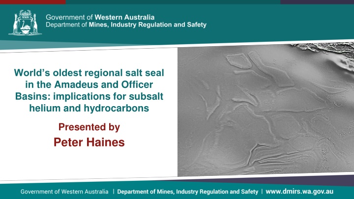
Worlds oldest regional salt seal in the Amadeus and Officer Basins: implications for subsalt helium and hydrocarbons Presented by Peter Haines
Talk outline Helium introduction Helium in hydrocarbon reservoirs Geological requirements for commercial helium accumulations Why Western Australia may a good place to explore Amadeus Basin Officer Basin Conclusions
Helium (He) Helium properties Second lightest element Second most abundant element in visible universe Noble gas / inert Lowest boiling point (-269 C) Very high demand with numerous hi-tech uses Primordial He mainly found in mantle; crustal He constantly generated by radioactive decay of U and Th ( -particle = He nucleus) Highly mobile due to inertness and small atom size; most free He in the crust lost into space over geological time
Helium in hydrocarbon reservoirs Most commercial He a bi-product of hydrocarbon production; separated from waste gas stream (rare He-only wells) Small concentrations (<<1%) can be economic, depending on infrastructure and markets High concentrations (>1%) are rare US first and biggest producer (since 1920s); stockpiled He (National Helium Reserve) in depleted Texas gas field until mid-1990s Non-US production only significant since 1990s Australia producing He from Bayu-Undan field offshore Bonaparte Basin since 2010 (~0.1% He at wellhead)
Geological requirements for commercial helium accumulations A He source: radiogenic U-Th bearing rocks in basement or within a basin A migration pathway (access to gas phase in pore fluid) A porous reservoir and trap (same as conventional hydrocarbons) Excellent seal due to high mobility; best seals are salt (halite, anhydrite) Lots of time because He generation/accumulation is very slow Coexisting hydrocarbon source; but a prolific source may reduce He concentration Therefore for highest He concentration (>1%) look in old basins with marginal hydrocarbon source rocks and intact salt seals over early formed traps (in US most production from Paleozoic fields with late Paleozoic salt seal)
Relevance to WA? Extensive old basins (Paleozoic, Neoproterozoic, and older) Radiogenic basement common Multiple old salt deposits including world s oldest basin-scale salt deposits (~800 Ma) in Officer and Amadeus basins; possibly extending elsewhere in the Centralian Superbasin Due to long periods of stability since the Paleozoic the salt has potential to seals traps dating from the Paleozoic or even Neoproterozoic
Centralian Superbasin (Post mid-Cambrian omitted) Modified from Munson 2013 NTGS Spec Pub 5 Centralian Superbasin Tectonized Centralian Superbasin under Canning Basin Super- sequences Generalized succession Cambrian 541 Ma SS4 Syntectonic siliciclastic package Ediacaran Post-glacial marine package SS3 ~635 Ma Neoproterozoic Elatina ( Marinoan ) Glaciation glacial erosion / unconformity Cryogenian Inter-glacial marine package SS2 Sturt ( Sturtian ) Glaciation glacial erosion / unconformity ~720 Ma Evaporite carbonate shale package SS1 Tonian Basal siliciclastic package 1000 Ma Mesoproterozoic
Centralian Superbasin (Post mid-Cambrian omitted) Modified from Munson 2013 NTGS Spec Pub 5 Centralian Superbasin Tectonized Centralian Superbasin under Canning Basin Super- sequences Generalized succession Cambrian 541 Ma SS4 Syntectonic siliciclastic package ? ? Ediacaran ? ? Post-glacial marine package ? SS3 ~635 Ma Neoproterozoic Elatina ( Marinoan ) Glaciation glacial erosion / unconformity ? Cryogenian ? ? Inter-glacial marine package ? ? SS2 ? Sturt ( Sturtian ) Glaciation glacial erosion / unconformity ~720 Ma ? Evaporite carbonate shale package SS1 Tonian Basal siliciclastic package 1000 Ma Mesoproterozoic Salt ~800 Ma (halite/anhydrite)
Amadeus Officer Tonian correlations Amadeus Basin WA Officer Basin ~753 Ma volcanics vvvvvvv Baicalia burra Stromatolite Assemblage Wallara Formation upper Buldya Group Supersequence 1 Browne Formation Buldya Group Bitter Springs Gp Johnnys Creek Fm upper Browne salt Acaciella australica Stromatolite Assemblage Tungussia erecta Woolnough Member Loves Creek Fm ? Gillen Formation lower Browne salt Gillen salt ? basal Gillen shale Lefroy Fm Heavitree Fm, Dean Qtz, Kulail Sst Townsend Quartzite Reservoir Hydrocarbon source Bitter Sp. Anomaly 13C (~800 Ma) Stromatolites
Centralian Superbasin (Post mid-Cambrian omitted) Modified from Munson 2013 NTGS Spec Pub 5 Centralian Superbasin Tectonized Centralian Superbasin under Canning Basin Super- sequences Generalized succession Cambrian 541 Ma SS4 Syntectonic siliciclastic package ? ? Ediacaran ? ? Post-glacial marine package ? SS3 ~635 Ma Dukas 1 Mt Kitty 1 Neoproterozoic GSWA Lancer 1 Elatina ( Marinoan ) Glaciation glacial erosion / unconformity Magee 1 Yowalga 3 Kanpa 1A ? Cryogenian GSWA Empress 1A ? ? Mulyawara 1 Inter-glacial marine package ? ? SS2 Kutjara 1 ? Sturt ( Sturtian ) Glaciation glacial erosion / unconformity ~720 Ma ? Evaporite carbonate shale package SS1 Tonian Basal siliciclastic package 1000 Ma Mesoproterozoic Salt ~800 Ma (halite/anhydrite)
Eastern Amadeus Basin Centralian Superbasin Gillen Fm salt Murphy 1 WCR Gillen Fm gypsum Ringwood Dome, NT Contorted Gillen Fm Ellery Creek, NT Bitter Sp Gp Lower Gillen Fm shale NT Johnnys Creek Fm Heavitree Fm Alice Springs, NT Loves Creek Fm salt lower shale sandstone Gillen Formation Heavitree Fm Salt in upper Gillen Formation Sub-salt black shales in NT drill holes (TOC up to 1.8%: Jarrett et al., 2016) are assumed source of sub-salt gas flows in Magee 1 and Mt Kitty 1
WA Amadeus Basin Basal Gillen Fm shale north Centralian Superbasin Contorted Bitter Springs Group Bonython Ra Basal Gillen Fm shale south Heavitree Fm north Dean Quartzite south Stromatolites allow confident identification of Gillen Fm in WA Abundant evidence of salt tectonics in WA; no salt at surface but salt seal probably preserved at depth Lower Gillen Fm shales in southwest much thicker than in east Amadeus Thick sub-salt reservoir; some outcrops in N are not strongly silicified
Dukas 1 Magee 1 (2,696 m) Pacific Oil & Gas 1992 63.1 Mscfd from 4.5 m sst Shale 0.5-0.8% TOC Nitrogen 43.61% Methane 30.58% Ethane 5.96% 49.09% Propane 1.94% Butane+ 1.66% Carbon dioxide 0.58% Hydrogen 0.03% Argon 0.46% Helium 6.23% Santos 2019 (Central Pet ten.) (Drilling suspended above inferred reservoir) Amadeus Basin Mt Kitty 1 (2,295 m) Santos 2014 (Central Petroleum tenement) 420 Mscfd from weathered/fractured granite Nitrogen 61% Methane 13% 18% Ethane 4% Hydrogen 11% Helium 9%
Dukas 1 Magee 1 (2,696 m) Pacific Oil & Gas 1992 63.1 Mscfd from 4.5 m sst Shale 0.5-0.8% TOC Nitrogen 43.61% Methane 30.58% Ethane 5.96% 49.09% Propane 1.94% Butane+ 1.66% Carbon dioxide 0.58% Hydrogen 0.03% Argon 0.46% Helium 6.23% Santos 2019 (Central Pet ten.) (Drilling suspended above inferred reservoir) Amadeus Basin Prove existence of a subsalt gas-prone hydrocarbon system Prove integrity of the salt seal 9% He (Mt Kitty 1) close to the upper limit from wells world-wide Isotope analysis indicates predominantly crustal He source Concentration of other radiogenic noble gas isotopes indicates trapping and accumulation since Neoproterozoic (McInnes et al, 2017) Hydrogen content (Mt Kitty 1) possibly results from either hydrocarbon oxidation or as an abiogenic breakdown product of hydrocarbons in the granite reservoir (McInnes et al, 2017) Both wells uneconomic because of poor reservoir Mt Kitty 1 (2,295 m) Santos 2014 (Central Petroleum tenement) 420 Mscfd from weathered/fractured granite Nitrogen 61% Methane 13% 18% Ethane 4% Hydrogen 11% Helium 9%
Dukas 1 Magee 1 (2,696 m) Pacific Oil & Gas 1992 63.1 Mscfd from 4.5 m sst Shale 0.5-0.8% TOC Nitrogen 43.61% Methane 30.58% Ethane 5.96% 49.09% Propane 1.94% Butane+ 1.66% Carbon dioxide 0.58% Hydrogen 0.03% Argon 0.46% Helium 6.23% Santos 2019 (Central Pet ten.) (Drilling suspended above inferred reservoir) Amadeus Basin Too deep Mt Kitty 1 (2,295 m) Santos 2014 (Central Petroleum tenement) 420 Mscfd from weathered/fractured granite Nitrogen 61% Methane 13% 18% Ethane 4% Hydrogen 11% Helium 9%
From Haines and Allen, 2019, WABS paper salt salt
Centralian Superbasin (Post mid-Cambrian omitted) Modified from Munson 2013 NTGS Spec Pub 5 Centralian Superbasin Tectonized Centralian Superbasin under Canning Basin Super- sequences Generalized succession Cambrian 541 Ma SS4 Syntectonic siliciclastic package ? ? Ediacaran ? ? Post-glacial marine package ? SS3 ~635 Ma Dukas 1 Mt Kitty 1 Neoproterozoic GSWA Lancer 1 Elatina ( Marinoan ) Glaciation glacial erosion / unconformity Magee 1 Yowalga 3 Kanpa 1A ? Cryogenian GSWA Empress 1A ? ? Mulyawara 1 Inter-glacial marine package ? ? SS2 Kutjara 1 ? Sturt ( Sturtian ) Glaciation glacial erosion / unconformity ~720 Ma ? Evaporite carbonate shale package SS1 Tonian Basal siliciclastic package 1000 Ma Mesoproterozoic Salt ~800 Ma (halite/anhydrite)
Modified from Munson 2013 NTGS Spec Pub 5 Centralian Superbasin Tectonized Centralian Superbasin under Canning Basin ? ? SW NE ? ? ? Dukas 1 Mt Kitty 1 GSWA Lancer 1 Magee 1 Yowalga 3 Kanpa 1A ? GSWA Empress 1A ? ? Mulyawara 1 ? ? Kutjara 1 ? ?
Western Officer Basin: Browne Formation in GSWA Lancer 1 Centralian Superbasin dolomite salt
Western Officer Basin: Browne Formation in GSWA Lancer 1 Centralian Superbasin Limited subsalt exploration GSWA stratigraphic holes not drilled on identified structural traps, and drilled into thin succession west of basin depocentre where salt unit sits on basement with very little subsalt shale Exploration wells Kanpa 1A drilled outside subsalt reservoir; Yowalga 3 didn t reach subsalt reservoir (if present) Subsalt shale and sandstone reservoir can be inferred farther east (outcrop evidence) Exploration drilling in SA near WA border (Mulyawara 1, Kutjara 1) prove subsalt shale and sandstone present, and contain numerous but minor gas shows over this stratigraphy
Conclusions World s oldest regional salt seal widespread in Amadeus and Officer Basins Basins overlie radiogenic basement He source Salt locally overlies thick sandstone reservoir and marginal gas-prone hydrocarbon source rocks Salt-sealed traps likely formed early (Neoproterozoic & Paleozoic tectonics) Ingredients thus in place for a world-class He province (challenges are remoteness, and lack of subsurface data) Trapping of very high He concentration in gas proven in two eastern Amadeus Basin wells (though uncommercial due to poor reservoir) Considerable opportunities in WA parts of Amadeus and Officer Basins


")