Geodesy and Geomatics Reference System Overview
This course provides a comprehensive overview of the shape and size of the Earth, reference ellipsoids, geodetic reference systems, coordinate transformations, datum methods, and map projections. Students will grasp the fundamental concepts required to understand the Earth's geometry, coordinate systems, and map projection techniques.

Download Presentation

Please find below an Image/Link to download the presentation.
The content on the website is provided AS IS for your information and personal use only. It may not be sold, licensed, or shared on other websites without obtaining consent from the author.If you encounter any issues during the download, it is possible that the publisher has removed the file from their server.
You are allowed to download the files provided on this website for personal or commercial use, subject to the condition that they are used lawfully. All files are the property of their respective owners.
The content on the website is provided AS IS for your information and personal use only. It may not be sold, licensed, or shared on other websites without obtaining consent from the author.
E N D
Presentation Transcript
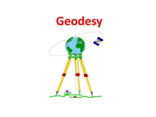
Course Introduction Reference System and Coordinate Transformation GeGo 5106 6 ECTS MSc Program in Geodesy and Geomatics
Course Description Overview of the shape and size of the earth: concepts of earth s curvature, irregularity of the earth s gravity field, the geoid; concepts of the geometrical shape of the earth; the reference ellipsoids, basic properties of the reference ellipsoids, center of mass, flattening, eccentricity, relationship between eccentricity and flattening, principal parameters of the reference ellipsoid, parameters of commonly used ellipsoid, use of ellipsoid as regional and global datum; coordinate system of reference ellipsoid; geodetic reference systems and frames: introduction to terrestrial and celestial reference systems and Earth rotation as the link between terrestrial and celestial systems; time observance and the relationships between the different time keeping systems; Overview of the dynamic nature of the reference frames due to the dynamicity and changing of earth; transformation between geodetic and Cartesian coordinates for a surface point, Special topics on coordinate transformation; conversion from one reference system to another; geometry of map projections, characteristics of map projections, mathematical concepts of map projections, distortions and scale notation; special topics on UTM and Lambert projections. Fundamentals of datum and 3-D reference system/frame. Datum transformation methods: the knowledge of translation, rotation and scaling between two datum and 7-parameters.
Course Objectives At the end of the course students will be able to Understand the geometry of the Earth and its mathematical approximations Understand the concept of datum, reference system and frame Perform coordinate and datum transformation Understand different map projection methods
Course Content Chapter One The Geometry of the Earth Size and shape of the Earth Reference Ellipsoid Coordinate system of reference ellipsoid Chapter Two - Geodetic Reference Systems and Frame Terrestrial reference system and frame Celestial Reference system and frame Time system Geodynamics Chapter Three - Coordinate Transformation Datum Transformation Datum Transformation methods Chapter Four - Map Projections Types of map projection Mathematical concepts of map projections
List of Lectures LECTURE 01 - INTRODUCTION LECTURE 02 - Coordinate systems on the ellipsoid LECTURE 03 GEODETIC LINES LECTURE 04 BASIC CONCEPTS OF MAP PROJECTION LECTURE 05 CYLINDERICAL PROJECTION LECTURE 06 GEODETIC ASTRONOMY LECTURE 07 ASTRO-GEODETIC TRINAGULATIONS AND GEODETIC DATUMS LECTURE 08 GRAVITY, GEOID AND HEIGHT SYSTEM LECTURE 09 GEODYAMICS AND REFERENCE SYSTEM LECTURE 10 EARTH ROATATION LECTURE 11 CELECETIAL VERSUS TERESTERIAL REFERENCE SYSTEM LECTURE 12 3D HELMERT TRANSFORMATION
ASSESMENT Assignments 30% Project 20% Final Exam 50%
REFERENCES Torge W, Muller J (2012), Geodesy, 4Th Edition, Walter De Guryter Seeber G. (2003). Satellite Geodesy, 2nd Edition, Walter De Guryter Fan (2010): Theoretical Geodesy Egeltoft & Stoimenov (2005): Map projections