Georgia's Geospatial Information Office - Empowering Policy Areas with GIS
The Georgia Geospatial Information Office, led by Susan Miller, aims to coordinate, promote, and enhance geospatial data development, analysis, and standards for the state, its agencies, and local governments. Through GIS, various policy areas such as health services, economic development, transportation planning, and environmental management can be empowered and optimized for better resource allocation and decision-making.

Download Presentation

Please find below an Image/Link to download the presentation.
The content on the website is provided AS IS for your information and personal use only. It may not be sold, licensed, or shared on other websites without obtaining consent from the author.If you encounter any issues during the download, it is possible that the publisher has removed the file from their server.
You are allowed to download the files provided on this website for personal or commercial use, subject to the condition that they are used lawfully. All files are the property of their respective owners.
The content on the website is provided AS IS for your information and personal use only. It may not be sold, licensed, or shared on other websites without obtaining consent from the author.
E N D
Presentation Transcript
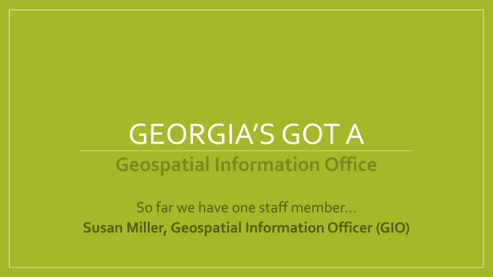
GEORGIAS GOT A Geospatial Information Office So far we have one staff member Susan Miller, Geospatial Information Officer (GIO)
A little background on Susan Education Longtime carrier as a GIS Manager, Mississippi River Watershed Esri, Development Team in Redlands, CA The Nature Conservancy Enterprise GIS (human, data & technology infrastructure) Develop& execute on strategies for a global network of approx. 3,500 GIS Practitioners from dozens or organizations and countries as well as across the U.S. Examples: global SDI, Training/Education, Technical Support, Community Development, Data Management, Cartography, Remote Sensing, Application Development, Procurement/Contracts/Site Licenses ~ Leveraging economies of scale Awarded the Esri Presidents Award for outstanding vision and leadership at TNC
Collaboration ~ Bringing a GIO to Georgia Association County Commissioners of Georgia GA Office of Planning & Budget GA Department of Community Affairs^ GA Forestry Commission GA Department of Economic Development State Properties Commission GA Department of Natural Recourses Regional Commissions / Government* GA Environmental Protection Division Local Government GA Department of Public Health Higher Education (UGA, GA Tech, etc.) GA Department of Transportation Private Industry (surveyors, vendors, local business, etc.) GIOs from SC, UT, AK, OR, NY, MD, VT, ID US Economic Development Administration* Centers for Disease Control GA Emergency Management Agency * Current funding source ^ Current administrative host
Draft Mission It is the mission of the Georgia GIO to coordinate, promote and enhance geospatial data development, analysis and standards for the State of Georgia, its agencies, authorities, regions and local governments.
If we do things right, eventually well see GIS empowering these policy areas Health services delivery Child support services Elderly support services Disease outbreak response Food-borne contamination tracking Public health linkage to pollution sources Bio-terrorism response Route management Capital project planning (bridges, roads, pipelines, etc.) Population growth estimates Transportation planning Economic development sustainability and support Resource allocation Supply and demand studies Housing planning Landuse planning Zoning administration Land records management Public Health, Healthcare, & Human Services Strategic Growth & Land Use Water resources management and allocation Greenhouse gas emissions reduction Drought and natural resource management Endangered species protection Climate Change 911 dispatch (coming soon: Next Generation 911) Common operational picture / situational awareness Natural disaster preparedness (e.g. flood, fire, hurricane, snow/ice, earthquake) Natural disaster response Critical infrastructure management Public communications Terrorism threat assessment Environment Emergency Response & Homeland Security Utilities mapping Demand forecasting Alternative energy sources development Flood mitigation, planning and response Food supply safety and security Precision agriculture Crop safety Animal and plant disease outbreak response Invasive/exotic plant species suppression Energy, Water & Utilities Agriculture
My first 5 months = Stakeholder Engagement State Level REGIONAL LEVEL Atlanta Regional Commission Coastal Regional Commission Georgia Mountains Regional Commission Northeast Georgia Regional Commission Southern Georgia Regional Commission Southwest Georgia Regional Commission Middle Georgia Regional Commission Central Savannah River Area Regional Commission Heart of Georgia - Altamaha Regional Commission Northwest Georgia Regional Commission River Valley Regional Commission Three Rivers Regional Commission NATIONAL LEVEL State Organizations / Groups Association County Commissioners of Georgia Georgia Association of Regional Commissions Georgia Geospatial Advisory Council GIS Coordinating Committee GIS Network Georgia Association of Metropolitan Planning Organizations Georgia Municipal Association Georgia Association of Assessing Officials Political Leadership Rep. Robert Dickey Rep. Budder Epps David Werner, Gov. Deal s COO State Higher Level Education Georgia Tech UGA/ITOS Private Sector Esri Google Quantum Spatial Sanborn Surdex Federal Agencies / Authorities US Census Bureau National Oceanic & Atmospheric Administration USGS Operation National Telecommunications and Information Administration First Responder Network Authority (FirstNet) Park Service, BLM & USFWS US Economic Development Administration State Agencies / Authority Department of Community Affairs Department of Defense Environmental Protection Division Department of Transportation Environmental Finance Authority Georgia Technology Authority Department of Agriculture Department of Economic Development Department of Human Service Department of Natural Resources Department of Public Health Forestry Commission Georgia Emergency Management Association Office of Planning & Budget Regional Transportation Authority Soil and Water Conservation Commission State Properties Commission National Organizations / Groups Centers for Disease Control National States Geographic Information Council Other State GIO s (Utah, Oregon, Arkansas, Alabama, Maryland, etc ) Urban and Regional Information Systems Association
Themes Remotely sensed imagery (Lidar, orthophotography, obliques, etc ) Problems: I need it, how do I get it? I have it and I don t know what to do with it Solutions: Projects GARC GIS Team Map 21 w/GDOT Statewide Contracting State Esri contract Hazard Mitigation/Risk Census 2020 Securing long-term funding for Office National legislation Georgia legislation Rep. GA at National Level via NSGIC Create an organized way to purchase A Statewide contracting process Develop training (two levels) The Georgia GIS Clearinghouse ~ What's next? Problems: I need data for X, Y, Z and I don t know where to go to find it The data I found on the Clearinghouse is old, where can I get more current data? Solutions: Work with Stakeholders to develop the next Georgia Clearinghouse, using current day technology Federated data management model (keep the data in the hands of the creator) ArcGIS Online how do we leverage at a State level? Data sharing (legal and technical challenges) Data Problems: I need framework datasets for my area and for the State Solutions: Interactive Q/A ;-)
Framework Data Themes Cadastral Cadastral data is information about rights and interest in land (e.g. real estate or parcel information) Transportation Transportation data contains multi-jurisdictional roads, ramps, bridge, railways, etc Administrative Boundaries Administrative Boundaries are legal/jurisdictional boundaries (eg. city, county, regional and state boundaries; school, fire, tax, voting districts, etc) Elevation Elevation data is a digital representation illustrating the elevation of the earth s surface (e.g. Digital Elevation Models (DEM), Digital Surface Models (DSM), Contours, and ancillary elevation products such as shaded relief maps. Source elevation data includes data like Lidar point clouds) Hydrography Hydrography includes surface water features such as lakes, ponds, streams, rivers, canals, springs, wells and ditches Orthoimagery Orthoimagery is an aerial photograph that has been geometrically corrected ("orthorectified") so that the photo has the same lack of distortion as a map. Unlike an uncorrected aerial photograph, an orthophotograph can be used to measure true distances, because it is an accurate representation of the Earth's surface, having been adjusted fortopographic releif , lens distortion and camera tilt Buildings & Structures Includes primary structures, buildings Geodetic Controls A consistent coordinate system that defines latitude, longitude, height, scale, gravity, and orientation throughout the State Addresses address points obtained from local, state, federal, and private data providers
Id like to hear what you think Framework Dataset Critical to You and your work? Yes or No Do you have access to a Statewide dataset? Yes or No If yes , how good is the Statewide dataset? Grade A - F Cadastral yes no n/a Transportation yes yes B+ Administrative Boundaries Elevation Hydrography Orthoimagery Buildings & Structures Geodetic Controls Addresses