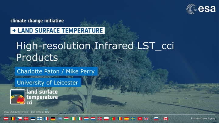
Explore high-resolution infrared and thermal classification products developed by Charlotte Paton and Mike Perry from the University of Leicester. These products offer a 100m classification scheme based on the thermal properties of observed land, providing classifications such as dense urban, vegetation types, coastal, and bare soil. The classification shows good agreement with existing land use schemes and offers new insights into surface thermal properties. Additionally, a native high-resolution Landsat product is available for the UK, with plans to extend coverage to Europe, showcasing good agreement with in-situ measurements.
Please find below an Image/Link to download the presentation.
The content on the website is provided AS IS for your information and personal use only. It may not be sold, licensed, or shared on other websites without obtaining consent from the author. If you encounter any issues during the download, it is possible that the publisher has removed the file from their server.
You are allowed to download the files provided on this website for personal or commercial use, subject to the condition that they are used lawfully. All files are the property of their respective owners.
The content on the website is provided AS IS for your information and personal use only. It may not be sold, licensed, or shared on other websites without obtaining consent from the author.
High resolution thermal classification 100m classification scheme based on thermal properties of observed land as opposed to standard land use based classifications Created by applying a series of statistically derived limits to visible and shortwave infrared indices ESA UNCLASSIFIED - For Official Use ESA | 05/12/2024 | Slide 2
High resolution thermal classification 100m classification scheme based on thermal properties of observed land as opposed to standard land use based classifications The 8 output classifications therefore become: Dense urban, Mid density urban, Low density urban, Dense vegetation, Mid density vegetation, Low density vegetation, Coastal, Bare soil ESA UNCLASSIFIED - For Official Use ESA | 05/12/2024 | Slide 3
High resolution thermal classification The classification shows good agreement with other LULC based schemes and where differences occur it is shown to better represent the thermal properties of the surface ESA UNCLASSIFIED - For Official Use ESA | 05/12/2024 | Slide 4
Native High Resolution Landsat Product Availability: All UK 2019-2022 Small region requests being taken Future plans to extend to whole of Europe Newley created 100m Landsat 8 product is based on updated emissivity priors from developed thermal classification scheme: ESA UNCLASSIFIED - For Official Use ESA | 05/12/2024 | Slide 5
Native High Resolution Landsat Product Validation When compared to 13 in-situ sites differences in the two LST measurements fall close to the 1:1 line, showing good agreement ESA UNCLASSIFIED - For Official Use ESA | 05/12/2024 | Slide 6
Native High Resolution Landsat Product Thermal Classificati on RMSE Landsat LST using GSW was calculated using two additional prior LSE methods: 1) NDVI Method by (Sobrino and Raissouni, 200) NDVI Method RMSE CAMEL RMSE Site Bondville, Illinois Fort Peck, Montana Goodwin Creek, Mississippi Hyytiala, Finland KIT Forest, Germany 3.91 4.04 4.83 3.74 4.13 3.41 2.83 4.15 3.88 3.65 2.17 4.08 2.37 4.39 2.61 0.98 0.042? ????+ ??1 ?? + ?? 0.99 ???? < 0.2 0.2 < ???? < 0.5 0.5 < ???? ??? = Penn State University, Pennsylvania 2.93 3.18 3.24 2) Combined ASTER and MODIS Emissivity for Land (CAMEL) database Puechabon, France Robson Creek, Australia Sioux Falls, South Dakota Svartberget, Sweden Wicken Fen, UK Wytham Woods, UK 2.36 2.7 2.66 2.45 4.32 4.3 3.3 4.21 3.51 Results show consistently better RMSE values when using the thermal classification 2.93 3.28 2.04 4.23 1.87 3.55 4.4 3.28 2.35 ESA UNCLASSIFIED - For Official Use ESA | 05/12/2024 | Slide 7
Downscaling Portsmouth case study: 7 summer cloud free scenes Coincident data for: MODIS Terra ASTER LANDSAT 8 Provides great ability to inter compare and check the spatial outputs ESA UNCLASSIFIED - For Official Use ESA | 05/12/2024 | Slide 8
Downscaling Southampton Agriculture Dense Forest Portsmouth ESA UNCLASSIFIED - For Official Use ESA | 05/12/2024 | Slide 9
Downscaling ESA UNCLASSIFIED - For Official Use ESA | 05/12/2024 | Slide 10
Downscaling ESA UNCLASSIFIED - For Official Use ESA | 05/12/2024 | Slide 11
Downscaling Portsmouth ESA UNCLASSIFIED - For Official Use ESA | 05/12/2024 | Slide 12
Downscaling Portsmouth ESA UNCLASSIFIED - For Official Use ESA | 05/12/2024 | Slide 13
Today at 11am ESA UNCLASSIFIED - For Official Use ESA | 05/12/2024 | Slide 14