Hill Country Associates Pedernales River Analysis
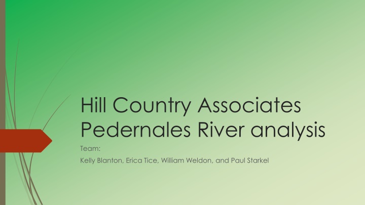
The Hill Country Associates Pedernales River analysis team, comprising Kelly Blanton, Erica Tice, William Weldon, and Paul Starkel, is conducting an in-depth study on the Pedernales River Basin in central Texas. The project focuses on monitoring water quality and quantity, crucial for agricultural, ranching, and environmental sustainability. Through data analysis, GIS mapping, and land use studies, the team aims to assess changes over time and provide valuable insights into this vital water source.

Download Presentation

Please find below an Image/Link to download the presentation.
The content on the website is provided AS IS for your information and personal use only. It may not be sold, licensed, or shared on other websites without obtaining consent from the author.If you encounter any issues during the download, it is possible that the publisher has removed the file from their server.
You are allowed to download the files provided on this website for personal or commercial use, subject to the condition that they are used lawfully. All files are the property of their respective owners.
The content on the website is provided AS IS for your information and personal use only. It may not be sold, licensed, or shared on other websites without obtaining consent from the author.
E N D
Presentation Transcript
Hill Country Associates Pedernales River analysis Team: Kelly Blanton, Erica Tice, William Weldon, and Paul Starkel
Overview 2 Introduction Data Literature Review Methods Timeline Budget Final Deliverables
Introduction 3 The Pedernales River Basin is an area of approximately 815,000 acres located in the central Texas Hill Country The Pedernales river is prone to major fluctuation in water levels Monitoring water quality and quantity is important Irrigates agricultural and ranching land Contributes 23% of flow into Lake Travis, a critical source of drinking water for Austin, Texas
Data 4 Aerial imagery showing change 2014 USDA NAIP Imagery Shapefiles showing Land use and Land Cover (LULC) amounts across the area National LULC Data Set (1992, 2001, 2006, 2011) TNRIS Ecological Classification system similar to LULC classification TPWD Ecological Systems Classification Project Texas Water Development Board
5 Using GIS to Detect Changes in Land Use Land Cover for Electrical transmission Line Sitting and Expansion Planning in Winona County, Minnesota, USA. By Charles U. Uzoukwu Uzoukwu was able to detect LULC changes in percentage by calculating raster area of each category in 1991 and comparing it to 2001 data. This way he was able to show the specific size of the change that had occurred in different types of land use. Using percentage change in LULC he used the Cell Statistics Function and CON tool to isolate and display areas of change between 1991 and 2001.
Little River Watershed, Tennessee 6 Five main LULC classes were classified: water, commercial land, residential land, mixed forest, and agricultural land. Images were taken at a two year interval from 1984-2010. Landsat images were used to observe LULC change. Since the spatial resolution of Landsat TM/ETM+ images is 30 meters, each pixel of the image is mixed in nature, especially in transition boundaries among different LULC classes (Zhu and Li 2010). This study showed that there was an increase in urban areas and forest, while a decrease in agriculture. The urban growth was concurrent with a rise in population. The increase in forest land may be aligned to farmers seeking employment in the city and abandoning their farms. Also, an increased conservation effort of the Great Smoky Mountains National Park to preserve forest land is attributed to forest growth.
Methods 7 Illustrate the percent change in land use and land cover over the years 1992, 2001, 2006, and 2011 a projection of current and future land use in the Pedernales area Create a visualization of land use and land cover change over time with population data Show effects of population growth over time by showing increase or decrease in amount of 16 land use classes measure our pixel size and get a total land area of the different LULC classifications Use cell statistics functions to show the actual areas where change has occurred between different years of data
JANUARY JANUARY W FEBRUARY FEBRUARY W S M T T F S S M T T F S #### Timeline 10 1 8 2 9 3 10 4 11 5 12 6 13 7 14 28 4 29 5 30 6 31 7 1 8 2 9 3 10 15 22 16 23 17 24 18 25 19 26 20 27 21 28 11 12 13 14 15 16 17 18 19 20 21 22 23 24 1 8 2 9 3 10 4 11 5 12 6 13 7 14 25 26 27 28 29 30 31 1 2 3 4 5 6 7 MARCH MARCH W APRIL APRIL W S M T T F S S M T T F S #### 1 8 15 2 9 16 3 10 17 4 11 18 5 12 19 6 13 20 7 14 21 29 5 12 30 6 13 31 7 14 1 8 15 2 9 16 3 10 17 4 11 18 22 29 23 30 24 31 25 1 26 2 27 3 28 4 19 26 20 27 21 28 22 29 23 30 24 1 25 2 5 6 7 8 9 10 11 3 4 5 6 7 8 9 MAY MAY W S M T T F S #### 26 3 10 27 4 11 28 5 12 29 6 13 30 7 14 1 8 15 2 9 16 17 24 18 25 19 26 20 27 21 28 22 29 23 30 31 1 2 3 4 5 6 Data Collection 27Jan- 6 Feb Project research 9 Feb- 23 Mar and proposal Data compilation 30 Mar- 22 Apr Final product 23 Apr- 8 May Assimilation
Budget 11
Final Deliverables 12 Report detailing changes in Land use and Land cover in the Pedernales river basin Analysis and predictions of population growth for the study area Shapefiles showing land use patterns in the Pedernales river basin area KMZ files for website access of analysis maps
Resources 13 Pedernales River Watershed: Brush Control Assessment and Feasibility Study. Austin, TX: Lower Colorado River Authority, 2000. 3-5. Pedernales River Watershed. Lower Colorado River Authority, 2000. Web. Feb. 2015. Texas Water Symposium. "Challenges Facing The Pedernales Basin." Challenges Facing The Pedernales Basin. Texas Public Radio, 27 Mar. 2014. Web. 12 Feb. 2015. Pedernales River Watershed: Brush Control Assessment and Feasibility Study. Austin, TX: Lower Colorado River Authority, 2000. 3-1, 3-4. Pedernales River Watershed. Lower Colorado River Authority, 2000. Web. Feb. 2015.