Impact of Climate Change on Irrigated Agricultural Area in Central West Tunisia
Explore the impact of climate change on an irrigated agricultural area in Central West Tunisia using Sentinel-2 satellite data. Assess the changing weather patterns affecting agriculture and food production, and the urgent need for sustainable solutions to address challenges in the region.

Download Presentation

Please find below an Image/Link to download the presentation.
The content on the website is provided AS IS for your information and personal use only. It may not be sold, licensed, or shared on other websites without obtaining consent from the author. If you encounter any issues during the download, it is possible that the publisher has removed the file from their server.
You are allowed to download the files provided on this website for personal or commercial use, subject to the condition that they are used lawfully. All files are the property of their respective owners.
The content on the website is provided AS IS for your information and personal use only. It may not be sold, licensed, or shared on other websites without obtaining consent from the author.
E N D
Presentation Transcript
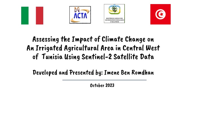
Assessing the Impact of Climate Change on An Irrigated Agricultural Area in Central West of Tunisia Using Sentinel-2 Satellite Data Developed and Presented by: Imene Ben Romdhan Climate Change on An Irrigated Agricultural Area in Central West of Tunisia Using Sentinel-2 Satellite Data October 2023 of Tunisia Using Sentinel-2 Satellite Data
Abstract Climate change is undeniably the defining issue of our time, and we find ourselves at a crucial juncture where changing weather patterns are profoundly affecting agriculture and food production. Taking prompt action is imperative, as failure to do so will make it significantly more challenging and costly to adapt to the future ramifications of these transformations. As we lacked historical data on the area, we devised a method of calculating indices for water, soil, and vegetation using Sentinel 2A satellite images and ArcGIS mapping software for two years 2003 and 2020 . We then compared the results.
Comparison models showed an increase in soil moisture content at surface and depth levels. Farmers have responded to the water deficit by increasing irrigation efforts However, this has resulted in soil salinity problems due to the high salinity of irrigation water and fine textured soil. Evapotranspiration increased in 2020, negatively affecting the chlorophyll concentration of vegetation and soil properties. Urgent strategies are needed to address climate change challenges in this region, stressing the importance of understanding and developing sustainable solutions for agriculture and the ecosystem
Table Of Contents 01 .Introduction 02 .Description of the Environment of the study area 03 .Setting and Methods 04 .Results 05 .Regression Models 06 .Discussion 07 . Conclusion 08 .Photos GIF - Flowcharts - Video
01 .Introduction The research focuses on the assessment of climate change (temperature and precipitation) in an irrigated agricultural area of the Sbiba region in central western Tunisia and its impact on soil and vegetation by developing predictive models using Sentinel-2A satellite data to create sustainable management strategies.
02 .Descriptionof the Environment of the Study Area The irrigated area, located in the Sbiba delegation in Kasserine Governorate, of 1990 hectares in the heart of west-central Tunisia (Fig 1). Nestled in an arid climatic zone, it bears the mark of a region marked by rare rainfall, brief winters and the embrace of hot and dry winds. The landscape has an essentially flat topography (Fig .2.). Fig .1. Location of irrigated area Fig.2. Digital elevation model of study area (3D)
The soil is dominated by a fine texture on calcareous crusts that cover alkaline and saline deposits. The agricultural activities of the Sbiba region are anchored around a diversified cropping system. Apple orchards are the predominant crop, complemented by a range of other tree species and annual crops (Fig .3.). The vital subsistence for this agricultural web is drawn from groundwater reservoirs, yet these springs bear the mark of high salinity, recording a content of 2.4 grams per liter. Fig .3. Land use map of irrigated area Sbiba. As we go through this presentation, let s deepen the intersection between this unique environmental configuration and the cascading impacts of climate change, a better understanding of the need for innovative adaptations to safeguard sustainable farming practices.
03 .Setting and Methods The climate data source is Freemeteo, a platform offering real-time weather observations and historical weather data. This data was utilized to conduct a comparative analysis of rainfall and temperatures between two years, 2003 and 2020. Additionally, Sentinel-2A satellite images, a component of the Copernicus program, were incorporated alongside the ArcGIS mapping software. These tools facilitated the assessment of temporal changes in the triad components water, soil, and vegetation. Specific formulas tailored to each index were employed to effectively map the spatial distribution of index classifications. These methodologies collectively enabled a comprehensive understanding of intricate environmental transformations. 31. Modelling and indexes mapping 31. Modelling and indexes mapping Images Processing Images Processing To map the salinity of the soil, we adopted an unsupervised classification of the Sentinel 2 images and for modelling indexes, we calculated the specific formulas for each index with Arc GIS tools: spatial Analyst tools / Map Algebra / Raster Calculator, raster have been obtained which are converted into polygons (vector map) to calculate the areas of each class of indices using Zonal / Zonal Geometry as Table tool.
04 . Results ..Variation Variationof oftemperature 41 41 temperature and and precipitation precipitationfor for the the years years 2003 2003 and and 2020 2020 Like all arid and semi-arid countries in the world, Tunisia is facing the impacts of climate change. The Sbiba region has already experienced and will continue to endure the long-term effects of this phenomenon, particularly concerning the rise in temperatures. From September 2003 to September 2020, temperatures increased from 28.37 C to 29.37 C. In October, the temperature rose from 23 C in 2003 to 26.5 C in 2020, with an increase of 0.5 C in November 2020 compared to 2020, and a significant 3.5 C increase in December 2020 compared to 2003. Precipitation has also been affected. In September 2003, there were recorded precipitation levels of 78 mm, whereas in September 2020, it decreased to 73 mm. The reduction in precipitation is particularly striking, especially during the months of October, November, and December, with values ranging from 52 mm to 20 mm, 38 mm to 12 mm, and 15 mm to 9 mm, respectively. These figures clearly demonstrate the adverse climate trends in the Sbiba region, highlighting the urgent need to take measures to mitigate the impacts of climate change and safeguard the environment for future generations. Change in the study area environment (soil, water, vegetation) Change in the study area environment (soil, water, vegetation) 42. 42.
Change in the study area environment (soil, water, vegetation) Change in the study area environment (soil, water, vegetation) 42. 42. Description of Indexes Is an index used to assess the presence of salt in terrestrial areas based on spectral data obtained from remote sensing instruments like satellites Normalized Difference Salinity Index (NDSI): Index (NDMI) detects moisture levels in vegetation The NDMI interval is -1 to +1, where the lowest values indicate a low vegetation moisture content, and the highest values correspond to a high water content. Normalized Difference Moisture Index (NDMI): MSI is a reflectance measure, sensitive to increases in the water content of leaves. Applications of ISM include vegetation stress analysis. Moisture Stress Index (MSI): NDWI is used to monitor changes in water content on the soil surface Normalized Difference Water Index (NDWI):
. Assessment of the state of a soil s water supply in relation to its optimal water supply (useful water supply). When the soil moisture index is close to 1, the soil is moist (greater than 1, the moisture index indicates that the soil is tending towards saturation). Conversely, when it tends towards 0, the soil is in a state of water stress (below 0, this indicates that the soil is very dry). Stored Water Index (SWI): In remote sensing, the Green Chlorophyll Index is used to estimate the content of leaf chlorophyll in various species of plants. The chlorophyll content reflects the physiological state of vegetation; it decreases in stressed plants and can therefore be used as a measurement of plant health (EOS, 2019). Green Coverage Index (GCI):