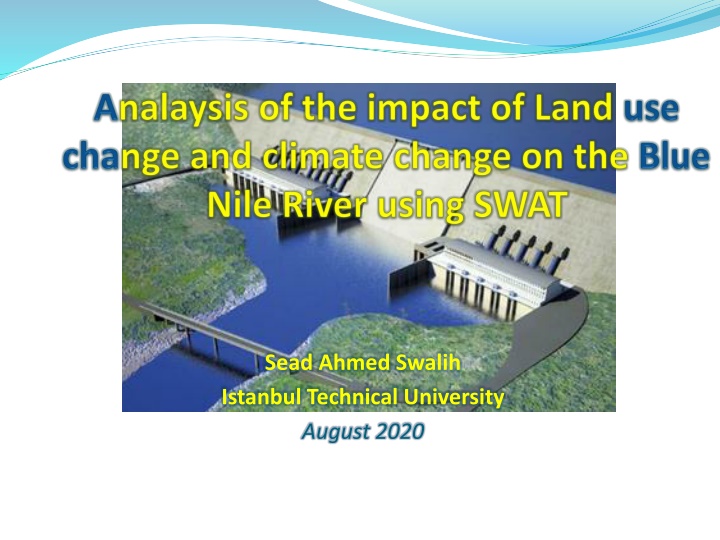
Impact of Land Use Change and Climate Change on Blue Nile River
Analyzing the impact of land use change and climate change on the Blue Nile River using the Soil and Water Assessment Tool (SWAT). The study focuses on the high development along the Nile, increased demand for irrigation and hydropower, vegetation degradation in Ethiopia, and the significance of assessing climate dynamics in the basin. The research aims to project basin hydrology under various scenarios to understand the potential impacts on the Blue Nile River.

Download Presentation

Please find below an Image/Link to download the presentation.
The content on the website is provided AS IS for your information and personal use only. It may not be sold, licensed, or shared on other websites without obtaining consent from the author. If you encounter any issues during the download, it is possible that the publisher has removed the file from their server.
You are allowed to download the files provided on this website for personal or commercial use, subject to the condition that they are used lawfully. All files are the property of their respective owners.
The content on the website is provided AS IS for your information and personal use only. It may not be sold, licensed, or shared on other websites without obtaining consent from the author.
E N D
Presentation Transcript
Sead Ahmed Swalih Istanbul Technical University August 2020
1 2 3 4 5 Introduction Problem statement and objectives Materials and methods Results and discussion Conclusion and recommendations Analysis of the impact of land use change and climate change on Blue Nile river using SWAT 2
Introduction World s climate - changing & expected to continue in the coming century Africa - most vulnerable to climate change and variability The Nile basin, the largest basin in Africa high topographic and climatic variability o Increase vulnerability NILE BLUE NILE WHITE NILE Analysis of the impact of land use change and climate change on Blue Nile river using SWAT 3
1 2 3 4 5 Introduction Problem statement and objectives Materials and methods Results and discussion Conclusion and recommendations Analysis of the impact of land use change and climate change on Blue Nile river using SWAT 4
Problem statement high development on the Nile, i.e. construction of the Aswan Dam, Sennar, and Rosieres reservoirs for irrigation and hydropower generation increased demand for irrigation and hydropower Ethiopia - GERD high vegetation degradation in Ethiopia, i.e. deforestation, results in land use change ecosystem degradation due to massive utilization of river waters in Sudan and Egypt, eg. loss of biodiversity increasing water demand upstream + climate change and land use change Analysis of the impact of land use change and climate change on Blue Nile river using SWAT 5
Objectives Assessing the dynamics of climate in the Basin Projecting basin hydrology using climate change and land use change scenarios to assess their impacts Analysis of the impact of land use change and climate change on Blue Nile river using SWAT 6
1 2 3 4 5 Introduction Problem statement and objectives Materials and methods Results and discussion Conclusion and recommendations Analysis of the impact of land use change and climate change on Blue Nile river using SWAT 7
Study area Blue Nile (in Amharic Abbay/in Arabic the Al Bahr al-Azraq) o1529 km long (longest in the world) o elevation of the basin varies from 4000m (little Abbay) to 700m at foot of the plateau o contribute for 60 % flow of Nile ocrucial for thesurvival of downstream countries The Blue Nile River Analysis of the impact of land use change and climate change on Blue Nile river using SWAT 8
Study area contd Land use/cover 70 SAVA Savanah forest Composition in % 60 CRDY Crop land/Dry land 50 40 WATB Water body 30 CRWO Crop land/Wood land 20 GRASS Grassland 10 0 BSVG Bush land vegetation SAVA CRDY WATB CRWO GRASS BSVG Land use Analysis of the imapct of land use change and climate change on Blue Nile river 9
Study area contd Climate varies from humid to semiarid Preciptation % o Kiremt (Jun-Sept) 70 o Bega (Oct-Jan) Belg o Belg .(Feb-May) For the year 1961-1990, Kiremt 13 Bega 17 oAnnual preciptation was 1200mm to1600mm oAnnual temprature-was 18.3 C (2 C seasonal variation) Analysis of the imapct of land use change and climate change on Blue Nile river 10
Materials Climate change scenario data o Source: IPCC data distribution centre o SRES-AR4 scenario runs of six AOGCMs were chosen BCM2_BCCR abbreviated as BCM2 (Norway) CSIRO_MK3 . CSMK3 (Australia) INMCM3 INCM3 (Russia) GISAOM . GIAOM (USA) MIROC3_2HI .. MIHR (Japan) MIROC3_2MED.. MIMR (Japan) o Preciptation and Temprature projections for 2020, 2055 and 2090 were analysed for storylines A1B and B1 Analysis of the impact of land use change and climate change on Blue Nile river using SWAT 11
Materials contd Preciptation change Temprature change MIMR MIMR 80 5 4 40 3 P % T C 0 2 -40 1 0 -80 Jan Mar May Jul Sep Nov Jan Mar May Jul Sep Nov 2020 2055 2090 2020 2055 2090 Analysis of the impact of land use change and climate change on Blue Nile river using SWAT 12
Materials contd Preciptation change Temprature change MIHR MIHR 5 80 4 40 3 P % T C 0 2 -40 1 -80 0 Jan Mar May Jul Sep Nov Jan Mar May Jul Sep Nov 2020 2055 2090 2020 2055 2090 Analysis of the impact of land use change and climate change on Blue Nile river using SWAT 13
Materials contd Preciptation change Temprature change BCM2 BCM2 80 5 4 40 3 P % T C 0 2 -40 1 0 -80 Jan Mar May Jul Sep Nov Jan Mar May Jul Sep Nov 2020 2055 2090 2020 2055 2090 Analysis of the impact of land use change and climate change on Blue Nile river using SWAT 14
Materials contd Land use and cover (LUC) change scenario data o Two hypothetical LUC scenarios for 2080 assuming + 10% change on savana forest o It has also been assumed that change in SAVA (savana) cover will be compensated by CRDY (crop land/ dry land) LUS-1 . Land use scenario 1 - 10% increase in SAVA LUS-2 2 - 10% decrease Analysis of the impact of land use change and climate change on Blue Nile river using SWAT 15
Materials contd Change in land use percentage 80 70 Composition in % 60 50 Land use 40 LUC-1 30 LUS-2 20 10 0 SAVA CRDY WATB CRWO GRASS BSVG Land use Analysis of the impact of land use change and climate change on Blue Nile river using SWAT 16
Methods Observed Flow Observed Baseline Precip. Bias Baseline Flow Model bias Correction Assessment for GCM uncertainty IPCC AR4 Baseline Precip. Analysis & comparison Corrected flow (1961-90) SWAT Model IPCC AR4 Scenario Precip. Observed Baseline Temp. Corrected flow (2011-99) SWAT Model Bias Assessment for GCM uncertainty IPCC AR4 Baseline Temp Model bias Correction Scenario Flow ) IPCC AR4 Scenario Temp. Input Data Output Data Processes Analysis of the impact of land use change and climate change on Blue Nile river using SWAT 17
Approaches Model evaluation Climate change anaysis Land use and cover (LUC) change analysis Land use change analysis coupled with climate change Analysis of the impact of land use change and climate change on Blue Nile river using SWAT 18
1 2 3 4 5 Introduction Problem statement and objectives Materials and methods Results and discussion Conclusion and recommendations Analysis of the impact of land use change and climate change on Blue Nile river using SWAT 19
Results Model evaluation Climate change anaysis Land use and cover (LUC) change analysis Land use change analysis coupled with climate change Analysis of the impact of land use change and climate change on Blue Nile river using SWAT 20
Results contd Annual yield Preciptation (mm) Annual Water Yield (mm) Discrepancy % Period Actual SWAT Rosieres Calibration Validation 1973-1978 1979-1982 866.4 971.2 251.1 199.0 252.4 180.1 -0.5% 9.5% Analysis of the imapct of land use change and climate change on Blue Nile river using SWAT 23
Results contd Statistical indices Annual mean flow (m /s) Variance (m /s) NSE R Actual SWAT model Actual SWAT model Rosieres Calibration Validation 1509.4 1196.5 1516.9 1082.3 41.7 38.3 42.7 33.5 0.89 0.83 0.89 0.86 Analysis of the imapct of land use change and climate change on Blue Nile river using SWAT 29
Results contd Model predictive range ROSSIER 10000 Observed Discharge (m /s) 8000 Baseline Average 6000 4000 2000 0 Jan Feb Mrt Apr Mei Jun Month Jul Aug Sep Okt Nov Dec Analysis of the imapct of land use change and climate change on Blue Nile river using SWAT 32
Results contd Model evaluation Climate change anaysis Land use and cover (LUC) change analysis Land use change analysis coupled with climate change Analysis of the impact of land use change and climate change on Blue Nile river using SWAT 36
Results contd Preciptation BCM2 60 A1B B1 40 20 P % 0 -20 -40 Jan Feb Mar Apr May Jun Jul Aug Sep Oct Nov Dec Analysis of the impact of land use change and climate change on Blue Nile river using SWAT 37
Results contd Temprature BCM2 3.0 2.0 T C 1.0 A1B B1 0.0 Jan Feb Mar Apr May Jun Jul Aug Sep Oct Nov Dec Analysis of the impact of land use change and climate change on Blue Nile river using SWAT 38
Results contd GCM uncertainty Bias BCM2 0.22 2.45 CSMK3 -0.80 2.55 INCM3 -0.85 2.41 GIAOM -1.01 2.70 MIMR 0.44 2.48 MIHR 0.36 2.43 Bias (kg/m *s) RMSE Water yield Anual water Yield (mm) P (%) Tav ( C) GCM Scenario Baseline 252.4 252.4 252.4 252.4 252.4 252.4 2020 223.4 215.5 298.7 304.9 234.6 241.0 2055 186.3 208.7 307.6 281.5 276.1 283.8 2090 165.7 190.7 391.4 311.0 271.6 244.6 WYLD % BCM2 A1B B1 A1B B1 A1B B1 -4.8 0.1 6.4 3.2 15.4 10.5 2.3 1.7 1.5 1.2 2.9 2.5 -24 -19 32 19 3 2 MIMR MIHR Analysis of the impact of land use change and climate change on Blue Nile river using SWAT 39
Results contd Average flow change 2020 3000 Discharge (m /s) 2000 1000 Average Base 0 BCM2 CSMK3 INCM3 GIAOM MIMR MIHR GCMs Analysis of the impact of land use change and climate change on Blue Nile river using SWAT 43
Results contd Average flow change 2055 3000 Discharge (m /s) 2000 1000 Average Base 0 BCM2 CSMK3 INCM3 GIAOM MIMR MIHR GCMs Analysis of the impact of land use change and climate change on Blue Nile river using SWAT 44
Results contd Average flow change 2090 3000 Discharge (m /s) 2000 1000 Average Base 0 BCM2 CSMK3 INCM3 GIAOM MIMR MIHR GCMs Analysis of the impact of land use change and climate change on Blue Nile river using SWAT 45
Results contd Seasonal flow change 2020 8000 BCM2 7000 Discharge (m /s) CSMK3 6000 INCM3 5000 4000 GIAOM 3000 MIMR 2000 MIHR 1000 Base 0 Jan Feb Mar Apr May Jun Jul Aug Sep Oct Nov Dec Analysis of the impact of land use change and climate change on Blue Nile river using SWAT 46
Results contd Seasonal flow change 2055 8000 BCM2 7000 Discharge (m /s) CSMK3 6000 INCM3 5000 GIAOM 4000 3000 MIMR 2000 MIHR 1000 Base 0 Jan Feb Mar Apr May Jun Jul Aug Sep Oct Nov Dec Analysis of the impact of land use change and climate change on Blue Nile river using SWAT 47
Results contd Seasonal flow change 2090 8000 BCM2 7000 Discharge (m /s) CSMK3 6000 INCM3 5000 4000 GIAOM 3000 MIMR 2000 MIHR 1000 Base 0 Jan Feb Mar Apr May Jun Jul Aug Sep Oct Nov Dec Analysis of the impact of land use change and climate change on Blue Nile river using SWAT 48
Results contd Model evaluation Climate change anaysis Land use and cover (LUC) change analysis Land use change analysis coupled with climate change Analysis of the impact of land use change and climate change on Blue Nile river using SWAT 49
Results contd Annual yield change Annual WYLD (mm) Land-use Scenario WYLD % Change in Savana forest % Baseline (1961-90) 223.4 0 0 LUS-1 (2080) 189.6 10 -15 LUS-2 (2080) 249.9 -8 12 Analysis of the impact of land use change and climate change on Blue Nile river using SWAT 50
Results contd Seasonal flow change 8000 Baseline Discharge (m /s) LUS-1 6000 LUS-2 4000 2000 0 Jan Feb Mar Apr May Jun Jul Aug Sep Oct Nov Dec Analysis of the impact of land use change and climate change on Blue Nile river using SWAT 51
Results contd Model evaluation Climate change anaysis Land use and cover (LUC) change analysis Land use change analysis coupled with climate change Analysis of the impact of land use change and climate change on Blue Nile river using SWAT 52
Results contd Annual yield change Land use Change Annual WYLD (mm) WYLD % Climate Change GCMs LUS P% T% SAVA% 1 0.1 1.7 10 158.9 -37.0 BCM2 2 0.1 1.7 -8 216.5 -14.2 1 3.2 1.2 10 276.7 9.7 MIMR 2 3.2 1.2 -8 337.1 33.6 1 10.5 2.5 10 207.8 -17.6 MIHR 2 10.5 2.5 -8 274.2 8.7 Analysis of the impact of land use change and climate change on Blue Nile river using SWAT 53
Results contd Seasonal flow change 8000 Baseline Discharge (m /s) BCM2-LUS1 6000 BCM2-LUS2 4000 MIMR-LUS1 MIMR-LUS2 2000 MIHR-LUS1 MIHR-LUS2 0 Jan Mar May Jul Sep Nov Analysis of the impact of land use change and climate change on Blue Nile river using SWAT 54
1 2 3 4 5 Introduction Problem statement and objectives Materials and methods Results and discussion Conclusion and recommendations Analysis of the impact of land use change and climate change on Blue Nile river using SWAT 55
Conclusion The SWAT model has been successfully evaluated o Satisfactory performance - minimum NSE=0.7 o But high flow predictions were not as good as low flow predictions Land use and climate change scenarios - helped to better understand the impact of climate change and land use change on Blue Nile river It has been proven that land use and cover (LUC) changes as well as climate change has resulted in significant changes (either by increasing or decreasing) in the hydrology of the basin Analysis of the impact of land use change and climate change on Blue Nile river using SWAT 56
Recommendations use of long time series and good quality data in the hydrologic models investigate the reasons of underestimation of peak flows for Blue Nile It will be of great importance to incorporate other factors in the assessment like, sediment transport and water quality analysis. Incorporating the newly constructed dam by Ethiopia (GERD) in the already built hydrologic model and analyzing the impact (on development) Analysis of the impact of land use change and climate change on Blue Nile river using SWAT 57