Important Considerations for Mapping Software and Apps
Explore key questions and factors to keep in mind when evaluating mapping software and apps, such as file formats, database structure, data support, import/export capabilities, and compatibility with popular tools like ArcGIS Pro, Google Earth, and Garmin GPS. Understand the information to include on maps for internal and public use, cost considerations, and ease of use for better decision-making in selecting the right mapping solution.

Uploaded on Mar 08, 2025 | 2 Views
Download Presentation

Please find below an Image/Link to download the presentation.
The content on the website is provided AS IS for your information and personal use only. It may not be sold, licensed, or shared on other websites without obtaining consent from the author.If you encounter any issues during the download, it is possible that the publisher has removed the file from their server.
You are allowed to download the files provided on this website for personal or commercial use, subject to the condition that they are used lawfully. All files are the property of their respective owners.
The content on the website is provided AS IS for your information and personal use only. It may not be sold, licensed, or shared on other websites without obtaining consent from the author.
E N D
Presentation Transcript
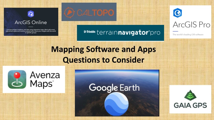
Mapping Software and Apps Questions to Consider
Software and Apps Software and Apps Things to Think About Supporting Data : Collection and rating of trail location. Trail Line on a Map Trail Classification 1-5 (6) Sharing Information Import/Export Software Pros/Cons
Mapping Software and Apps Questions to Consider Is it important to have a common file format? Is it important to have a common file format? Shapefiles KML/KMZ GPX TPA
Do We Want Do We Want a Decentralized Database a Decentralized Database or or a Centralized Data Base? a Centralized Data Base?
What Do We Need to Know What Do We Need to Know About a Mapping Software or Apps? About a Mapping Software or Apps? Can it include the necessary data for a MET map? Tracks; Class Change; Trail Verification Can you discriminate between which data to import and export?
Shapefile KML/KMZ GPX Software App Export Can Import kml Import Can Export kml Can Import shp Import Can Export shp Export Can Import gpx Can Export gpx Export Import Terrain Navigator Pro No No No Yes Yes Yes Yes Yes Yes Yes Yes Yes ArcGIS Pro Software and App Compatibility No No No Yes Yes Yes Google Earth No No Yes Yes Yes Yes Avenza No No Yes Yes Yes Yes Gaia GPS No No No No Yes Yes Garmin GPS No No Yes Yes Yes Yes CalTopo No No Yes Yes Yes Yes Base Camp Survey 123
What information should appear on maps? Internal Use and Public Use