Integrating Official Statistics and Geospatial Information: Challenges and Solutions

Increasing demand for location-based information emphasizes the need for better integration of geospatial and statistical data. This integration is crucial for evidence-based decision-making and caters to a continuum of user needs across various sectors. The Statistical Spatial Framework presents opportunities and challenges in managing socio-economic datasets and ensuring accessibility, utility, and privacy of geocoded unit record data. Addressing these challenges is essential for maximizing the value of geospatially enabled socio-economic information.

Download Presentation

Please find below an Image/Link to download the presentation.
The content on the website is provided AS IS for your information and personal use only. It may not be sold, licensed, or shared on other websites without obtaining consent from the author.If you encounter any issues during the download, it is possible that the publisher has removed the file from their server.
You are allowed to download the files provided on this website for personal or commercial use, subject to the condition that they are used lawfully. All files are the property of their respective owners.
The content on the website is provided AS IS for your information and personal use only. It may not be sold, licensed, or shared on other websites without obtaining consent from the author.
E N D
Presentation Transcript
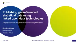
Integrating Official Statistics and Geospatial Information ABS experience Frank Yu First Assistant Statistician Project Management and Infrastructure Division October 2013 Creative Commons License
Background Increasing demand for location based information about places, people, human activity, business, economic growth, wellbeing, . Recognition of the value of linking socio-economic information to location.
The challenge The work on global geospatial information management over the past two to three years has confirmed that one of the key challenges is a better integration of geospatial and statistical information as a basis for sound and evidence-based decision-making. Secretary General of the UN Economic and Social Council, 2012.
Continuum of user needs Academic Researchers Infra. and Transport Natural Resources Education Human Services Local National Security Government Socio- Economic Information Spatial Information Statistical Spatial Framework Business Intelligence Policy Analysts Emergency Services Health Agriculture Land Admin Economics
The environment The future Statistical Spatial Framework Spatial Community Statistical Community
Statistical Community Spatial Community Socio-economic datasets Spatial Data Frameworks Fundamental Elements Core NSO datasets Tax SSF bridge Income and business tax Themes: Census, Demographics, Agriculture, Building, Labour Force, etc. Admin. & statistical boundaries Addressing, Place Names Electoral Transport, Water Human Services Medicare, Pharmaceuticals Land and Property Land Use and Value Elevation and Depth Imagery Payments Unemployment, Disability, Family Support Positioning Others
Challenges for the SSF How should unit record socio-economic data be coded geographically? What information management practices should be applied to this geocoded unit record data to ensure accessibility and utility, as well as confidentiality and privacy? What is the most appropriate geography to disseminate the new geospatially enabled data for? For a broad range of users, how do we ensure maximum accessibility and utility for geospatially enabled socio- economic data?
Challenges How should we geocode socio-economic data? What information management practices and infrastructure is required to ensure accessibility and utility, as well as maintaining confidentiality and privacy? What is the most appropriate geography for analysis and dissemination of geospatially enabled data? How can I convert data between geographies? How can we maximise the use of administrative data for national Statistics?
The Framework Australian application of SSF Policies, standards and guidelines, covering: confidentiality and privacy, data quality, analysis, dissemination and visualisation. & Guidelines Standards Developing the interoperability of statistical and spatial metadata. Metadata interoperability ASGS Australian Statistical Geography Standard Common geographic boundaries Geocode is a NAMF compliant point coordinate and ASGS Mesh Block. Data management: geocoded unit record data NAMF National Address Management Framework Agreed and authoritative geocoding
SSF in the ABS Overarching SSF elements SSF Steering Committee provides high level guidance and coordination for SSF implementation in the ABS. New ABS Geospatial Policy formalises SSF and geospatial requirements for ABS operations. New enterprise architecture will be designed to integrate SSF and other geospatial elements.
SSF in the ABS Agreed and authoritative geocoding Australia has a Geocoded National Address File (GNAF), part of the National Address Management Framework (NAMF). However, some gaps in coverage and some accuracy issues.
SSF in the ABS Data management: geocoded unit record data ABS is building an address register that will be a geospatially enabled frame GNAF provides the main geospatial input. Policy challenges exist in moving to retain and store address and geocode information for households. Technical work remains to be completed to develop metadata and data management protocols, standards and content.
SSF elements Common Geographic Boundaries ABS has implemented a new statistical geography: the Australian Statistical Geography Standard (ASGS). Mesh Blocks are the new stable, small area building block. Larger Statistical Area regions are based on population size and functional relationships. Ongoing task to support the use of ASGS by ABS statistical areas and other agencies.
SSF in the ABS Metadata interoperability Metadata driven processes require full and accurate metadata to a standard. Integrating statistical and geospatial metadata standard is a critical focus internationally and nationally. ABS will be looking to adopt relevant parts of the current International Metadata Standard ISO 19115 in dissemination datasets.
SSF in the ABS Standards & Guidelines Relevant standards and guidance material is being compiled for reference on the National Statistical Service website. www.nss.gov.au ABS will also publish additional guidance material based on internal documentation on this website for reference.
Develop a global framework UN Economic and Social Council (ECOSOC) UN Committee of Experts on Global Geospatial Information Management (UN-GGIM) List of nine issues included 'linking of spatial to statistics' UN Statistical Commission (UNSC) ABS Geospatial program review proposed a global SSF UN Statistical-Geospatial Expert Group (UN SGEG) UN Statistical-Geospatial Integration Conference
For more information E-mail: geography@abs.gov.au Visit: www.nss.gov.au