Introduction to GIS Programming with Dr. Jim Graham
This course focuses on programming in GIS, covering how computers work, debugging code, and tackling GIS tasks using Python, ArcGIS, and other packages. Students will learn software development, documentation, and user satisfaction strategies.

Download Presentation

Please find below an Image/Link to download the presentation.
The content on the website is provided AS IS for your information and personal use only. It may not be sold, licensed, or shared on other websites without obtaining consent from the author.If you encounter any issues during the download, it is possible that the publisher has removed the file from their server.
You are allowed to download the files provided on this website for personal or commercial use, subject to the condition that they are used lawfully. All files are the property of their respective owners.
The content on the website is provided AS IS for your information and personal use only. It may not be sold, licensed, or shared on other websites without obtaining consent from the author.
E N D
Presentation Transcript
Geo 118/318 Introduction to GIS Programming Dr. Jim Graham
Class Goals Focus: Programming in GIS How computers work How to program & debug code How to tackle GIS programming tasks With Python By itself With ArcGIS With other packages Software development Documentation Management/Phases Making users happy
About This Class Moving from Toolbox to Python Programming in Python Putting Python and ArcGIS Together Other libraries GIS Software development Special topics: What would you like to see here?
We are not learning Everything about Python It s a huge language that is growing all the time! You only need a fraction of what is out there The challenge is to find that fraction and get good at it! Everything about programming ArcGIS You will learn how to find anything available in programming ArcGIS Everything about programming GIS More on this later
We are learning Everything you need to figure out how to solve any programming problem in GIS that can be solved! Programming Debugging Finding answers Getting help Intro to the larger world of software development
Resources for Help ArcGIS help best for Arc libraries The web search for answers ListServs ? Other students make friends in this class Me and the TA Others? Anyone you can find who might have dealt with the same problem!
Other Stuff The website: See Moodle Will be updated before class Please send corrections and suggestions! Office hours: When is best?
Last Semester 20% did not pass! If you fall behind in this class you will not pass! Each week we learn concepts that are used the next week We move together as a whole group Attendance is mandatory If you miss a class, make sure you catch up and getting assignments in Assignments must be in on time If you fall behind you ll be working on the wrong assignment
Keep Up with the Pack! This class moves! This is a skills class, not everything you need to know is online you ll need to attend class and lab Turn in labs each week Better to turn in partial work than completed work late Get help when you need it! If you get stuck for 20 minutes, get help!
Final Projects GIS Programming Problem Must include some code you have written Must apply to a GIS application Class is 15 weeks don t build a biomass model for the earth! Start getting the data now!
Examples Harvest tree ring data to create a map in GoogleEarth with growth charts Program to compute likely camping sites in wilderness areas Program to mosaic LandSat scenes for anywhere in US
About Me Programming for over 30 years! Developer, Manager, CEO, Research Scientist, Professor Operating systems: CPM, Apple, DOS, Mac, Windows, and others Languages: Machine code, assembly, Pascal, Fortran, C/C++, VBA, Visual Basic, Forth Most recently: PHP, JavaScript, Java, SQL, Python
Me and ArcGIS Worked on ArcGIS 8 beta Helped improve performance of raster transforms 10x Visual Basic Lots of VBA, some C/C++, now Python And I teach classes on using ArcGIS and applying it to natural resource problems
About You! Name Department & Degree Programming Experience GIS Experience What you want to get out of the class Other comments, questions, concerns?
Why Program? Automate tasks Repeated over and over again Speed up tasks Computers can run 24/7 Allows for exact replication of processes Except that the libraries you call will change! Encapsulate functionality and expertise You and everyone else can use it
Ready to become a NERD? Learn a bunch of new terms (mostly TLAs) Think like a computer Amaze (and confuse) your friends! Get a whole new wardrobe!
Definitions Code Instructions for a computer Programming/Coding writing, documenting, and testing code Program A file with instructions for a computer to execute to complete a task Application A program with a graphic user interface (as opposed to a command line interface) Library A file with code for a computer to be used by other programs
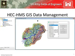
GIS Library/Package A library with code to complete GIS tasks Spatially referenced data Tasks specific to GIS Union, intersect, mosaic, project, and lots more! Options ArcGIS arcpy, etc. GeoTools Open source GDAL, ORG, Proj Open source BlueSpray SchoonerTurtles
Big Picture ArcGIS Desktop Wing IDE Other Programs Model Builder Python Scripts ArcGIS Libraries Other Libraries Data Daa includes GIS (spaially referenced) and non-spatially reference
Why Python? ESRI s primary scripting language (for now) Very popular in GIS (Arc and OpenSource) Very flexible (can solve lots of problems) Well supported (with Wing IDE) Easy to learn (relative to complied languages) Portable But it is not the fastest language Compiled (C/C++, Java, C#) are faster
Results in ArcGIS 10 New window in ArcGIS 10 Records each time you use a tool Right click to Copy to Python Paste into another window to see how to use the tool Warning: The function calls do not always match exactly! (more on this later)
First Assignment Do at least two operations with tools that you would normally do Copy the Python code into Wing IDE Make sure it works! Use data in files, not loaded into ArcGIS Document what the Python code is doing in your own words (comments)