Large Scale Seabed Mapping Workshop Insights
Explore key data integration and exchange projects/initiatives discussed in the Atlantic Seabed Mapping Workshop held at Dublin Castle, Ireland. Learn about current/planned initiatives, priority issues, and operational strategies for enhancing seabed mapping data sharing and management. Join the conversation led by Stephen Locke from Natural Resources Canada to navigate the complexities of large-scale seabed mapping data integration.

Download Presentation

Please find below an Image/Link to download the presentation.
The content on the website is provided AS IS for your information and personal use only. It may not be sold, licensed, or shared on other websites without obtaining consent from the author. If you encounter any issues during the download, it is possible that the publisher has removed the file from their server.
You are allowed to download the files provided on this website for personal or commercial use, subject to the condition that they are used lawfully. All files are the property of their respective owners.
The content on the website is provided AS IS for your information and personal use only. It may not be sold, licensed, or shared on other websites without obtaining consent from the author.
E N D
Presentation Transcript
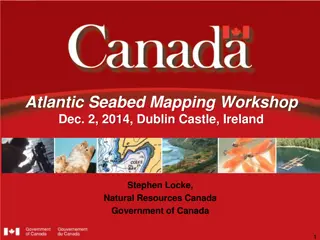
Atlantic Seabed Mapping Workshop Dec. 2, 2014, Dublin Castle, Ireland Stephen Locke, Natural Resources Canada Government of Canada 1
Session 3: Large Scale Seabed Mapping Data Integration & Exchange: Linking Datasets 2
Session 3: Large Scale Seabed Mapping Data Integration & Exchange: Linking Datasets SLIDE 1 What are the current/planned key data integration and exchange projects/initiatives? 1) Open Government Policy (OGP) recently initiated and Federal Geospatial Platform (FGP) in year 1 with 21 federal agencies (led by NRCan) 2) Spatial Data Infrastructure (SDI) Projects: - Marine Spatial Data Infrastructure (MSDI) Pilot Project - as part of IHO commitment. 100km x 100km - Arctic SDI Project 3) Several other innovative initiatives: - Newfoundland & Labrador Seabed Atlas - COIN Atlantic data portal concept Stephen Locke, Director GSC Atlantic, Natural Resources Canada, Canada 3
Session 3: Large Scale Seabed Mapping Data Integration & Exchange: Linking Datasets SLIDE 2 What are the key /priority issues to be addressed ? 1) What is the best data platform and policy framework to use and share seabed mapping data? Global evaluation? 2) Need to identify data holders, format of data, policies, standards and methodologies. 3) How to share that international information on shared Atlantic? Who owns and who manages? Where does it reside? Accessibility? Stephen Locke, Director GSC Atlantic, Natural Resources Canada, Canada 4
Session 3: Large Scale Seabed Mapping Data Integration & Exchange: Linking Datasets SLIDE 3 How can the key/priority issues identified above be operationalised? 1) One key repository for any Atlantic Seabed information? Atlantic GIS or portal concept? 2) See what we have already, e.g multibeam tracks, spot samples, project data. Possibly build the platform first then populate? 3) Establish Working Group to share information and evaluate data integration and exchange Stephen Locke, Director GSC Atlantic, Natural Resources Canada, Canada 5