Marine Spatial Data Infrastructure Initiatives in Iran
Explore the National Reports and Initiatives of the Islamic Republic of Iran regarding Marine Spatial Data Infrastructure, focusing on data exchange, policy, governance, and technical standards to enhance marine data utilization and integration.

Download Presentation

Please find below an Image/Link to download the presentation.
The content on the website is provided AS IS for your information and personal use only. It may not be sold, licensed, or shared on other websites without obtaining consent from the author. If you encounter any issues during the download, it is possible that the publisher has removed the file from their server.
You are allowed to download the files provided on this website for personal or commercial use, subject to the condition that they are used lawfully. All files are the property of their respective owners.
The content on the website is provided AS IS for your information and personal use only. It may not be sold, licensed, or shared on other websites without obtaining consent from the author.
E N D
Presentation Transcript
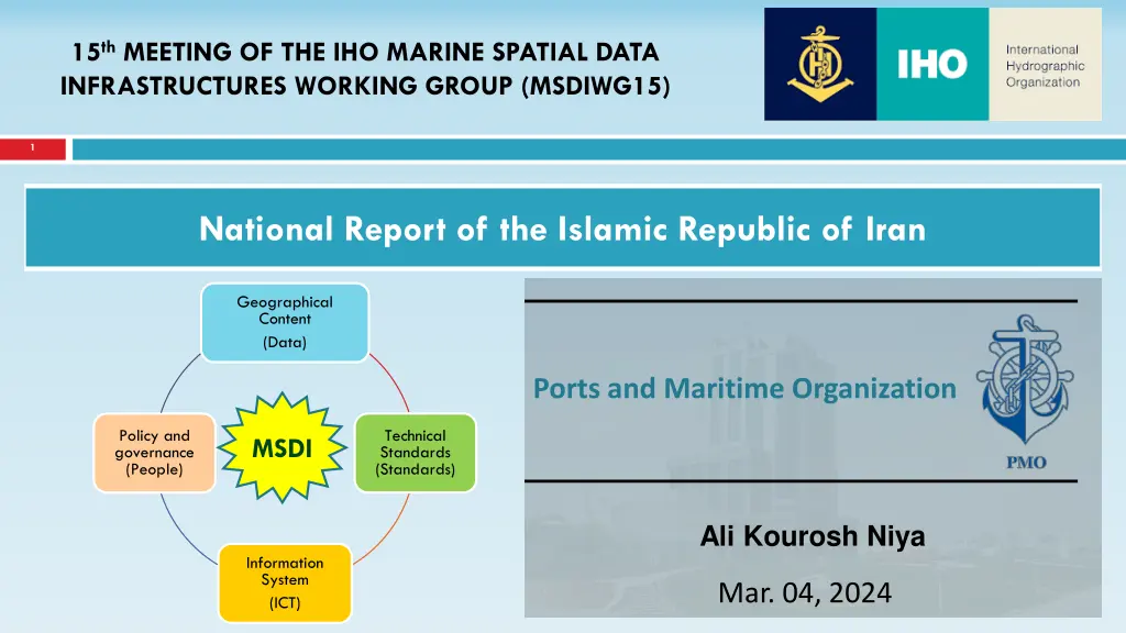
15thMEETING OF THE IHO MARINE SPATIAL DATA INFRASTRUCTURES WORKING GROUP (MSDIWG15) 1 National Report of the Islamic Republic of Iran Geographical Content (Data) Ports and Maritime Organization Policy and governance (People) Technical Standards (Standards) MSDI Ali Kourosh Niya Information System (ICT) Mar. 04, 2024
National Report of the Islamic Republic of Iran 2 National Hydrographic Committee Iranian Committee has the role of controlling, harmonizing and activities in this regard National Hydrographic integrating National Geographical Organization (NGO) To integrate, standardize, share, and accelerate marine data exchange, we need to design, prepare, and implement the MSDI NCC Other members Controlling - Integration - Harmonization
National Report of the Islamic Republic of Iran 3 participation and sharing policies by the producer MSDI Web-base platform Managing dashboard for decision- makers and planners + user-friendly geoportal to attract stakeholders MSDI DSS thematic and functional sub- portables = Marine Spatial DSS distributed resources on the client side
Thanks for your attention Thanks for your attention