Overview of Global Navigation Satellite System
Global Navigation Satellite System (GNSS) is a vital technology that provides accurate positioning and timing information globally. This system comprises multiple satellite constellations, including GPS, GLONASS, Galileo, and more. GNSS plays a significant role in various applications, from navigation to surveying, offering precise location data with different levels of accuracy based on the technology used. The evolution of GNSS terminology, advancements in satellite technology, and future developments highlight the continuous growth and importance of this navigation system.

Download Presentation

Please find below an Image/Link to download the presentation.
The content on the website is provided AS IS for your information and personal use only. It may not be sold, licensed, or shared on other websites without obtaining consent from the author.If you encounter any issues during the download, it is possible that the publisher has removed the file from their server.
You are allowed to download the files provided on this website for personal or commercial use, subject to the condition that they are used lawfully. All files are the property of their respective owners.
The content on the website is provided AS IS for your information and personal use only. It may not be sold, licensed, or shared on other websites without obtaining consent from the author.
E N D
Presentation Transcript
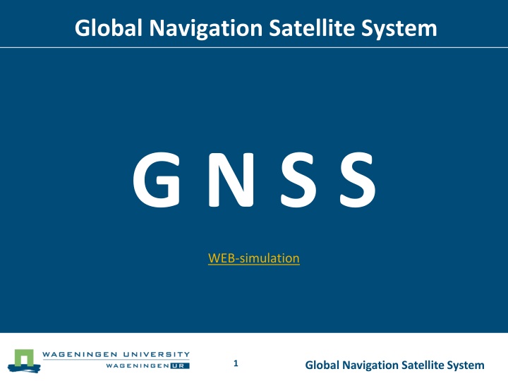
Global Navigation Satellite System G N S S WEB-simulation 1 Global Navigation Satellite System
Global Navigation Satellite System Schedule Philip Wenting Short explanation Equipment, old and new Demonstration outside ? Questions? Please interrupt and ask! 2 Global Navigation Satellite System
Global Navigation Satellite System Terminology is changing ! No longer GPS but GNSS 3 Global Navigation Satellite System
Global Navigation Satellite System Now active GPS USA Global Positioning System GLONASS Russia GLObal'naya NAvigatsionnaya Sputnikovaya Sistema 4 Global Navigation Satellite System
Global Navigation Satellite System Future Compass ( Beidou-2 ) China (Ursa Maior) Galileo Europe 5 Global Navigation Satellite System
Global Navigation Satellite System Regional IRNSS India Indian Regional Navigational Satellite System Beidou-1 China Doris France Doppler Orbitography and Radiopositioning Integrated by Satellite QZSS Japan Quasi-Zenith Satellite System 6 Global Navigation Satellite System
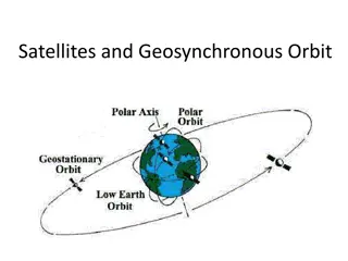
Global Navigation Satellite System Technical information A satellite is a radio transmitter Distance to earth: 20200 km. Frequency and Wave length ( 20 cm.) With 28 satellites always 4 visible , and why 4? 7 Global Navigation Satellite System
Global Navigation Satellite System Positions directly calculated from Satellite data are always wrong ! Why ? 8 Global Navigation Satellite System
Global Navigation Satellite System Accuracy Standard up to 10 metres Differential up to 1 metre RTK few cm And almost everything in between, depending on the budget ! More money >> higher accuracy. 9 Global Navigation Satellite System
Global Navigation Satellite System Better results Averaging Correction from a geostationary satellite WAAS (Wide Area Augmentation System) EGNOS (European Geostationary Navigation Overlay Service) Radio beacon (Long distance) Base station (Short distance) Real position on a known point Virtual ( 06-GPS-Netwerk ) 10 Global Navigation Satellite System
Global Navigation Satellite System Where to find more information? Everywhere on the WWW, search for GNSS on Google or Wikipedia 11 Global Navigation Satellite System
Global Navigation Satellite System When GNSS is not possible: use other landsurveying techniques and/or equipment ! 12 Global Navigation Satellite System
Global Navigation Satellite System Routes outside Forum Made with Garmin s On 2 october 2013 Click 13 Global Navigation Satellite System
Global Navigation Satellite System Thank you for your attention. Please remind : No longer GPS but GNSS ! 14 Global Navigation Satellite System