PACE Mission Overview
PACE mission focuses on global ocean color measurements for enhanced ecological and biogeochemical data, alongside polarimetry measurements for clouds and aerosols. Learn about the mission's history and objectives as outlined by the Science Definition Team.

Download Presentation

Please find below an Image/Link to download the presentation.
The content on the website is provided AS IS for your information and personal use only. It may not be sold, licensed, or shared on other websites without obtaining consent from the author. If you encounter any issues during the download, it is possible that the publisher has removed the file from their server.
You are allowed to download the files provided on this website for personal or commercial use, subject to the condition that they are used lawfully. All files are the property of their respective owners.
The content on the website is provided AS IS for your information and personal use only. It may not be sold, licensed, or shared on other websites without obtaining consent from the author.
E N D
Presentation Transcript
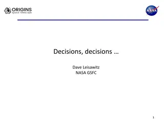
The Pre- Aerosol, Clouds, and ocean Ecosystem Mission PACE a report from the Science Definition Team http://decadal.gsfc.nasa.gov/pace.html by: Carlos E. Del Castillo The Johns Hopkins University-APL 2012 NASA Ocean Color Research Team Meeting April 23-25, Seattle, WA
What is the PACE mission? The PACE mission will make global ocean color measurements to provide extended data records on ocean ecology and global biogeochemistry (e.g., carbon cycle) along with polarimetry measurements to provide extended data records on clouds and aerosols. Understanding of impacts and feedbacks of the Earth system to climate are critical importance. The PACE mission was envisioned as an advanced Ocean Color Sensor provided by NASA and a Polarimeter (3MI) provided by CNES or ESA. CNES recently declined to provide the 3MI sensor. NASA is in conversations with ESA. Nothing more to report on this. ~$750,000,000
A Brief History of PACE In 2010 NASA HQ decided to implement PACE due to the outstanding issues for continuity of MODIS products for ocean color, aerosol, cloud from NPP and JPSS VIIRS. The guiding document is: Responding to the Challenge of Climate and Environmental Change: NASA s Plan for a Climate-Centric Architecture for Earth Observations and Applications from Space http://science.nasa.gov/media/medialibrary/2010/07/01/Climate_Architecture_Final.pdf 25 July, 2011 NASA issued a Dear Colleague Letter inviting proposals for Science Definition Team (SDT) membership. 18 October, 2011 NASA issued selection letters for the SDT.
PACE time line Targeting LRD of FY19 (end 2018) - +/- 1yr 25 July 2011 PACE SDT DCL released 9 September 2011 PACE SDT DCL applications due (50) 18 October 2011 PACE SDT Selection 16-18 November 2011 First PACE SDT Workshop (Washington, D.C.) 14-16 March 2012 Second SDT workshop (Washington, D.C.) 25-27 June 2012 Third SDT workshop (Washington Marriott, Washington, D.C.) July/August 2012 SDT final report due January/February 2013 Target AO release April/May 2013 AO Proposals Due Summer/Fall 2013 AO review and Step 1 Selection October 2013 Phase A begins for Selectee(s) Summer 2015 Step 2 Selection, Phase B
The PACE Science Definition Team Atmosphere Aerosols & Clouds: Cairns, Brian NASA GISS DaSilva, Arlindo NASA GSFC Diner, David NASA JPL Dubovik, Oleg Univ. of Lille, France Kahn, Ralph NASA GSFC Marshak, Sasha NASA GSFC Massie, Steve NCAR Platnick, Steve**- NASA GSFC (Deputy Chair) Reidi, Jerome Univ. of Lille, France Ocean Biology and Biogeochemistry: Antoine, David LOV, France Balch, Barney Bigelow Lab Behrenfeld, Mike Oregon State Univ Boss, Emmanuel- Univ of Maine Del Castillo, Carlos* Johns Hopkins APL (Chair) Franz, Bryan- NASA GSFC Frouin, Robert UCSD-SIO Gregg, Watson NASA GSFC McClain, Chuck NASA GSFC Meister, Gerhard- NASA GSFC Mitchell, Greg UCSD-SIO Muller-Karger, Frank Univ of S. Florida Siegel, David UC-Santa Barbara Wang, Menghua NOAA NESDIS Werdell, Jeremy- NASA GSFC (SSAI) Atmosphere/Ocean: Chowdhary, Jacek NASA GISS Terrestrial: Huemmrich, K. Fred NASA GSFC Instrument Engineering: Puschell, Jeffery Raytheon Commercial Data Use: McNaughton, Cameron Golder Associates, Canada
Science Definition Team Charter The SDTs are charged with defining the science content of the mission and working closely with the engineering team to define a mission concept(s) that optimizes science, cost, and risk. The SDT is also responsible for defining and defending the science value of the mission concept(s). To accomplish this, SDT must work closely with engineering teams SDTs should not work in a vacuum Build upon, use as input, previous work by other groups (Decadal Survey, IOCCG, ACE SWGs, NRC, etc.) The SDT is working on mission requirements, not just instrument requirements. The PACE SDT is not agnostic about cost.
Science Definition Team Responsibilities and Products Unique Responsibilities: Define mission science investigation(s) Use hierarchical format of Goals Objectives Measurements (or could be phrased as Science Questions->Measurements- >Approaches->Instruments Requirements->Mission Requirements (STM)) Prioritize to extent possible The definition of measurement requirements should be supported by detailed analysis Link science content to strategic documents Define Level 1 science requirements as you are able/as needed Define straw-man payload(s) as you are able aas needed including supporting analysis describing the needed capabilities of the instruments With engineering team: Participate in the various Working Groups created by the mission study teams Derive mission requirements from science G O M Define mission architecture Conduct trade analyses Determine data return necessary for the science investigations Produce a System Requirements Document(s)
Science Definition Team Regulations The PACE instrument(s) and mission could be assigned to a center, or competed. Members of the SDT could be involved in the competition. Therefore: -All SDT meetings are open to the community and advertized in the PACE website. - Telecons are not open due to logistics. The chair takes notes during the telecon and distributes them to the SDT for comments. All the telecon agendas and notes will be posted in the PACE website -All documents generated by the SDT, as well as all reference documentation are posted in the PACE website -Final draft will be available to the community for review. The SDT will take comments under advisement. -The SDT will be disbanded before NASA HQ starts working with a possible AO. No one in the SDT will have input or access to the AO during formulation.
How the PACE SDT operates? -Three meetings and ~weekly telecons -off line communications between SDT members -consultation with non-members and engineering team The team is using the experience of the community with satellite sensors. -During the first meeting, the SDT adopted a structure for the final report, devised a schedule, and assigned responsibilities for writing and developing studies. -The SDT adopted the threshold goal classification system to state science requirements. -The SDT commissioned a series of engineering studies (IDL and MDL) to understand cost deltas between thresholds and goal requirements. Based on the results, the team will evaluate changes to the report.
Section # Table of Contents Writing Team Del Castillo, Platnick Del Castillo, Platnick Del Castillo, Platnick Del Castillo, Platnick Del Castillo, Platnick Del Castillo, Platnick Del Castillo, Platnick explore other programs from other countries.Move section 6 here. January February March April x x x x x x x May x x x x x x x x x June July x x x x x x x x x x x x x x x x x x x x x x x x x x x x x x x x x x x x Preface The Science Definition Team Summary Background and Program Rationale Introduction Study approach and organization of the report Programmatic background Historical background -This section could be merged with other sections. TBD Chuck McClain, Frank Muller-Karger, Greg Mitchell, Atmospheric? Check for redundancy. Scientific background-This section could be merged with other sections. TBDChuck McClain, Frank Muller-Karger, Greg Mitchell, Atmospheric? Scientific Objectives Introduction Del Castillo, Platnick Ocean Ecology and Biogeochemistry Mike Behrenfeld, Greg Mitchell, Frank Muller-Karger, Dave Siegel Clouds Brian Cairns, Alexander Marshak, Steve Platnick Aerosols Ralph Kahn, Cameron McNaughton, Steve Massie Terrestrial Ecology Fred Huemmrich, Barney Balch Watershed & Lakes Fred Huemmrich, Barney Balch PACE Science-Driven Measurement Requirements Introduction Del Castillo, Platnick Ocean Ecology and Biogeochemistry Mike Behrenfeld, Greg Mitchell, Frank Muller-Karger, Dave Siegel Clouds Steve Platnick, Brian Cairns, Alexander Marshak Aerosols Ralph Kahn, Cameron McNaughton, Steve Massie Terrestrial Ecology Fred Huemmrich, Barney Balch Watershed & Lakes Fred Huemmrich, Barney Balch PACE Mission Requirements This section could be merged with other sections. TBD Orbital This section could be merged with other sections. TBD Instrumental This section could be merged with other sections. TBD Post-launch calibration requirements Gerhard Meister, Robert Frouin, Bryan Franz, Dave Siegel, Frank Muller-Karger, Jeremy Werdell, Mike Beherenfeld, Menghua Wang, Atmosphere x Data processing, re-processing, and archiving, and dissemination requirements Bryan Franz, Robert Frouin, Dave Siegel, Jeremy Werdell, Menghua Wang, Cameron McNaughton, Atmosphere? x PACE Implementation Plan Orbit selection Jeff Puschell Strawman instruments Jeff Puschell Spacecraft requirements Jeff Puschell Vicarious calibration system requirements, cal-val program Jeremy Werdell, Robert Frouin, Bryan, Franz, Dave Siegel, Frank Muller-Karger, Mike Beherenfeld, Menghua Wang, Carlos Del Castillo, Atmosphere?Cam x x Launch Vehicle Jeff Puschell Mission operation Chuck McClain, Bryan Franz, Jeremy Werdell Data processing Bryan Franz, Robert Frouin, Dave Siegel, Jeremy Werdell, Menghua Wang, Watson Gregg x Science requirements Frank Muller-Karger,Watson Gregg, Dave Siegel, Chuck McClain, Fred Huemmrich Relationship Between PACE and Other Programs (low priority now) Science TBD Synergies with proposed future missions Frank Muller Karger Data management TBD ETC.... TBD Appendices TBD x 1 1.1 1.2 1.3 1.4 1.5 2 2.1 2.2 2.3 2.4 2.5 2.6 3 3.1 3.2 3.3 3.4 3.5 3.6 4 4.1 4.2 4.3 4.4 5 5.1 5.2 5.3 5.4 5.5 5.6 5.7 5.8 6 6.1 6.2 6.3 6.4 6.5 x x x x x x x x x x x x x x x x x x x x x x x x x x x x x x x x x x x x x x x x x x x x x x x x x x x x x x x x x x x x x x x x x x x x x x x x x
Table of Contents Section # Table of Contents PACE Mission Requirements Orbital Instrumental Post-launch calibration requirements Data processing, re-processing, and archiving, and dissemination requirements PACE Implementation Plan Orbit selection Strawman instruments Spacecraft requirements Vicarious calibration system requirements, cal-val program Launch Vehicle Mission operation Data processing Science requirements Relationship Between PACE and Other Programs (low priority now) Science Synergies with proposed future missions Data management ETC.... Appendices 4 Preface The Science Definition Team Summary Background and Program Rationale Introduction Study approach and organization of the report Programmatic background Historical background -This section could be merged with other sections. TBD Scientific background-This section could be merged with other sections. TBD Scientific Objectives Introduction Ocean Ecology and Biogeochemistry Clouds Aerosols Terrestrial Ecology Watershed & Lakes PACE Science-Driven Measurement Requirements Introduction Ocean Ecology and Biogeochemistry Clouds Aerosols Terrestrial Ecology Watershed & Lakes 4.1 4.2 4.3 4.4 5 5.1 5.2 5.3 5.4 5.5 5.6 5.7 5.8 6 6.1 6.2 6.3 6.4 6.5 1 1.1 1.2 1.3 1.4 1.5 2 2.1 2.2 2.3 2.4 2.5 2.6 3 3.1 3.2 3.3 3.4 3.5 3.6
PACE Ocean Science Questions 1-What are the standing stocks, compositions, and productivity of ocean ecosystems? How and why are they changing? Quantify phytoplankton biomass, pigments, and optical properties, assess key phytoplankton groups (e.g., calcifiers, nitrogen fixers, carbon export), and estimate particle size distribution and productivity using bio-optical modeling, chlorophyll fluorescence, and ancillary data on ocean physical properties (e.g., SST, MLD, etc.). Validate these retrievals from pelagic to near-shore environments. 2-How and why are ocean biogeochemical cycles changing? How do they influence the Earth system? Measure phytoplankton biomass and functional groups, POC, PIC, DOC, PSD and productivity. Validate these retrievals from pelagic to near-shore environments. Assimilate PACE observations in ocean biogeochemical models to provide fields for missing observations (cf., CO2 stocks, air-sea CO2 fluxes, carbon export, pH, etc.). 3-What are the material exchanges between land & ocean? How do they influence coastal ecosystems and biogeochemistry? How are they changing? Quantify particle abundance, dissolved material concentrations and their characteristics and optical properties. Validate these retrievals from coastal to estuarine environments. Compare ACE observables with ground-based and model-based land-ocean exchange in the coastal zone, physical properties (e.g., winds, SST, SSH, etc), and circulation (coastal connectivity, etc).
4-How do aerosols influence ocean ecosystems & biogeochemical cycles? How do ocean biological & photochemical processes affect the atmosphere? Quantify ocean photobiochemical and photobiological processes and atmospheric aerosol loads and distributions. Combine ACE ocean and atmosphere observations with models to evaluate (1) air-sea exchange of particulates, dissolved materials, and gases and (2) impacts on aerosol and cloud properties. Conduct field sea-truth measurements and modeling to validate retrievals from the pelagic to near-shore environments. 5-How do physical ocean processes affect ocean ecosystems and biogeochemistry? How do ocean biological processes influence ocean physics? Compare PACE ocean observations with measurements of physical ocean properties (winds, SST, SSH, OOI assets, etc.) and model-derived physical fields (ML dynamics, horizontal divergence, etc.). Estimate ocean radiant heating and assess feedbacks. Validate from pelagic to near-shore environments. 6- What is the distribution of both harmful and beneficial algal blooms and how is their appearance and demise related to environmental forcings? How are these events changing? Measure phytoplankton biomass, pigments and key group abundance including harmful algae. Quantify bloom magnitudes, durations, and distributions, assess inter-seasonal and inter-annual variations, and compare variability to changing environmental/physical properties. Validate these retrievals from pelagic to near-shore environments. 7- How do changes in critical ocean ecosystem services affect human health and welfare? How do human activities affect ocean ecosystems and the services they provide? What science-based management strategies need to be implemented to sustain our health and well-being? Establish close linkages between science, operational, and resource management communities early in the planning phases of the PACE mission and maintain the feedback mechanisms throughout the life of the mission. Ensure that the science community understands the requirements of the management and operational communities and engage the latter fully in science planning efforts. Estimate the social and economic impacts of ocean ecology, including biodiversity, biogeochemical processes, and biological and chemical stocks and fluxes. Understand the applications of PACE products for water quality assessments and pollution identification. Implement strong STEM education and capacity building programs scoped to address national and international needs.
In some cases, the SDT is very prescriptive in technical requirements and instrumental approaches. This is based on the experience that the OC community has accumulated from CZCS through present. However, the SDT is mindful of not overprescribing in areas where technical innovation may offer novel approaches.
Ocean Science Measurement Goals (not ranked) Noon equatorial crossing time ( 10 min) 1-day global coverage Coverage to a solar zenith angle >75o Characterization of instrument performance changes to 0.1% within 3 years and maintenance of this accuracy thereafter. Overall instrument artifact contribution to TOA radiance retrievals of <0.2%. No detector saturation for any science measurement bands up to 1.2 Lmax Spatial resolution of 1 km2 ( 10%) at all scan angles Along-track spatial resolution of 250 m2 to <1 km2 for inland, estuarine, coastal, and shelf area retrievals for all bands or a subset of bands. Two or more SWIR bands within the wavelength range of 1240 to 2130 nm for atmospheric corrections over turbid waters with SNR as indicated in Table 1 and Appendix I. Identified approach or measurement capacity for evaluating/measuring aerosol vertical distributions and type for improved atmospheric corrections. Identified approach or measurement capacity for characterizing/measuring NO2 and/or ozone concentrations at sufficient accuracy for improving atmospheric corrections Spectral subsampling at ~1-2 nm resolution from 655 to 700 nm for refined characterization of the chlorophyll fluorescence spectrum SNR for bio-optical science bands greater than those shown in Table 1 and Appendix I Spectral measurement band centered at 820 nm or 940 nm to determine water vapor content Retrieval of normalized [rw(l)]N for open-ocean, clear-water conditions and standard marine atmospheres with an accuracy of the maximum of either 10% or 0.002 over the wavelength range of 350 395 nm
Outstanding Issues -Cost of augmenting the baseline ocean ecology sensor to accommodate more atmospheric research IDL studies commissioned. -Class C vs. B or 5-10 years instead of 3-5 -1 km vs. 250 m spatial resolution -Atmospheric corrections To what extend are data in the UV useful without having more information about aerosols? No clear consensus within the SDT. However, it is clear that, as envisioned, the PACE sensor will provide ground-braking science even with current atmospheric correction protocols -Will ESA or NASA provide a polarimeter? -Will NASA compete a vicarious calibration system? -Launch vehicles- This is not an issue for the SDT, but it is an issue for the community.
NLS II Launch Vehicles The following vehicles are currently listed in the NLS II Contract X = Not offered X = Not available X = Not affordable X = Not certified, but possible X X X X X Only 5 left! X X For detailed performance data see http://elvperf.ksc.nasa.gov NOTE: Delta IV and Antares are not currently offered on NLS II


")