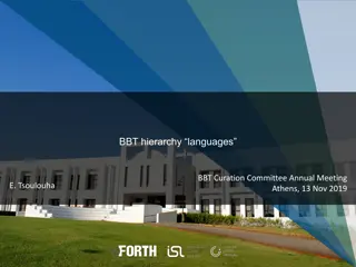
PARTHENOS Project and Geometric Extents in Research Infrastructures
PARTHENOS Project aims to strengthen cohesion in Linguistic Studies, Humanities, and more through European Research Infrastructures. Explore the theme of Geometric Extents with a focus on points, linear extents, surface areas, and 3D volumes. Delve into the spatial projection of real-world phenomena and the significance of place types in historical discourse.

Download Presentation

Please find below an Image/Link to download the presentation.
The content on the website is provided AS IS for your information and personal use only. It may not be sold, licensed, or shared on other websites without obtaining consent from the author. If you encounter any issues during the download, it is possible that the publisher has removed the file from their server.
You are allowed to download the files provided on this website for personal or commercial use, subject to the condition that they are used lawfully. All files are the property of their respective owners.
The content on the website is provided AS IS for your information and personal use only. It may not be sold, licensed, or shared on other websites without obtaining consent from the author.
E N D
Presentation Transcript
Geometric Extents and co. Geometric Extents (facet) geometric extents (top-term) [BBT] [BBT] [BBT] [pending] [BBT] [pending] points (term) linear extents (term) surface areas (term) 3D-volumes (term) What motivated them?
PARTHENOS Project Goal: PARTHENOS aims at strengthening the cohesion of research in the broad sector of Linguistic Studies, Humanities, Cultural Heritage, History, Archaeology and related fields through a thematic cluster of European Research Infrastructures, integrating initiatives, e- infrastructures and other world-class infrastructures, and building bridges between different, although tightly, interrelated fields. PARTHENOS will achieve this objective through the definition and support of common standards, the coordination of joint activities, the harmonization of policy definition and implementation, and the development of pooled services and of shared solutions to the same problems. https://www.parthenos-project.eu/about-the-project-2
The PARTHENOS Place Types List The PARTHENOS Place Types List was compiled based on the TGN place types i.e. controlled terms describing the TGN entities (e.g., nation, empire, caliphate, inhabited place, village, archaeological site, cave dwelling, peak). These place link to AAT and their meaning is defined as a spatial projection of the spatiotemporal extents of observable and/or measurable real world phenomena.
SP2 Phenomenal Place (abridged version) This class comprises instances of E53 Place whose extent and position is defined by the spatial projection of the spatiotemporal extent of a real world phenomenon that can be observed or measured. The spatial projection depends on the instance of S3 Reference Space onto which the extent of the phenomenon is projected. In general, there are no limitations to the number of Reference Spaces one could regard, but only few choices are relevant for the cultural-historical discourse. Typical for the archaeological discourse is to choose a reference space with respect to which the remains of some events would stay at the same place, for instance, relative to the bedrock of a continental plate. On the other side, for the citizenship of babies born in airplanes, the space in which the boundaries of the overflown state are defined may be relevant . Instances of SP2 Phenomenal Place exist as long as the respective reference space is defined. Note that we can talk in particular about what was at a place in a country before a city was built there, i.e., before the time the event occurred by which the place is defined, but we cannot talk about the place of earth before it came into existence due to lack of a reasonable reference space.
Using the CRM, we often need to refer to the space occupied by an object or feature Amara West Neal Spencer, Anna Stevens & Michaela Binder. (2015). Amara West, Living in Egyptian Nubia.
Revealing the buried town and landscape. Sophie Hay [ ] a geophysical survey allowed us to understand the size, layout and landscape setting of the ancient town [ .]. Gradiometry is a survey technique that measures small changes in the Earth s magnetic field caused by the presence of buried remains. By plotting each data point as a shade of grey, to reflect different magnetic gradients, we can produce a readable plan of the ancient town as it survives under the sand. The enclosure wall (100 x 100m) with buttresses against its external face, and external towers at each corner, is clearly visible (black contour) [ ]. Inside the town walls, the temple occupies the northeastern corner and its sandstone walls are denoted by negative anomalies (white lines) [ ]. [ ] Seeking to define the shape and depth of ancient Nile channels around Amara West, we deployed a different remote sensing method: ground-penetrating radar (GPR). High- frequency radar pulses are transmitted into the ground, and a sensor measures how these are reflected by subsurface features. By taking thousands of measurements, a three- dimensional model of underground features can be created. [ ] One of the palaeochannels lies immediately north of the town. A blank, smooth area in the data clearly indicates the course of this ancient river channel.
Measurements designating a specific place and their types: The place of Amara West cast as a set of coordinates whereby to locate it; incidentally, the coordinates found in google maps represent the centroid of Amara (both West and East eastern part was established much later, after the western part was abandoned) TYPE: point The white lines on the northeastern corner of the city, each denoting the temple walls. TYPE: linear extent The surface surrounded by the enclosure wall of the city (100*100 m2) TYPE: surface area The shape and depth of the ancient Nile channel that lies immediately north of the town, represented as a three-dimensional model of underground features (in m3) TYPE: 3D-volume They would all be kinds of Geometric Extents.
So far we have accepted Geometric Extents (facet) geometric extents (top-term) [BBT] [BBT] [BBT] [pending] [BBT] [pending] points (term) linear extents (term) surface areas (term) 3D-volumes (term) It s really a situation of either accepting all of them, or none.
Geometric Extents This facet comprises kinds of designations and definitions of spatial extents based on either geometric expressions or spatial properties of observable features -like mountains, lakes, buildings, cities, etc. -and social constructs -referring to the spatial extent of territories that fall within the jurisdiction of some geopolitical or other administrative unit. NOTE: The terms and hierarchies of this facet can be coordinated with the suitable type of phenomenal place, in the sense of CRMgeo, [1] classified accordingly under Physical Features, Built Environment or Geopolitical Units. [1] Hiebel, G.H, Doerr, M. (2013). An ontological spatio-temporal refinement for the CIDOC CRM and GIS standards. 19th Annual meeting of the European Association of Archaeologists (EAA2013) 2013, Pilsen, Czech Republic, 4-8 September 2013, p. 20.
points This term classifies zero-dimensional geometric primitives that represent the position of the centroid of a particular feature on a given surface. The actual spatial extent of the feature thus represented is of no importance. Deciding to capture the centroid of a feature depends on the scale of the representation (the smaller the scale, the more likely it is to represent a feature as a point), convenience, the type of feature the points stand for (f.i. some position on a linear structure, such as a "border triangle"). NOTE: The terms listed as points can be coordinated with the suitable type of phenomenal place -in the sense of CRMgeo -classified under the hierarchies of Physical Features, Built Environment or Geopolitical Units.
surface areas The term classifies expressions specifying the position and extent of a two dimensional feature, figure or shape. Such expressions may be numerically determined closed paths, such as a connected sequence of x,y coordinate pairs/points forming a polygon, or the geometric projection of a stationary two-dimensional feature on a surface, in particular that of earth. They may even be projections of temporally limited dynamic phenomena such as a flood area or a battle field. Surface areas can be seen as contiguous projections onto some reference space. Examples of such areas are enclosed spaces like that of islands, cities, forests, lakes, country or real estate boundaries and so on. NOTE: The kind of Physical feature, Built environment or Geopolitical unit providing the geometric extent -i.e. a lake, a stadium, a prefecture -can be specified by coordinating this term with the suitable feature type, such as surface areas of Physical features/ Built environments/ Geopolitical units .
linear extents (pending) This term classifies one-dimensional shapes on a surface that are either straight or curved and can be defined by a connected series of unique x,y coordinate pairs/points forming a continuous path. The said points are all contained in it. Linear extents may be used to approximate the 2- dimensional extent of features much longer than wide, such as roads, rivers, contours, footpaths, flight paths and so on, or to describe declarations of borders. NOTE: The kind of Physical feature or Built environment providing the geometric extent -i.e. a a river, a coastline, a road or a bridge -can be specified by coordinating this term with the suitable feature type, such as surface areas of Physical features/ Built environments .
3D-volumes (pending) This term characterizes physical features or material objects on the crust of the Earth, that extend in three dimensions/ defined along three axes of a Euclidean space . They can but need not be solid. NOTE: The kind of Physical feature, Built environment or Geopolitical unit shaping a geometric extent can be specified by coordinating this term with the suitable feature type, such as surface areas of Physical features/ Built environments/ Geopolitical units . For example, the water filling the bed of a lake, the volume occupied by a building, or the Exclusive Economic Zone of a sovereign state can be represented in terms of a 3D volume.
Following the decision to introduce Geometric Extents in the BBT to represent the various projections of objects/features (i.e. the spatial extent of things), it was proposed that a note be introduced to the relevant BBT terms suggesting coordinating the properties inherent to objects/features to the property of having a spatial extent common to them all. The terms affected are: GEOPOLITICAL UNITS PHYSICAL FEATURES BUILT ENVIRONMENT
Geopolitical Units Scope note: This facet comprises types of administrative divisions used by a state or other sovereign or political structure within the boundaries of its jurisdiction. Intrinsic features of these units include, among others, the extent of the area over which they are applied/exercised, the chronological extent during which they are in force, their governing bodies and the degree of autonomy they are granted in relation to managing and exploiting of their resources.
Geopolitical Units; adding the note: NOTE: The administrative divisions grouped under Geopolitical Units have a spatial extent, best captured as feature geometry, i.e. by coordination with the respective terms subsumed under the facet "Geometric Extents". For instance, an administrative region may be referred to by means of its surface area (km2). So, given the administrative region of South Aegean (Greece), which has a total surface area of 5,285.99 km2, the data entry representing it could be something like the following: "has_current_location: <Region of South Aegean> and <Region of South Aegean>has_type: <BBT: surface areas AND geopolitical units>.
physical features Scope note: This term classifies specific formations that are integrally adapted to certain material objects. They cannot, therefore, be separated from the carrier-object, but they also do not identify with it, since it is only a part of the carrier-object that carries the entire feature. In this sense, the feature is fixed, with respect to the carrier-object, while any attempt to remove it will result in the loss of part of the carrier-object. They may have two- or three-dimensional geometric extent, but there are no natural borders that separate them completely, in an objective way from the carrier-objects. Instances of Physical Features can be features in a narrower sense (scratches, holes, reliefs, surface colours etc.), while in the wider sense, they are portions of particular objects with borders that are not absolutely defined, such as the core of the Earth or the head of a marble statue
physical features; adding the note NOTE: The formations grouped under Physical features have a spatial extent stationary with respect to surrounding matter and undergoing slow modifications, which qualifies the aspect of their spatial extent also as kinds of places. They constitute geographical features in the sense of the Open Geospatial Consortium (OGC, www.opengeospatial.org) if they are located stationary on the surface of earth. Therefore classifying their spatial aspect as kinds of places is best captured by coordinating an adequate term subsumed under the facet "Geometric extents" with the term "physical features" or one of its narrower terms.
built environment Scope note: This term classifies structures, simple or complex, regardless of their size, duration of construction or use, that are attached or embedded in the ground and cannot be moved without irreversible damage. NOTE: The structures grouped under built environment have a spatial extent, best captured as geometry of a geographical feature in the sense of the Open Geospatial Consortium (OGC, www.opengeospatial.org), i.e. by coordination with the respective terms subsumed under the facet "Geometric extents".


")


")
")