PGSC Working Group Progress Capacity Development
The PGSC Working Group aims to support Goal 4 of the PGSC Strategy, fostering a self-reliant geospatial and surveying community with a culture of learning, innovation, and gender equity. Through various activities like trainings, seminars, and workshops across member countries, the group strives to enhance capacity and promote sustainable practices within the community.
Download Presentation

Please find below an Image/Link to download the presentation.
The content on the website is provided AS IS for your information and personal use only. It may not be sold, licensed, or shared on other websites without obtaining consent from the author.If you encounter any issues during the download, it is possible that the publisher has removed the file from their server.
You are allowed to download the files provided on this website for personal or commercial use, subject to the condition that they are used lawfully. All files are the property of their respective owners.
The content on the website is provided AS IS for your information and personal use only. It may not be sold, licensed, or shared on other websites without obtaining consent from the author.
E N D
Presentation Transcript
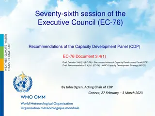
PGSC WORKING GROUP PROGRESS CAPACITY DEVELOPMENT 5thPACIFIC GEOSPATIAL AND SURVEYING COUNCIL MEETING 11thAugust 2020
PGSC Working group mandate This Working Group primarily supports Goal 4 of the PGSC Strategy: Goal 4: The geospatial and surveying community is self-reliant with a culture of learning, innovation and gender equity. All working groups are also tasked to seek out resources to support sustainable PGSC activities, as per Goal 3.
PGSC Working Group Virtual (Zoom) Meeting Date: 31 July 2020 (11am to 1pm - Fiji Time) Participants: Forty One (41) Countries: Tonga, Tuvalu, Cook Islands, Fiji, Kiribati, Solomon Islands Agencies: SPC, IGS, GA, IIC, FIG-APCDN, UN-GGIM-AP, UN-GGIM, S+SNZ Chair: Mr. Viliami Folau, Tonga Host: Mr. Anthony Blake Scribe: Ms. Carrol Chan Rapporteur: Ms. Litia Gaunavou
PGSC Working Group Activities Activities 2018-2020 Progress Identify trainings, courses, and workshops available to the member countries (online and in- person) - Continued Tonga; Trainings and seminars through UNGGIM Asia Pacific and FIG SPC-GNSS training workshop Internal training programmes o SPC-GNSS training workshop PacSAFE tool training with GA and SPC Drone Operation Training Cook Islands: South-west Pacific Hydrographic Commission Capacity Building Programmes IHO Hydrography Surveying CAT A & CAT B Nauru: Basic GIS Training Maritime Boundaries Delimitation Training PNG: Basic GIS and Database Training Marshall Islands: GIS/RS Training GNSS Equipment and surveying methods Solomon Islands: Common Sensing Training (Basic GIT using Sat Imagery) Drone Operation Training Advanced GIS Training for CommonSensing Kiribati: Maritime boundary delimitation training. Marine Spatial Planning (MSP)
PGSC Working Group Activities Activities 2018-2020 Progress Identify trainings, courses, and workshops available to the member countries (online and in- person) - Continued Samoa & Vanuatu: Data Management Training through NZ MFAT Partner project Fiji: MLMR provides trainings to Ministries in regards to utilisation of VanuaGIS Ministry of Lands and Mineral Resources in-house National Surveying and Draughting Examination qualifications (conducted) Monthly GIS/RS user groups to update on monthly activities and sharing Fiji Met, NDMO - UNDP RESPAC funded Basic GIS Training for DRR (February 2019) Fiji Met, NDMO, Stats GA-SPC PacSAFE training II (April 2019) Geodetic Operational Training for Fiji Datum Upgrade Project (50 participants from Survey and Hydrography) Basic GPS training for Energy Fiji Limited (Dec 2019) Tuvalu: Capacity Mapping through TCAP Drone Training Building Asset Data Collection GNSS Survey Campaign Data Processing and Analysis Trimble Training Online trainings (self-paced/ self-taught You tube, Trimble webinars, etc)
PGSC Working Group Activities Activities 2018-2020 Progress Identify trainings, courses, and workshops available to the member countries (online and in- person) Regional/Multi-Country/Organization: IALA Level 1 AtoN managers training at SPC for 9 PICs SPC-FAO regional training on GIS (Agricultural and Population Census Survey) FIG Reference Frame Seminar (2018) UNOOSA GNSS Technology Workshop (2019) GIS Training IIC (Bathymetric and Topographic LiDAR) MSDI Training IIC for National Level Planning. IIC planned S-5B Hydrographic Training Course FIG working week (virtual/face to face) ESRI webinars ArcGIS Pro ESRI Grant Programme UNGGIM AP Plenary (Nov/Dec 2020) UNGGIM AP regional events (IGIF-Tonga/Fiji) Pacific Tertiary Universities: FNU: Diploma in Surveying USP: Diploma, BSc, MSc in Geospatial Science
PGSC Working Group Activities Activities 2018-2020 Progress Conduct training needs assessment at national level (capacity mapping) Establish capacity development plans at the national level 2018, 2019 COSPPac Capacity mapping completed in (13/14 of 14 PICs (PNG outstanding) PGSC questionnaire (10/14 countries; PNG, Kiribati, FSM, Palau outstanding) Tonga: Cook Islands: Succession plans (2 female scholars in NZ under scholarship) COSPPac (Fiji MRD, Lands), Fiji Campaign, PICRAFI, TCAP (Tuvalu)Tuvalu(2 surveyors) Fiji GNSS Survey Campaign Phase 2 SPC (Tonga) to GA for 2 weeks attachments Tuvalu(2 surveyors) Fiji GNSS Survey Campaign Phase 2 Aids to Navigation (AtoN) managers (Solomon and Kiribati) 1 week at SPC Tonga: LINZ for professional support in Geodetic Surveying for international attachments through NZ Short term training scholarships Further opportunities for attachments with GA Training plan and succession plan (Surveying Division, Ministry of Lands) Include more workshops and hands-on training for geospatial and surveying professionals as part of regional development projects Organise ongoing professional training or career development opportunities with NZIS, GA, FIG, SSSI and other potential partners SPC: Attachments from Lands and surveys when travel resumes, call for EOI for countries SSSI /PGSC MoU; professional development and exchange of information / knowledge (LOCATE event in 2021 and SSSI webinar). Support participation in relevant regional and international conferences FIG UN Geospatial Congress UN-GGIM GEO SEASC
PGSC Working Group Activities Activities 2018-2020 Progress Lobby for national geospatial and surveying scholarships some specifically for women and youth Cook Islands: 2 female scholars (Vic University, Wellington NZ) BSc Geoscience Tonga: 2 scholars (1 female) at University of Otago, Dunedin NZ. 2 more scholars planned to attend for Surveying at University of Otago Tuvalu TCAP project scholarships (2 scholars - Geospatial programme) GIZ-REDD+ Scholarships for MSc in Geospatial at USP (2019) USP Bachelor of Geospatial science Degree and Masters in Geospatial Science. Support the continued development of existing regional geospatial and surveying programmes offered by technical institutes (e.g. USP, FNU, Solomon Islands National University, UniTech PNG, College of the Marshall Islands) Establish young professionals networks in the region Unitec, Auckland Diploma in Surveying. FNU Diploma in Surveying Pacific Young Surveyors Network established (Chethna Ben, USP) Links with FIG Young Surveyors Network, inclusive of geospatial and land management professionals. Interest in developing Fiji chapter Pacific Young professionals forum organised for PGSC-5 Opportunity to build on MOU with SSSi and S+SNZ UNGGIM interested in collaborating with groups including PYSN to build capacity Ensure young professionals group is included in PGSC activities, events and identify opportunities for young professionals to contribute to decision-making
PGSC Working Group Activities Activities 2018-2020 Progress Encourage government geospatial and surveying internships or short- term placement for high school graduates Submit national and regional success stories to the Asia Pacific Spatial Excellence Awards (APSEA) SPC; Graduates - FNU and USP; interns for two-month attachment Nomination process at SSSI website APSEA; PGRSC Conference awards for Pacific category in 2018 awardees for USP Geospatial Science Programme and SkyEye Samoa Highlight success stories of young professionals in relevant regional and international channels (video, media, newsletters, social media) Siotasia Malolo (Tonga); SPC IWD story (2018) Carrol Chan (SPC GIS), SPC Women in Science week (2019) Women in GIS session at the PGRSC User conference in 2019; Catherine Paul (Kiribati), Elizabeth Whippy and Vasiti Soko (Fiji) Highlight success stories of women in relevant regional and international channels (video, media, newsletters, social media) PGSC Chair Rosamond Bing Breaking Barriers in Tonga World Bank on International Women s Day (2020) PGSC Chair and Vice-chair; SPC web story (2018) 6 women in geospatial and surveying; SPC video (2018) Numerous women profiled in Pacific Women in Surveying and Geospatial Science info sheet (2018) Women profiled for Pacific Women in Geospatial Newsletter (2019) Carrol Chan, SPC-GIS, SPC Women in Science week (2019) Women in Geospatial Magazine (Fiji Vasiti Soko) Women in GIS/RS/Surveying across the Pacific Women in Geospatial + Channel (newly formed global channel) Siotasia (Tonga) feature on Women in Tonga video Inclusion of a new session on Women in GIS (PGRSC Conference 2019)
PGSC NEW Working Group Activities Activities NEW Collate listing of planned events/courses and coordinate Post-COVID courses, meetings and opportunities Develop google form/survey for events and view it on an open excel/google sheet for reporting PGSC to endorse SPC s application to establish and Ocean Teacher Global Academy Regional Training Centre For PGSC consideration
COVID-19 Delayed Trainings UNGGIM- Workshop in Tonga in April 2020 PCRAFI-2 Training TCAP Training in Tuvalu IIC GIS training in conjunction with PREP (Tonga, Samoa, Vanuatu, RMI) Tonga- Students are stranded overseas or unable to undertake scholarships due to travel restrictions University of Otago Cook Islands- Students requested to come home to Cook Islands and undertake studies online, but they remained in NZ so they would not be stranded. Tuvalu- TCAP Scholars are stranded in Tuvalu. Unable to undertake this year
Challenges faced Lots of different equipment, software with expensive updates, upgrades, maintenance Lots of activities going on/ potential for duplication of effort Access to online mediums for training, meetings, webinars poor internet connectivity and unaware of opportunities Do decision-makers understand the link between capacity development and improved organisational performance/achieve goals? COVID-19- cannot travel to attend trainings/courses in 2020 Rescheduled events/ meetings/ trainings will result in stretched resources and busy scheduling in 2021 onward Lack of participation across PGSC working group members to update on activities, knowledge sharing is impacted, country reports from limited PIC WG members
Opportunities Online: Leadership/ Management through Humentum GNSS protocols First Hydrographic Training Course with IIC via distance learning Webinars (to follow from PGSC meeting) ISPRS trainings/webinars In person: Tailored trainings available from IIC, GA More broadly provide training to the country FIG Working Week Papers on Capacity Development FIG Working Week in 2021 ESRI webinars in ARCGIS, least squares adjustment program UNGGIM Virtual Session on Capacity Development in Bali, Indonesia IOC-Ocean Teacher Global Academy Regional Training Centre TCAP (GCF, UNDP, SPC project in Tuvalu) Coastal Monitoring Training
Opportunities- Continued National and regional success stories to the Asia Pacific Spatial Excellence Awards (APSEA) http://sssi.org.au (nominations close 31 Aug 2020) TOR for Working Group, deliver work plan to identify steps to achieve WG activities? UNGGIM Capacity Building WG opportunity to undertake case study to highlight addressing of needs/issues/area/region for showcasing how issues are solved through an action plan IIC capacity development framework model Develop capacity development plan to identify urgent needs common to most nations capacity mapping and online poll Formalise working relationship with USP and FNU with other working groups from SSSI, FIG, UN-GGIM to align activities Incorporate surveying and geodesy courses/units into Geospatial programme (USP)
THANK YOU MALO AUPITO
