Practical Impacts of NSRS Modernization: Tools for a Changing World
The modernization of the National Spatial Reference System (NSRS) is crucial for adapting to emerging needs such as sea level rise and coastal geohazards. By updating tools, integrating modern coding, and providing new geoids, the NSRS will affect every latitude, longitude, and height measurement in the USA. Learn about the extent of the current NSRS, its deficiencies, and the practical impacts of the ongoing modernization efforts.

Download Presentation

Please find below an Image/Link to download the presentation.
The content on the website is provided AS IS for your information and personal use only. It may not be sold, licensed, or shared on other websites without obtaining consent from the author.If you encounter any issues during the download, it is possible that the publisher has removed the file from their server.
You are allowed to download the files provided on this website for personal or commercial use, subject to the condition that they are used lawfully. All files are the property of their respective owners.
The content on the website is provided AS IS for your information and personal use only. It may not be sold, licensed, or shared on other websites without obtaining consent from the author.
E N D
Presentation Transcript
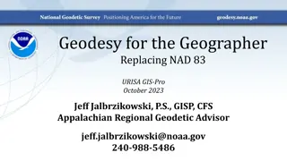
Practical Impacts of the Modernized NSRS Dru Smith NSRS Modernization Manager NOAA s National Geodetic Survey May 31, 2023 FIG 2023 Orlando 1
Outline A very brief overview of NSRS Modernization Practical Impacts Tools for a changing world May 31, 2023 FIG 2023 Orlando 2
The National Spatial Reference System The NSRS Official coordinate system for the USA Defined by the (USA) National Geodetic Survey Required to be used by all (USA) Federal Government agencies Often used by many (USA) state and local government agencies or private surveyors May 31, 2023 FIG 2023 Orlando 3
Extent of the current NSRS Frames: Truly global but used regionally Geoid/Vertical: Regional Conterminous US (CONUS; Lower 48 ) Alaska Hawaii Territories: Puerto Rico, U.S. Virgin Islands, American Samoa, Guam, CNMI May 31, 2023 FIG 2023 Orlando 4
NSRS Modernization in (very) brief Why? The current NSRS was: Defined in the pre-GPS era Without GPS, the Earth s center (frame origin) was very hard to detect Defined without aid of gravity-mission satellites Leveling, terrestrial gravity, disconnected from the geometric frame Defined right after punch-cards went away Tools relied upon 80-character ASCII files and FORTRAN Defined without a long-term strategy to acknowledge Earth s dynamics In short, the current NSRS has failed to keep up with emerging needs Sea level rise, floodplain mapping, coastal geohazards May 31, 2023 FIG 2023 Orlando 5
NSRS Modernization in (very) brief NATRF2022 NAD 83(2011) Gravimetric geoid PATRF2022 Hybrid geoids NAD 83(PA11) CATRF2022 NAD 83(MA11) MATRF2022 NAVD 88 ASVD 02 GDX / OPUS 6 Modern coding Integrated tools Updated manuals Bluebooking FORTRAN Disparate tools Outdated manuals PRVD 02 NAPGD2022 NMVD 03 GUVD 04 VIVD 09 6 May 31, 2023 FIG 2023 Orlando
Practical Impacts Every latitude, longitude and ellipsoid height will change from its NAD 83 values in the +/- 2 meter range Every orthometric height will change from its NAVD 88 (et al.) values in the +/-2 meters median range, with an unknown limit on change due to (as yet) unquantified subsidence impacts Published coordinate functions at active control stations will be the primary geodetic control of the NSRS Greater integration of NGS tools will improve consistency and reduce confusion May 31, 2023 FIG 2023 Orlando 7
Practical Impacts One day, every digital surveying instrument could be capable of providing direct input to OPUS 6 via GDX GDX: Geodetic Data Exchange format. Can hold raw measurements from GNSS receivers, levels, total stations, gravimeters OPUS 6: NGS s future do-it-all geodetic survey project processing tool Time-dependency will be built into the modernized NSRS. Users will need to actively disengage it. May 31, 2023 FIG 2023 Orlando 8
Tools for a changing world Before working in the modernized NSRS, most users want to know how to get their decades of existing data into it There are always three ways Method Accuracy Cost Re-survey High High Re-adjust Medium Medium Transform Low Low May 31, 2023 FIG 2023 Orlando 9
Tools for a changing world Re-survey Return to the field, and survey points of interest, relying on the modernized NSRS control Definitely can yield new geodetic control (for a while) for you to use Re-adjust Using pre-existing observations, load them up to OPUS, and re-adjust them to modernized NSRS control Probablyyields new geodetic control (for a while) for you to use Transform Using tools like NADCON and VERTCON (NGS models) estimate mass-changes to your datasets. Does notyield new geodetic control May 31, 2023 FIG 2023 Orlando 10
Re-survey or Re-adjust The NOAA CORS Network will be improved OPUS-S and OPUS-Projects 5.x will be available for GNSS only OPUS 6 (the do-it-all suite) will not be ready until after 2025 Multiple constellations (M-PAGES) Coordinates in ITRF2020, N/M/P/CATRF2022, NAPGD2022, SPCS2022 May 31, 2023 FIG 2023 Orlando 11
Transform Using all GNSS and leveling data ever provided to NGS, we will create updates to NADCON and VERTCON Available in NCAT and VDatum Will get your data to the 2020.00 epoch in the new frames / new geopotential datum May 31, 2023 FIG 2023 Orlando 12
Timeline NGS will release all modernized NSRS data and many support tools on their BETA website over the 2024-2025 timeframe Because the creation of some data/tools are the prerequisites for creating other data/tools, some parts of the modernized NSRS will be on BETA for over a year, while others for only a few months Once everything has been publicly available for 3 months, the FGCS will meet to decide on adopting the whole package FGCS: Federal Geodetic Control Subcommittee. Under the FGDC (Federal Geodetic Data Committee) With a positive vote, everything moves from BETA to the live NGS page NGS expects this vote in late 2025 May 31, 2023 FIG 2023 Orlando 13
Early release Some data/tools can and will be released early This was a request from industry partners Such early-releases ( alpha products ) aren t usually publicly available, so this will only be true for a handful of things SPCS2022 EPP2022 GEOID2022 A few others May 31, 2023 FIG 2023 Orlando 14
Early release Alpha products are, by definition, any or all of the following: Incomplete Inaccurate Buggy Subject to change without notice As such, their early release is primarily to see the big picture such as formats of data, a general direction that NGS is taking, etc. May 31, 2023 FIG 2023 Orlando 15
Whats on deck? Soon: M-PAGES in OPUS-S Soon: GDX to replace GVX Soon: The release of the State Plane Coordinate System of 2022 Late 2023: The first ( alpha ) set of RECs in N/P/C/MATRF2022 on 100,000+ marks End of 2023: ITRF2020 coordinate functions on all NOAA CORS Network stations End of 2023: First ( alpha ) release of GEOID2022 ( GEOID2022 Beta v. 0.1 ) May 31, 2023 FIG 2023 Orlando 16
Thank you! May 31, 2023 FIG 2023 Orlando 17
Questions? May 31, 2023 FIG 2023 Orlando 18
Extra slides May 31, 2023 FIG 2023 Orlando 19
The path to full roll-out (1 of 2) Complete data and tools that have been tested internally will be released on the beta website. Once the complete package of modernized data and tools have been on beta for at least 3 months, NGS will ask FGCS to formally adopt the modenized NSRS After that vote, all modernized data and tools on the beta website will be moved, en masse, up to the live website We will all celebrate and relax because this process can t possibly have any hiccups May 31, 2023 FIG 2023 Orlando 20
The path to full roll-out The next few slides show key elements, and their roll-out order, though with a purposefully vague timeline to allow some flexibility To aid in readability, some details are omitted, but can be inferred, such as: All data will be loaded in the NSRS database A data delivery system will exist All tools will be incorporated into NCAT May 31, 2023 FIG 2023 Orlando 21
The path to full roll-out: Frames NCN w/ ITRF2020 EPP2022 SPCS2022 2023 2024 2025 IFDM2022 May 31, 2023 FIG 2023 Orlando 22
The path to full roll-out: Geopotential GRAV-D Complete GM2022 DEFLEC2022 DEFLEC2022 Beta v0.1 (alpha release) 2023 2024 2025 GEOID2022 Beta v0.1 (alpha release) GEOID2022 May 31, 2023 FIG 2023 Orlando 23
The path to full roll-out: OPUS OPUS-Projects w/ LASER and new adjustment procedures OPUS-Projects w/ M-PAGES OPUS-S w/ EPP2022 OPUS-Projects w/ ITRF2020 OPUS-S w/ M-PAGES OPUS-S w/ ITRF2020 Initial GDX release LASER completed 2023 2024 2025 OPUS-Projects w/ IFDM2022 (not HTDP) OPUS-S w/ Simultaneous Processing OPUS-S w/ IFDM2022 (not HTDP) OPUS-Projects w/ IFDM2022 (not HTDP) May 31, 2023 FIG 2023 Orlando 24
The path to full roll-out: Passive control Geometric RECs NADCON VERTCON Orthometric RECs 2023 2024 2025 May 31, 2023 FIG 2023 Orlando 25


 brief – Why?")
 brief")


")