Risk-Based Pipeline Route Optimization in the Persian Gulf Region
This project involves analyzing risk factors and optimizing pipeline routes in the Persian Gulf region. Focus areas include project overview, analysis methodology, results, and conclusions. The topography, bathymetry, and constraints of the region are considered for effective decision-making. Key objectives include creating risk maps, identifying and weighting risk factors, and testing the system against existing pipelines. The presentation highlights the importance of risk management in enhancing project performance and aligning with internal safety measures.

Download Presentation

Please find below an Image/Link to download the presentation.
The content on the website is provided AS IS for your information and personal use only. It may not be sold, licensed, or shared on other websites without obtaining consent from the author.If you encounter any issues during the download, it is possible that the publisher has removed the file from their server.
You are allowed to download the files provided on this website for personal or commercial use, subject to the condition that they are used lawfully. All files are the property of their respective owners.
The content on the website is provided AS IS for your information and personal use only. It may not be sold, licensed, or shared on other websites without obtaining consent from the author.
E N D
Presentation Transcript
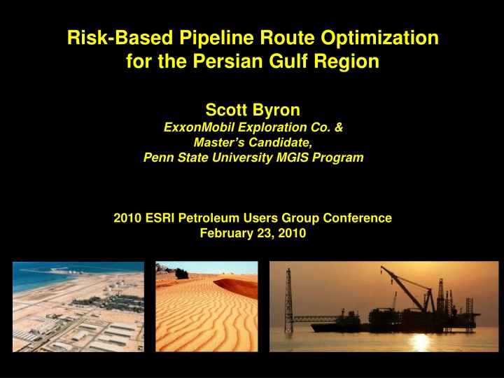
Risk-Based Pipeline Route Optimization for the Persian Gulf Region Scott Byron ExxonMobil Exploration Co. & Master s Candidate, Penn State University MGIS Program 2010 ESRI Petroleum Users Group Conference February 23, 2010 ras%2Blaffan%2Bindustrial%2Bcity Sand dunes near Dubai, UAE
Presentation Overview Project overview Analysis methodology Results & Conclusion Courtesy: NASA 2010 ESRI PUG Conference
Project Overview 2010 ESRI PUG Conference
Project Objectives A vast overland pipeline links the Abu Dhabi receiving terminal with Dubai and Oman. Proof of concept Create risk maps by Identifying & weighting analysis risk factors Test system against existing pipelines Qatar Abu Dhabi Oman Pipeline Courtesy: Oil & Gas Journal 2010 ESRI PUG Conference
The Persian Gulf region topography & bathymetry Why Focus on Risk? New pipelines will encounter high-risk environments People can easily perceive risks Risk management improves project performance Must apply internal safety & risk management policies Key Map ~90m (Approx. depth of Persian Gulf) -1,788m 0m 2,863m 2010 ESRI PUG Conference
The Persian Gulf region topography & bathymetry Constraints Availability of experts No marine examples Reliance on public data Expectation that low risk path will equate to shortest, lowest cost path Key Map ~90m (Approx. depth of Persian Gulf) -1,788m 0m 2,863m 2010 ESRI PUG Conference
Analysis Methodology 2010 ESRI PUG Conference
Risk Categories Risk Factor Identification Construction 10 risks 36 risk factors identified Operation 13 risks 19 terrestrial, 11 marine, 6 - both Divided into 4 categories Socio-Economic 7 risks Environmental 6 risks 2010 ESRI PUG Conference
Risk Scores Formal Risk Analysis Potential Impact Potential Impact 1 2 3 1 2 3 3.5 6 1.5 2.5 4 8 1 1 Probability of Occurrence & Potential Impact scores combined for Risk Score Probability of Probability of Occurrence Occurrence 3.0 4.0 2 6 2.0 2 2 2 3.5 4.5 3 3 2.5 2 3 3 High priority risks have Risk Score >= 3.0 Risk Count Potential Impact Potential Impact High priority risks used in weighting methods Probability of 1 2 3 1 2 3 3.5 6 1.5 2.5 4 8 1 1 Probability of Occurrence Occurrence 3.0 4.0 2 6 2.0 2 2 2 3.5 4.5 3 3 2.5 2 3 3 = High Priority Risks 2010 ESRI PUG Conference
Weighting Methodology Simple Weighted Index Index Factor Factors evaluated independently A 4.5 Evaluated 21 risks B 4.0 Increasing C risk 3.5 D 3.0 2010 ESRI PUG Conference
Factor A Factor B > Weighting Methodology Pair-Based Comparison Overview Evaluating Brown & Peterson method, Analytical Hierarchy Process Factor C Factor A < Factors compared to each other Factor C Factor B < Data collected via survey Fewer risks evaluated Factor C Factor A Factor B > > 2010 ESRI PUG Conference
Frequency matrix for 10 respondents Weighting Methodology Brown & Peterson Method Factors Captures selection frequency A B C D A 8 5 2 Is row factor riskier than column factor? Factors B 2 5 6 C 5 5 4 No factor categories D 8 4 6 Simple calculation of weights 15 17 16 12 Column Sums 30 30 30 30 Max. selection # Factor s column sum Maximum selection # 0.500 0.567 0.533 0.400 Weight = Weight 2010 ESRI PUG Conference
Weighting Methodology Analytical Hierarchy Process Analysis Problem Captures Degree of importance (How much riskier?) on scale of 1 7 (similar significantly riskier) Category 1 Category 2 Weights categories Factor A Factor C Uses matrix similar to BP method Factor D Factor B Weights categories Complex weight calculation 2010 ESRI PUG Conference
Weighting Weighting Methodology Analytical Hierarchy Process Analysis Problem Factors A B C D Category 1 Weight = 1.00 Category 2 Weight = 1.5 A 3 5 1 Factors B 0.333 0.25 0.143 C 0.2 4 0.2 Factor A Weight = 4.28 Factor C Weight = 6.1 D 1 7 4 Steps Factor B Weight = 1.00 Factor D 1. 2. 3. 4. Sum each column Divide all cell values by column sum Sun each row Divide all row sums by smallest row sum Divide by combined row sums Multiply by Category weights, repeat steps 4 & 5 Weight = 4.52 5. 6. 2010 ESRI PUG Conference
Results 2010 ESRI PUG Conference
Top High Priority Risks Seismic Steep Slope (>5%) Commercial Shipping Low High Low High Low High Landslide Crossings Reefs & Spill Windows High risk areas River, road, rail or pipe Spill response window (2 day) Coral reefs 2010 ESRI PUG Conference
Final Risk Surfaces Simple Weighted Index Brown & Peterson Analytical Hierarchy Process 0 0.424 0 0.466 0 0.514 Land riskier than ocean due to higher number of land risks Less ocean land distinction Further loss of ocean land distinction Zagros is riskiest Exaggerated risk variation Zagros has highest risk 2010 ESRI PUG Conference
The IGAT 4 pipeline, Iran Validation IGAT 4 Pipeline Land oil pipeline Crosses mountains, active earthquake area ~$1 billion Key Map 2010 ESRI PUG Conference
Alignments on BP Risk Map Validation IGAT 4 Pipeline SWI shortest, has greater slope variability BP, AHP have best match Key risks: seismic, slope, landslide, crossings Key Map 2010 ESRI PUG Conference
Validation IGAT 4 Pipeline IGAT 4 Pipeline 635 Straight- line 547 SWI BP AHP Criteria Length (km) Alignment 620 Alignment 696 Alignment 694 Length of pipeline (km) within seismic risk environment (peak horizontal acceleration) 1.6 - 2.4 cm/s2 2.4 - 3.2 cm/s2 3.2 - 4.0 cm/s2 > 4.0 cm/s2 1 164 264 206 0 92 370 158 0 245 301 150 0 238 289 158 0 211 215 120 Length of pipeline by slope categories (km) 573 108 15 0 400 182 53 4 265 214 68 6 469 123 28 0 566 113 15 0 < 5% (preferred) 5 - 15% 15 - 30% 30% + Number of crossings 3 3 34 3 8 7 5 2 35 1 4 2 38 1 4 8 37 1 Pipelines Rivers Roads 18 1 Number of urban areas crossed 2010 ESRI PUG Conference
The Dolphin Pipeline, Qatar - UAE Validation Dolphin Pipeline Marine gas pipeline Crosses highly developed area $3.5 billion Key Map 2010 ESRI PUG Conference
Alignments on SWI Risk Map Validation Dolphin Pipeline SWI has best match BP, AHP similar, but route southward Key risks: commercial shipping, pipeline crossings, coral reefs & spill windows Key Map 2010 ESRI PUG Conference
Validation Dolphin Pipeline Dolphin Pipeline 364 Straight- line 346 SWI BP AHP Criteria Length (km) Length of pipeline (km) within low seismic risk environment (peak horizontal ground acceleration of 1.6 - 2.4 cm/s2) Length of pipeline within spill window (km) Length of pipeline within commercial shipping threat zone (km) Alignment 361 Alignment 470 Alignment 469 111 111 197 191 190 10 15 11 15 15 46 314 11 1 1 46 313 11 1 1 Moderate 203 160 15 2 1 135 208 19 2 1 89 270 18 2 0 Low Number of pipeline crossings Number of coral reefs crossed Number of urban areas crossed 2010 ESRI PUG Conference
Conclusion 2010 ESRI PUG Conference
Learnings oil-pipeline Risk approach is valid Lowest risk path: pair-based Shortest path: SWI Data quality impacts results Finer resolution needed Reevaluate some factors for coverage and weight 2010 ESRI PUG Conference
Questions? dubai Dubai, UAE 2010 ESRI PUG Conference
Appendix 2010 ESRI PUG Conference
List of Risk Factors High Priority Risk Factors Analyzed by all Weighting Methods Probability of Occurrence 1 3 3 2 3 2 3 1 1 3 2 2 2 1 3 1 2 1 Potential Impact 3 2 3 3 3 3 3 3 3 2 3 3 3 3 2 3 3 3 Risk Score/SWI Weight 3.5 3.5 4.5 4.0 4.5 4.0 4.5 3.5 3.5 3.5 4.0 4.0 4.0 3.5 3.5 3.5 4.0 3.5 BP AHP Weight Category Socio-Economic Operational Construction Construction Construction Operational Operational Operational Operational Environmental Operational Environmental Socio-Economic Socio-Economic Construction Construction Environmental Operational Risk Contamination of water supply Corrosion from sea spray Cost of building over high slopes Cost of excessive river, rail, pipeline or road crossings Cost of urban construction Damage from commercial ship traffic (anchors and collisions) Damage from seismic activity Damage from shifting sand dunes Damage from unstable Sabkha surface Damage to coral reefs Damage to footings from wave activity Damage to forest environment Impact to agriculture (limited use on Right of Way) Pollution of populated areas Route too close to existing oil infrastructure Shallow or surface bedrock requires blasting Spill pollutes environmentally sensitive area - assumes pipeline failure Threat from landslides (high slope) Weight 0.565 0.130 0.556 0.417 0.685 0.870 0.269 0.185 0.444 0.574 0.157 0.750 0.389 0.611 0.389 0.407 0.407 0.676 3.364 1.260 4.137 2.668 5.628 6.000 10.833 1.860 1.433 2.416 4.930 1.000 2.022 3.974 2.665 2.522 2.507 6.747 Additional High Priority Risk Factors Analyzed by SWI Weighting Method Environmental Damage to wetlands Environmental Damage to shrub/grassland environment 2 2 2 2 3.0 3.0 -- -- -- -- 2010 ESRI PUG Conference
List of Risk Factors (Cont) Additional Unweighted Risks Probability of Occurrence 2 1 1 1 1 3 1 2 3 1 1 1 1 1 1 1 Potential Impact 1 2 1 2 2 1 1 1 1 1 2 1 2 2 2 2 Category Operational Socio-Economic Environmental Construction Operational Operational Construction Socio-Economic Socio-Economic Socio-Economic Construction Construction Construction Operational Operational Operational Risk Damage due to objects dropped from platforms/supply ships Damage to historical or archaeological sites Degradation of landscape Excessive span lengths Hydrodynamic instability from seafloor currents Internal pressure variability from extreme external temperatures Limited availability of power Minimize degradation of recreation/tourist areas Minimize interference with fisheries Repositioning of utilities due to utility congestion Route crosses lake Route too close to military installations ROW width - insufficient width for construction equipment ROW width - Insufficient maintenance corridor ROW width - limited access to pipeline ROW width - Unable to expand pipeline Risk Score 2.0 2.5 1.5 2.5 2.5 2.5 1.5 2.0 2.5 1.5 2.5 1.5 2.5 2.5 2.5 2.5 2010 ESRI PUG Conference
Resources Applying AHP in Weighting GIS Model Criteria. Retrieved from http://www.innovativegis.com/basis/Supplements/BM_Sep_03/T39_3_AHPsupplem ent.htm Brown T.C., & Peterson G.L. (2009). An enquiry into the method of paired comparison: Reliability; scaling; and thurstone's law of comparative judgment. USDA Forest Service - General Technical Report RMRS-GTR. (216 RMRS-GTR), 1-98. http://www.fs.fed.us/rm/pubs/rmrs_gtr216.pdf Longley, P. A., Goodchild, M. F., MaGuire, D. J. & Rhind, D. W. (2005). Geographic Information Systems and Science, 2nd Ed.. London: John Wiley& Sons, Ltd.. 2010 ESRI PUG Conference
Resources (Cont) Montemurro D., Barnett S., & Gale T. (1998). GIS-based process helps TransCanada select best route for expansion line. Oil and Gas Journal. 96(25), 63- 71. Saaty T.L., Vargas L.G., and Dellmann K. 2003. The allocation of intangible resources: The analytic hierarchy process and linear programming. Socio- Economic Planning Sciences. 37 (3):169-184. Pipelines Braestrup, Mikael W. Design and Installation of Marine Pipelines.. Blackwell Publishing. Online version available at: http://knovel.com.ezaccess.libraries.psu.edu/web/portal/browse/display?_EXT_KN OVEL_DISPLAY_bookid=1384&VerticalID=0 2010 ESRI PUG Conference
Resources (Cont) Guo, Boyun; Song, Shanhong; Chacko, Jacob; Ghalambor, Ali Offshore Pipelines. Elsevier. Online version available at: http://knovel.com.ezaccess.libraries.psu.edu/web/portal/browse/display?_EXT_KN OVEL_DISPLAY_bookid=1258&VerticalID=0 Data Global Seismic Hazard Program. (2009 August 27). Middle East Hazard Map. Retrieved from: http://www.seismo.ethz.ch/GSHAP/ National Center for Ecological Analysis and Synthesis. (2009, August 2). Commercial Activity (Shipping) Dataset. Retrieved from: http://www.nceas.ucsb.edu/GlobalMarine/impacts 2010 ESRI PUG Conference
Resources (Cont) NationMaster.com. (2009, September 22). Oil Consumption (per Capita) (Most Recent) by Country. Retrieved from: http://www.nationmaster.com/graph/ene_oil_con_percap-energy-oil-consumption- per-capita Tupper, M., Tewfik, A., Tan, M.K., Tan, S.L., The, L.H., Radius, N.J., & Abdullah, S. (2009, September 2) ReefBase: A Global Information System on Coral Reefs [Online]. Retrieved from: http://www.reefbase.org United Nations Environmental Program. (2009, August 18). Global Environment Outlook (GEO) Data Portal. Retrieved from: http://geodata.grid.unep.ch/ United States Geological Survey. (2009, September 2). Earthquake Hazards Program: Epicenters Database. Retrieved from: http://neic.usgs.gov/neis/epic/epic_rect.html 2010 ESRI PUG Conference
Resources (Cont) World Database on Protected Areas. (2009, August 5). Annual Release 2009 Dataset. Retrieved from: http://www.wdpa.org/Default.aspx 2010 ESRI PUG Conference


")

")
")
")
")