River landscapes in the UK
Dynamic river valleys in the UK, learn about fluvial processes and distinctive landforms, and discover flood risk factors along with management strategies spanning from hard engineering to soft engineering solutions.

Download Presentation

Please find below an Image/Link to download the presentation.
The content on the website is provided AS IS for your information and personal use only. It may not be sold, licensed, or shared on other websites without obtaining consent from the author.If you encounter any issues during the download, it is possible that the publisher has removed the file from their server.
You are allowed to download the files provided on this website for personal or commercial use, subject to the condition that they are used lawfully. All files are the property of their respective owners.
The content on the website is provided AS IS for your information and personal use only. It may not be sold, licensed, or shared on other websites without obtaining consent from the author.
E N D
Presentation Transcript
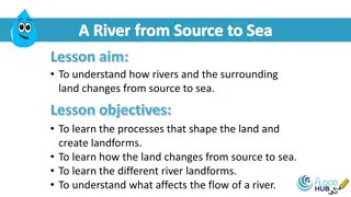
River landscapes in the UK The shape of river valleys changes as rivers flow downstream. Distinctive fluvial (river) landforms result from different physical processes. Different management strategies can be used to protect river landscapes from the effects of flooding.
Changes in rivers and their valleys What is a drainage basin? How does the long profile of a river change downstream? How does the cross profile of a river and its valley change downstream?
Fluvial (river) processes Erosion lateral and vertical Hydraulic action Abrasion Attrition Solution Transportation Traction Saltation Suspension Solution Deposition
River landforms The River Tees Upper course Interlocking spurs and V shaped valleys Waterfalls Gorges Middle course Meanders Pools and riffles Ox-bow lakes Lower course Floodplains Levees Estuaries
Factors increasing flood risk What is a flood? What causes flooding? Physical factors Precipitation amount and intensity Geology Steep slopes Soil moisture/ drainage basin size/ drainage density Human factors Urbanisation Deforestation Agriculture Hydrographs
Managing floods hard engineering Costs vs benefits Dams and reservoirs Channel straightening Embankments Flood relief channels
Managing floods soft engineering Afforestation Wetlands and flood storage areas Floodplain zoning River restoration Preparing for floods Environment agency Flood risk maps Responses to floods
Managing floods at Banbury Where is Banbury? How has Banbury been affected by flooding? Reducing the risk of flooding Flood storage areas Earth embankment Flow control structures Road raising Pumping station Afforestation Biodiversity Action Plan


 processes")