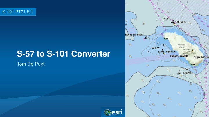
Explore the development and evolution of the S-101 converter by Esri, funded jointly by NOAA and Esri. Learn about the multiple iterations as S-100 and S-101, along with key milestones. Delve into the implemented requirements supporting S-100 Edition 2.0.0 changes, new bridge modeling, data coverage features conversion, and the support for CATZOC modeling. Discover the solutions and advancements made in the conversion process.
Please find below an Image/Link to download the presentation.
The content on the website is provided AS IS for your information and personal use only. It may not be sold, licensed, or shared on other websites without obtaining consent from the author. If you encounter any issues during the download, it is possible that the publisher has removed the file from their server.
You are allowed to download the files provided on this website for personal or commercial use, subject to the condition that they are used lawfully. All files are the property of their respective owners.
The content on the website is provided AS IS for your information and personal use only. It may not be sold, licensed, or shared on other websites without obtaining consent from the author.
Introduction Esri tasked to develop converter in 2010 Funded jointly by NOAA and Esri Multiple iterations as S-100 and S-101 have matured Version 0.8.9 was originally provided on June 30th 2015 Version 0.8.14 was provided at TSM3 September 2016 Version 0.8.19 was provided post TSM3 Baseline documents - S-101 ENC Product Specification 20150623_baseline - S-101 Data Classification and Encoding Guide Final Baseline (April 2014) - S-101 Feature Catalog baseline version 0.8.8 - S-100 Edition 2.0.0
Implemented Requirements Support S-100 Edition 2.0.0 changes to the Feature Catalogue schema - Version 0.8.8 of the S-101 Feature Catalogue (ROK) Calculate ECDIS System Attributes - Default Clearance Depth (based on TSMAD28_DIPWG6_9.4A paper) - Surrounding Depth (based on TSMAD28_DIPWG6_9.4A paper) - Sector Extension (S-52 6.0 CSP LIGHTS06 logic) - In the Water (use DCEG definition of navigable water) - Flare Angle (S-52 6.0 CSP LIGHTS06 logic)
Implemented Requirements Support new Bridge modelling Implemented DCEG modeling Limitation discovered when a multiple bridges share the same pylon - Each bridge touching that shared pylon gets converted as the same bridge aggregation All features convert correctly Potential solution - Create a C_AGGR
Implemented Requirements M_CSCL Conversion to Data Coverage features - No limit imposed. - CSCALE is used to populate maximum display scale - Datasets CSCL used to populate minimum display scale Support V-AIS modeling
Implemented Requirements Implement min/max display scale override support for Data Coverage features Added MinMaxDisplayScaleOverride.xml Allows you to override existing: - M_CSCL feature s CSCALE values - Sets minimum and maximum display scale values for M_COVR with CATCOV = 1 features when converted to Data Coverage features According to S-101 When a dataset has multiple Data Coverage features, then the minimum Display Scale must be the same for all Data Coverage features within the dataset. The maximum Display Scale for multiple Data Coverage features within a dataset may be the same or different.
Implemented Requirements Support CATZOC modelling provided by DQWG Based on DQWG Nov. 2014 report Custom code to map CATZOC table was required Esri modified feature catalog to include modeling found in DCEG and report - Version S-101_FC_0.8.9 Inconsistencies found - DCEG and Report did not match - Multiplicities not defined for all attributes - Defaulted to 0,1 when in doubt to avoid conversion errors - Attributes already defined in feature catalog 0.8.8 as simple, DQWG made them complex - verticalUncertainty is an example of this. Created a new complex attribute named verticalUncertaintyX
Dropped Requirements Adding DOCARE and LOKBSN to Group 1 - Requires new geometries to be created in order to create holes in existing Group 1 features - Creating new geometries is outside the scope of the converter - Recommend further discussion
New Functionality CATALOG.031 files are now supported - Updates and external file references are automatically applied Updated log file - Added additional warning messages to identify gaps in the feature catalogue Updated data dictionary for S-100 Dump utility Implemented version control - As long as the schema does not change new content can be added - Allows updated feature catalogue files to be distributed without modifying the converter
Testing The following datasets passed conversion - All NOAA dataset published on June 25, 2015 - Mickelfirth 2007 Contribution from - IIC Technologies: creation of S-101 test data - IC-ENC: tested their complete set of ENC datasets and reported no errors - Caris: identifying issue with C2IL coordinates and curve records - ROK: providing a copy of their S-100 Viewer for testing - SevenCs: ObservationsOnS101ISOEncoding.doc - SPAWAR: DDR feedback
Items to be Recognized It was agreed during TSMAD 29 that S-57 Object and Attribute acronym values will be added to the Feature Catalogue Alias field for use by the converter. As new bindings are added to the Feature Catalogue, using the existing S-100 Edition 2.0.0 schema, the S-57 to S-101 Converter will automatically discover them. Warning messages have been added to the log file to help identify gaps in the S-101 Feature Catalogue
Recommendations Encourage ENC producers and distributors to convert their ENC datasets using the latest version of the S-57 to S-101 Converter and provide their log file to the S- 100WG. This will help identify any issues with the converter and help identify gaps with the S-101 Feature Catalogue. Create an updated S-101 Feature Catalogue that is up to date with the DCEG baseline document at a minimum. This will allow the converter to convert 100% of the S-57 ENC content to S-101 and provide richer test data for the S-100/S-101 Test Bed project. Have the DQWG and the DCEG work item leader discuss and harmonize the inconsistencies for Quality of Bathymetric Data. Propose encoding guidance to create a C_AGGR feature in S-57 ENC for bridge features that share the same pylon. Discuss alternatives for converting DOCARE and LOKBSN features to Group 1. 1. 2. 3. 4. 5.
Addendum A Documents the changes between version 0.8.14 and 0.8.19 Documents changes planned for a post 0.8.19 version after this meeting
S-101 Project Team is invited to Endorse version 0.8.19+ of the S-57 to S-101 Converter for the current baseline 1. Note the improvements to the converter 2. Convert your S-57 ENC datasets and provide feedback to the project team 3. Discuss proposed recommendations 4.