San Diego Regional GIS Council 2011 Survey Results
The San Diego Regional GIS Council conducted a comprehensive survey in 2011, presenting key findings on GIS software and technology usage, agency staffing, budget, data usage, and more. The survey covered various sections and questions, with insights on the maturity of the GIS community, software utilization, and staff distribution within agencies.

Download Presentation

Please find below an Image/Link to download the presentation.
The content on the website is provided AS IS for your information and personal use only. It may not be sold, licensed, or shared on other websites without obtaining consent from the author.If you encounter any issues during the download, it is possible that the publisher has removed the file from their server.
You are allowed to download the files provided on this website for personal or commercial use, subject to the condition that they are used lawfully. All files are the property of their respective owners.
The content on the website is provided AS IS for your information and personal use only. It may not be sold, licensed, or shared on other websites without obtaining consent from the author.
E N D
Presentation Transcript
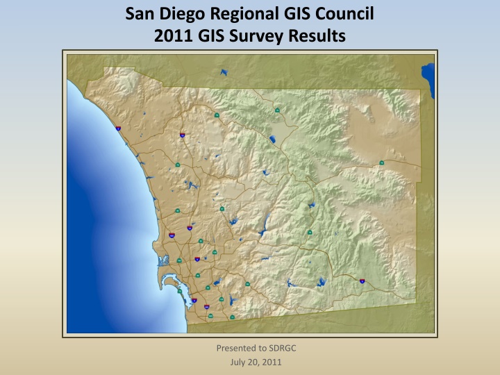
San Diego Regional GIS Council 2011 GIS Survey Results Presented to SDRGC July 20, 2011
2011 GIS Survey - Overview Survey Focus Software and Technology Usage Agency GIS Staffing & Budgets Current Data Usage Data Updates : Local-to-Regional Workflows Survey Structure and Timeline 9 Sections 38 Questions Survey Open from March 7 to end of June Key Stakeholders List 1 person from every public agency directly invited, in addition, posted to SDRGC list Respondents Missing Data 5 Surveys were incomplete (including the County) 4 Surveys had unknown agency 44 Surveys Analyzed
Key Findings How many years has your agency used GIS? 16 Mature GIS Community 42 out of 44 use GIS 14 12 10 8 6 4 2 0 Less than 1 1-4 5-10 11-15 16 or more Approximately how many people in your agency use GIS (directly or via web apps)? GIS Staffing varied Avg # Full-Time Staff = 3.5 Avg # Part-Time = 4.7 Avg # Contractors = 1.5 Many Agencies with Low Number of GIS Users 18 16 14 12 10 8 6 4 2 0 Less than 10 11 - 25 26 - 100 101 - 500 Over 500
Software Use Of the following Desktop GIS applications or extensions, what does your agency use? 40 35 Desktop Product Use 30 Plan to use w/in 1 year 25 Would use if licensed 20 15 Licensed but don't use 10 Currently use 5 0 Delorme ArcScan ArcExplorer ArcInfo Publisher 3D Analyst ArcView Cartographic Tracking Analyst ArcGlobe Network Analyst Google Earth Pro Data Interoperability Maplex ArcEditor MapInfo Open Source Schematics ArcScene Bing Integraph GeoMedia Google Earth Google Earth Enterprise Spatial Analyst Survey Analyst Geostatistical Analyst Of the following Web Mapping products, what does your agency use? Web Mapping Software Use 35 30 Plan to use w/in 1 year 25 Would use if licensed 20 15 Licensed but don't use 10 Currently use 5 0
Software Use Of the following Database products, what does your agency use? 30 Database Product Use 25 20 Plan to use w/in 1 year 15 Would use if licensed 10 Licensed but don't use 5 0 Currently use Of the following other GIS-related software, what does your agency use? Other GIS-related Software Use 30 25 Plan to use w/in 1 year 20 15 Would use if licensed 10 Licensed but don't use 5 Currently use 0
Software Use Of the following programming and scripting languages, what does your agency use? Of the following programming and scripting languages, what does your agency use? 30 Programming Language 25 20 Currently use 15 Plan to use w/in 1 year 10 5 0 What are the operating systems used for GIS in your agency? Check all that apply. What are the operating systems used for GIS in your agency? Check all that apply. 35 Operating Systems 30 25 20 15 10 5 0 Linux Solaris Unix Windows XP Windows Vista Windows 7 Other
Software Use Does your jurisdiction/agency have an Esri Enterprise License Does your jurisdiction/agency have an Esri Enterprise License Agreement? Agreement? 8% 8% Enterprise License Agreements Yes 41% 41% No Not yet, but looking into it. 51% 51% Do you use GPS? If so, what is the accuracy? Do you use GPS? If so, what is the accuracy? GPS Don't use 24% 24% 26% 26% Use LOW accuracy Use MEDIUM accuracy 8% 8% Use HIGH accuracy 42% 42%
Web Map Services Does your agency consume map services as part of your GIS Does your agency consume map services as part of your GIS workflow? workflow? Yes 24% 24% 37% 37% No No, but planning on it in the next year 39% 39% Sources: Internally created ArcGIS Online Open Street Map Google Maps Esri Resources USGS
GIS Data Does your agency use the following SanGIS data layers? Please check all that Does your agency use the following SanGIS data layers? Please check all that apply. apply. 30 25 20 Send updated data back to SanGIS SanGIS Data Usage & Updates 15 Update SanGIS with local data 10 Use as base maps 5 0 Please provide the source for your agency. If from multiple sources, check all that apply. Please provide the source for your agency. If from multiple sources, check all that apply. 60 Our own Agency Data Sources Other Vendors: Imperial County Tax Assessor 50 ArcGIS Online 40 SanGIS 30 SANDAG 20 State/Fed Agency DMI Merrick 10 Purchase from Vendor 0
Please rank the importance to your agency. 40 35 Not that Important GIS Data 30 Somewhat Important 25 20 Very Important 15 10 Top 5 (by Average): Imagery Parcels Rights-of-Way Street Centerlines Address Points 5 0 Please rank the need for improvement. 35 30 Needs no work 25 Needs some work 20 Needs a lot of work 15 10 Top 5 (by Average): Building Footprints Easements Rights-of-Way Routable Network Parcels 5 0
Please rank the priority for regional maintenance 35 30 GIS Data 25 Not that Important 20 Somewhat Important 15 Very Important 10 Top 5 (by Average): Parcels Street Centerlines Rights-of-Way Imagery Address Points 5 0 Is the majority of your agency's data available to others? Is the majority of your agency's data available to others? 18 16 14 12 Web Mapping Service 10 FTP 8 Upon Request 6 4 2 0 To the public for free To the public for cost To gov't/public agencies only
GIS Data Coordinate Reference System What coordinate reference system does your agency use? What coordinate reference system does your agency use? 35 30 Others listed: 25 NAD 27 WGS 1984 Web Mercator Auxiliary Sphere 20 NAD 83 15 Other 10 Web Mercator Auxiliary Sphere for Web Map Services 5 0 UTM Geographic (Lat/Long) State Plane Albers
GIS Applications What applications are tied directly to your agency's GIS? Check all that apply. What applications are tied directly to your agency's GIS? Check all that apply. 90% 80% 70% Percent of Total Applications tied to GIS (22 responded) 60% 50% 40% 30% 20% 10% 0% Are there any "outside" databases directly tied to your GIS? Are there any "outside" databases directly tied to your GIS? Check all that apply. Check all that apply. Response Response Percent Percent 25.0% 25.0% 50.0% Response Response Count Count 2 2 4 Answer Options Answer Options Tax Assessor School enrollment Water usage answered question answered question 8 8
GIS Applications Does your agency have a geocoding tool? If so, what is the source data? Does your agency have a geocoding tool? If so, what is the source data? Geocoding Tool (20 responded) 70% 60% Others listed: 50% Percent of Total 40% Custom built (3) 30% Linear Reference Tool (TeleAtlas/TIGER) 20% 10% 0% SanGIS Esri Bing Thomas Brothers Google 3rd Party Applications CommunityViz Cityworks (2) PowGIS & eZoning FME (2) GBA GIS Analyst Permits Plus Mapplet (2) Geoviewer InfoWater FireView/CrimeView (2) InfraMap (2) Adjust.IT Hansen Laserfiche Magik Components TRAKiT FileNet StreetSaver MapLibrary
GIS Applications Internet Applications http://redi.sandag.org http://igr.sandag.org http://gis.sandag.org/tficsr11/ http://gis.sandag.org/boundary http://www.sandag.org/resources/maps_and_ gis/jobsDensity.asp http://www.sandag.org/resources/maps_and_ gis/residentialDensity.asp http://eassistance.cityofencinitas.org/ http://ezoning.cityofencinitas.org/ http://maps.geocortex.net/imf- 5.2.2/sites/zoning/jsp/launch.jsp http://209.242.148.137/ArcGIS/survey.html PropertyFinder OnPoint(development-related info) http://www.sangis.org http://209.242.148.137/ArcGIS/cip.html http://209.242.148.137/ArcGIS/street.html http://www.icommutesd.com/Bike/BikeMap.a spx Intranet Applications Emergency Response COP Finder Map site locator w/ownership GIS Data Map Viewer for city staff Dig Alert Tracking OneStop GIS (query, view, print) CVMapper (city staff map viewer) EPIC planning tool Parcel and Address Viewer / Site Profiler Map imagery, parcel, streets and eventually sewer and storm drain OnPoint general purpose viewer ArcGIS Server Web ADF for employees Plat map, engineering drawings, general geo for parcels and utilities Water Utility App / Utility Viewer Construction Project Info Viewer ABC L censing App Online Ordering System City app for code enforcement Internal image server app Survey Viewer
Agency GIS Budgets What is your agency's approximate GIS budget? What is your agency's approximate GIS budget? Combined costs for personnel, operating expenses, hardware & costs for personnel, operating expenses, hardware & software procurement/maintenance, data acquisition and software procurement/maintenance, data acquisition and consultant services. consultant services. Combined Agency Budget & Funding Means How does your agency fund its GIS operating How does your agency fund its GIS operating budget? budget? 10% 10% Less than $100,000 6% 6% $100,000 - $400,000 Single budgetary item 29% 29% 32% 32% 45% 45% $401,000 - $700,000 16% 16% Allocated to multiple dept budgets $701,000 - $1,000,000 Over $1,000,000 Both single and multiple 39% 39% 23% 23% Budget Wish Lists $10k = Hardware, Training, Imagery, Staffing, Assistance w/EOC Plan, GPS Hardware/Data, Software, Data, Application integration $100k = Software, Hardware, Cloud Services, Data/Licensing, Staffing/Consultants, Integration Services, Digital plan submission program, Custom app/web development, GPS Hardware $500k = Above + Enterprise Licensing/System Integration, GDB implementation, mobile hardware/software for field personnel
Agency GIS Budgets What percentage of your GIS budget goes to the following categories? What percentage of your GIS budget goes to the following categories? How the GIS Budget is Broken Down (29 responses) 70 60 Average Percent of Budget 50 40 30 20 10 0 Hardware Software Data Personnel Other What percentage of your data budget goes towards What percentage of your data budget goes towards buying v. collecting v. producing? buying v. collecting v. producing? 50 Average Percewnt of Data Budget 45 How the GIS Data Budget is Broken Down (24 responses) 40 35 30 25 20 15 10 5 0 Buying Collecting Producing
GIS Use by Departments/Functions For the following departments/business functions in your jurisdiction or agency, check if your agency does the following: 25 20 15 10 5 0 Consumes GIS (i.e. through apps) Uses GIS (i.e. desktop software) Provides GIS Services
Regional GIS Council & Participating Agencies Does your agency participate in SD Regional GIS Does your agency participate in SD Regional GIS Council? Council? San Diego Regional GIS Council Participation Yes, at least 1 person attends most mtgs 19% 19% Yes, on the email list but don't get to many mtgs 14% 14% 67% 67% No Thank you to the following agencies for participating. If you responded but do not see your name, please let us know as we had a few without the agency listed. City of Carlsbad City of Chula Vista City of Coronado City of Del Mar City of El Cajon City of Encinitas City of Escondido City of La Mesa City of National City City of Oceanside City of Poway City of San Diego City of San Marcos City of Solana Beach City of Vista Borrego Water District Calrans District 11 Camp Pendleton IGI&S Coronado Unified School District County of San Diego Helix Water District Imperial Beach Poway Unified School District Ramona Unified School District Regional Task Force on the San Diego County Water Authority San Diego Unified Port District SANDAG SanGIS Santa Fe Irrigation District SDDPC SDUSD Sweetwater Authority U.S Forest Service U.S. Fish and Wildlife Service UC San Diego Libraries USGS Valley Center Municipal Water District Vista Irrigation District
2011 GIS Survey Results Poster at 2011 ESRI UC Final Report to RTC (Regional Technology Center) Publish on SDRGC website


![(❤Read⚡) [✔PDF✔] The Best Travel Guide - San Diego: A Cicerone’s View of To](/thumb/68088/read-pdf-the-best-travel-guide-san-diego-a-cicerone-s-view-of-to.jpg)