San Joaquin River Exchange Contractors Water Authority Information
The San Joaquin River Exchange Contractors Water Authority is a Joint Powers Authority established in 1992 to protect water rights and administer various plans related to water conservation and transfers. The authority's main purpose is to ensure the maintenance and control of local water supply through the Exchange Contract. Learn more about the background, mission, and operations of this key water management entity.

Download Presentation

Please find below an Image/Link to download the presentation.
The content on the website is provided AS IS for your information and personal use only. It may not be sold, licensed, or shared on other websites without obtaining consent from the author.If you encounter any issues during the download, it is possible that the publisher has removed the file from their server.
You are allowed to download the files provided on this website for personal or commercial use, subject to the condition that they are used lawfully. All files are the property of their respective owners.
The content on the website is provided AS IS for your information and personal use only. It may not be sold, licensed, or shared on other websites without obtaining consent from the author.
E N D
Presentation Transcript
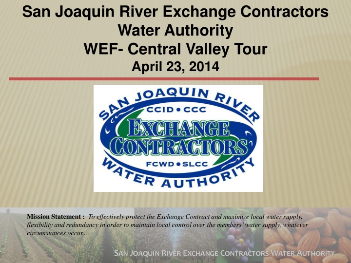
San Joaquin River Exchange Contractors Water Authority WEF- Central Valley Tour April 23, 2014 Mission Statement :To effectively protect the Exchange Contract and maximize local water supply, flexibility and redundancy in order to maintain local control over the members water supply, whatever circumstances occur.. 1
San Joaquin River Exchange Contractors Water Authority 2
The Exchange Contract - What is it Anyway? The corner stone for the Development of the CVP ( Friant Dam, Shasta Dam, DMC) Two documents were signed in 1939: 1. Exchange Contract Monthly Delivery Limits, Flow Limits, Water Quality Criteria, Water Supply( Shasta) Criteria [ We operate under the 1967 Second Amended Contract] 2. Purchase Contract Conveyed high flow rights, reserved low flow rights, We have our senior water rights on the San Joaquin River 3
Background of the Exchange Contractors Pre-1914 and Riparian Rights on the San Joaquin and Kings Rivers dating back to the 1870 s Irrigate approximately 240,000 ac in Fresno, Madera Merced and Stanislaus Counties. Normal Year allocation 840,000 acre feet Critical Year allocation 650,000 acre feet Allocation is based on Forecasted inflow into Shasta Lake 4
Background of the Exchange Contractors The SJRECWA is a Joint Powers Authority that was formed in 1992, its members include: Central California Irrigation District (145,000 ac) Columbia Canal Company (16,000 ac) Firebaugh Canal Water District( 22,000 ac) San Luis Canal Company (47,000 ac) Main Duties: Protect water rights Administer AB 3030 Plans & Water Conservation Plans Administer water transfers Main point of contact for the administration of the Exchange Contract Other duties as assigned 5
How The Exchange Contract Works The SJR Exchange Contract Madera Canal 250,000 AF Delta Mendota Pool
1960s 7
2014 Operations The March 1st 2014 Water Supply update has forecasted inflows into Shasta Lake between 2.4 MAF(90%) to 2.8 MAF( 50%) for the year, the Exchange Contract trigger for a 100 % allocation in 2014 is 3.26 MAF. Therefore, we are Critical which means our allocation is 75% or 650,000 af. We have been declared a Critical Year only four times before this year (1977, 1991, 1992, 1994) Neighboring Federal South of Delta Ag Service Water Districts are 0% allocation. Friant Districts are receiving a 0% allocation.
Increased Regional Water Availability As a result of member agency conservation programs, water service to the growers has improved and the SJRECWA has the ability to redirect water to other local water agencies. These savings come from large investments in both large district-wide projects and smaller on-farm conservation projects. Due to high investment costs, we needed an innovative approach to fund these efforts.
Floodwater Volumes San Joaquin River flows from CalSimII, Kings River flows from James Bypass flows from USGS 1974-2009 and SJRECWA 2010-2012 10
Exchange Contractors & SLDMWA Projects to Evaluate SJR to DMC Connections West Stanislaus Flood Control Projects Level 2 & Level 4 Refuge Water Supply Program San Luis Reservoir Low-Point Improvement Project Los Banos Creek Conjuctive Use Project Westside Regional Drainage Plan Westside Surface Storage Reservoir Project 11
Exchange Contractors Water Resources Plan Exchange Contractor Board commissioned the initial analysis in 2011 and identified several potential projects with the goal to: Provide both seasonable and multi-year flexibility. Enhance local resources due to delta export reductions or failure. Provide reliability if we were to receive a major portion our water from Friant Dam. 12
Water Resources Plans Joint Exchange Contractors Projects Los Banos Creek WRP City of LB, SLWD, GWD, Exchange Contractors Various Water Banking Projects SLWD, DPWD, Exchange Contractors Internal Surface Storage Joint SL&DMWA Projects 13
Los Banos Creek Detention Dam Background Owned by US Bureau of Reclamation. Operated by State of California Department of Water Resources. Operational in 1962. Normal Gross Area: 470 Acres Max Storage Capacity: 34,600 AF Historic Operational Capacity: 20,600 AF Owned by US Bureau of Reclamation. Operated by State of California Department of Water Resources. Operational in 1962. Normal Gross Area: 470 Acres Max Storage Capacity: 34,600 AF Historic Operational Capacity: 20,600 AF
Proposed Project Average Annual Yield = 6,848 Acre Feet Range 0 to 30,000 Acre Feet Max Storage=20,600 AF 250 CFS 6,848 AF/yr Hwy 152 Bold Numbers are Avg. Annual Volumes (1995-2011) Aqueduct 200-1,000 CFS Sept. 15 Mar. 15 DMC Release for recharge 342 AF/yr DMC Project Costs $2.4 million Quantification of Los Banos Creek Channel recharge from LBCDR to Highway 152. LBC Control Weir and Gravity Inlets to capture LBCDR releases into the DMC.
San Joaquin River Exchange Contractors Water Authority Initial Recharge and Recovery Projects Summary of Estimated Groundwater Storage Capacity Kenneth D. Schmidt & Associates January 2011 Recharge Capacity (AF/yr) Intentional Recharge 20,000 3,000 Underground Storage Capacity (AF) Area In-Lieu Orestimba Creek Garzas Creek 2,000 25,000 <10,000 0 Santa Nella 5,000 0 2,500-7,5001 Los Banos Creek B&B Ranch East of Firebaugh 10,000 5,000 3,000 10,000 15,000-35,0002 0 0 10,000 <7,000 New Columbia Ranch Red Top 16,000 3,000 11,000 80,000-130,000 20,000-30-000 0 Total 1 Greater space would be available if the shallow groundwater levels were first lowered. 2 The available storage space varies considerably, based on depth to water (i.e., wet years versus droughts). 65,000 23,000 153,000-250,000 17
Conceptual Pilot Water Recharge and Recovery/Surface Storage Projects 18
Surface Storage Projects Annual Operations Costs (P&P Revision of AECOM Original Costs) Surface Storage Projects Estimated Annual O,M & P Costs Short Detention Storage (AF) Estimated Water Cost Range ($/AF Short-Long Duration)* Estimated Capital Annual Costs Long Detention Storage Amount (AF) Project Alternative Estimated Capital Costs Camp 13 (1,800 acre) $43,867,000 $2,854,000 $219,000 11,400 AF 9,300 AF $269/AF - $332/AF Camp 13 (1,000 acre) $27,423,000 $1,784,000 $137,000 6,600 AF 5,400 AF $290/AF - $359/AF Camp 13 (500 acre) $15,589,000 $1,014,000 $78,000 3,300 AF 2,700 AF $327/AF - $405/AF Ingomar (Phase 1) $7,701,000 $501,000 $111,000 1,100 AF 1,100 AF $551/AF $10,561,00 Ingomar (Phase 2) $687,000 $187,000 2,600 AF 2,600 AF $320/AF 0 Ingomar Combined * Reservoirs assumed to be operated every year $18,262,000 $1,188,000 $298,000 3,700 AF 3,700 AF $388/AF 19
Conceptual Pilot Water Recharge and Recovery/Surface Storage Projects 20
Summary of Recharge and Recovery Project Capacities 1 Kenneth D. Schmidt & Associates, 2011 Total Underground Storage Capacity (AF)1 Avg. Annual Recharge (AF/yr) Total Creek Recharge Potential (AF/yr)1 Project Max. Dry Year Recovery (AF/yr) Los Banos Creek - - - - Northern Site 1,500 - 6,900 - Southern Site 1,500 - 6,900 - Subtotal 3,000 10,000 13,800 15-35,000 Orestimba Creek - - - - Small Pits 300 - 1,700 - Large Pits 500 - 1,700 - Riddle (40 ac) 1,000 - 3,300 - Subtotal 1,800 20,000 6,700 25,000 Total (all projects) 4,800 30,000 20,500 40-60,000 21
Recharge and Recovery Projects Annual Operations Recharge/Recovery Projects Estimated Capital Annual Costs Estimated Annual O&M Costs Average Annual Yield (AF) Estimated Capital Costs Max. Dry Year Yield (AF)1 Estimated Water Cost ($/AF)2 Project Alternative Los Banos Creek Northern Site $96/AF $2,785,000 $93,000 $54,000 6,900 AF 1,500 AF Los Banos Creek Southern Site $84/AF $2,241,000 $75,000 $54,000 6,900 AF 1,500 AF Orestimba Riddle (20 ac) $131/AF $1,287,000 $43,000 $16,000 1,700 AF 500 AF Orestimba Riddle (40 ac) $150/AF $3,411,000 $114,000 $35,000 3,300 AF 1,000 AF Orestimba (small pits) $306/AF $2,189,000 $73,000 $10,000 1,700 AF 300 AF Orestimba (17 ac pit) $135/AF $1,343,000 $45,000 $16,000 1,700 AF 500 AF Weighted Average $118/AF TOTAL $13,256,000 $443,000 $185,000 22,200 AF 5,300 AF 1 - Maximum dry year yield based on recovery well capacity, and assumes sufficient water in storage. 2 - Water assumed to be delivered about once every three years. Does not include water purchase or wheeling costs. 22
Exchange Contractors Groundwater Management Groundwater Management The member agencies conjunctively manage their surface water and groundwater supplies The Authority has an approved AB 3030 Groundwater Management Plan since 1997 The Authority strongly believes that local control is the best way to manage our groundwater resources. Subsidence Issue 23
26 Merced and Madera County
Approximate location of maximum subsidence in the United States identified by research efforts of Dr. Joseph F. Poland (pictured). Signs on pole show approximate altitude of land surface in 1925, 1955, and 1977. (28 feet in 50 years, .56 feet/year) The site is in the San Joaquin Valley southwest of Mendota, California, 15 miles southwest of Sack Dam.
Western Madera County Subsidence Area Base-map with Recharge Ponds and Conveyance Facilities In Association with KDS and Associates 28
Western Madera and Merced County Subsidence Study Long Term Solutions Import water at Sack Dam. Continue grower-driven process to revive existing districts. Develop Groundwater Bank for use on overlying land. Replace deep wells with shallow aquifer wells. Construct internal conveyance infrastructure improvements. Keep Merced and Madera Counties, and others informed. 29
CONTACT INFORMATION: San Joaquin River Exchange Contractors Water Authority 541 H Street/P.O. Box 2115 Los Banos, CA 93635 (209) 827-8616 Steve Chedester, Executive Director Email: schedester@sjrecwa.net Website: www.sjrecwa.net 30