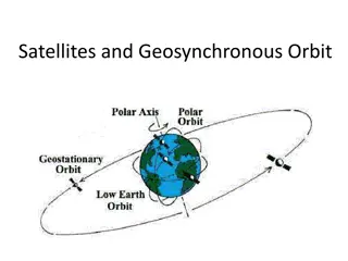
Satellite Data for Flood Prevention in Sao Paulo City
Sao Paulo City, the largest megalopolis in South America, faces increasing flood risks due to urban growth and impermeable surfaces. The use of satellite data has become crucial in managing these risks by providing insights into rainfall patterns and flood-prone areas. With a growing population and urban expansion, smart city initiatives in Sao Paulo are leveraging satellite technology to enhance flood prevention strategies and mitigate the impact of extreme weather events. This case study explores the role of satellite data in enhancing flood resilience in one of the world's largest cities.

Download Presentation

Please find below an Image/Link to download the presentation.
The content on the website is provided AS IS for your information and personal use only. It may not be sold, licensed, or shared on other websites without obtaining consent from the author.If you encounter any issues during the download, it is possible that the publisher has removed the file from their server.
You are allowed to download the files provided on this website for personal or commercial use, subject to the condition that they are used lawfully. All files are the property of their respective owners.
The content on the website is provided AS IS for your information and personal use only. It may not be sold, licensed, or shared on other websites without obtaining consent from the author.
E N D
Presentation Transcript
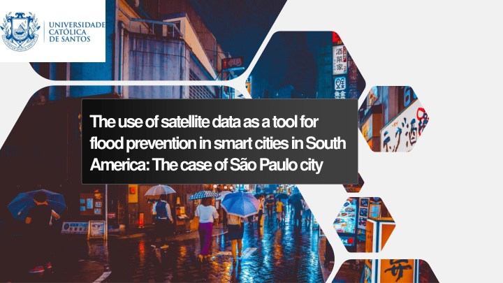
The use of satellite data as a tool for flood prevention in smart cities in South America: The case of S o Paulo city
ABOUT THE AUTHOR Francisco Campos da Costa Phd. Candidate at Catholic University of Santos, S o Paulo, Brasil, with CAPES/PROSUC; Me. International Law at Catholic University of Santos. Researcher and Invited professor at Catholic University of Santos. Laywer and Consultant in Brazil. full scholarship of 2
SO PAULO CITY Largest Megalopolis in South America The 2nd biggest in Americas The 6th biggest in the World Approximate population of 21.57 million inhabitants Within 30 years (1985-2018) the urban area grew over 85km , from 793,2 km to 878,6 km , with represents 57% of the cities territory. The increase of impermeable areas may increase the chances of flood by 6 or 7 times according to TUCCI (2005, p. 89) Sources: http://www.citymayors.com/statistics/urban_2020_1.html; https://www1.folha.uol.com.br/cotidiano/2020/02/solo-impermeavel-cresce-11-em-33- anos-em-sp.shtml; Tucci, Carlos E. M. Gest o de guas Pluviais Urbanas/ Carlos E. M.Tucci Minist rio das Cidades Global Water Partnership - Wolrd Bank Unesco 2005. 3 Source: https://www.al.sp.gov.br/noticia/?id=396223
SO PAULO CITY The impermeable surfaces absorb part of the solar energy, increasing the ambient temperature, producing heat islands in the central part of the urban centers, where concrete and asphalt predominate (TUCCI, 20045, p. 91). The micro climate combined with the emissions of CO and other greenhouse gases and with global climate change have changed the cities environment and increased the frequency of extreme weather events like rainfalls with over 80mm and 100mm. Between 1981 to 1990 S o Paulo City experienced at least 7 episodes of rainfalls with over 80mm and 5 over 100mm. Between 2011 to 2020 S o Paulo city experienced 21 episodes of rainfalls with over 80mm and 11 over 100 mm. Source: https://jornal.usp.br/ciencias/ciencias-ambientais/dados-comprovam- aumento-de-eventos-climaticos-extremos-em-sao- paulo/#:~:text=Dados%20de%20duas%20esta es%20meteorol gicas,aumento%20 da%20intensidade%20das%20chuvas. 4 Source: https://www.al.sp.gov.br/noticia/?id=396223
SO PAULO CITY The actual losses of floods in S o Paulo aren t precise and in a period of 10 days during February of 2020, it rained over 179,9 mm. Annual losses in S o Paulo due to floods are estimated in R$ 762 millions. Sources: https://g1.globo.com/sp/sao- paulo/noticia/2020/02/10/por-que-a-cidade-de-sao- paulo-nao-consegue-evitar-as-enchentes- frequentes.ghtml; http://g1.globo.com/sao- paulo/noticia/2013/03/enchentes-em-sp-causam- prejuizo-anual-de-r-762-milhoes-diz-pesquisa.html 5 Source: https://www.al.sp.gov.br/noticia/?id=396223
SO PAULO AS A SMART CITY S o Paulo City is investing in flood prevention and flood management. The use of satellite data gives the proper information about the cloud s saturation levels and the wheatear forecast. Ground radars and weather stations, used by S o Paulo Flood Alert System (SAISP) gives real time information and rain reports. SAISP gives information to the Emergency Management Center (CGE), to Civil Defense, to city hall employees Engineering Company (CET) The Emergency Management Center (CGE) and Municipal Civil Defense Coordination (Comdec) works to avoid damages caused by severe rains. and to the Traffic Source: https://sdgs.un.org/goals/goal11 6
SO PAULO AS A SMART CITY With the information and coordinated work the Civil Defense, the Traffic Engeneering Company (CET) and the others: 1) Warn the locals by SMS (message to the mobiles). 2) Manage the traffic and avoid traffic jam in or near flooded areas. 3) To proceed with the necessary actions to rescue and inform citizens of any evacuation. Sources: https://www.saisp.br/estaticos/sitenovo/home.x mlt https://www.cgesp.org/v3/monitoramento.jsp http://www.inpe.br Source: https://sdgs.un.org/goals/goal11 7
SO PAULO AS A SMART CITY The CGE operates with integrated information given by many sources, such as SAISP and INPE (National Institute for Space Research) INPE uses satellite data to predict flooding The Civil Defense use all of these data to inform the citizens of incomming flood, to determine areas of action and the necessary protocol to avoid casualties and losses. The actions taken by the Civil Defense are law enforcement of the National Civil Defense and Protection Policy (PNPDEC) The civil defense also acts to educate the population and understand what measures must be taken during a severe rain and eventually a flood. Sources: https://www.saisp.br/estaticos/sitenovo/home.xmlt https://www.cgesp.org/v3/monitoramento.jsp http://www.inpe.br Source: https://sdgs.un.org/goals/goal11 8
SO PAULO AS A SMART CITY It also used the so called smart culvert to avoid obstruction of water flow through the galleries. The city planning uses green spaces such to prevent flooding's as well. Sources: https://revistapegn.globo.com/Startups/noticia/2 020/02/startup-testa-500-bueiros-inteligentes- em-sao-paulo-para-minimizar-alagamentos.html Source: https://sdgs.un.org/goals/goal11 9
BUILDING SUSTAINABLE A SMARTER CITIES Rethinking the city and the solutions: Immediate technological approach The use of draining pavement or porous asphalt to avoid water accumulation and redirect the water to the rivers of to an reservoir and use it in distribution, similar to the Gcams project in Japan. This approach also implies in the reduction of climate change effects and may reduce the extreme events of rain (SDG 13). Increase green areas and the capacity of natural draining. Change the materials used in civil engineering to provide a better draining capacity. Source: encurtador.com.br/bglR5 10
BUILDING SUSTAINABLE A SMARTER CITIES Midterm approach: Public Policy to reduce taxes and create incentives for the space industry in Brazil, in order to explore new approaches and uses of satellite data. Create a joint approach between the government, universities, tech companies and incoming space companies to develop integrated actions and long term solutions to the flooding problem. Build a larger network of meteorological radars to have better understanding and awareness of the rain impacts and the urbanization and increase of impermeability of new areas. Source: encurtador.com.br/bglR5 11
BUILDING SUSTAINABLE A SMARTER CITIES Midterm approach: Use of paradiplomacy as a tool to enhance the exchange of information, technology, projects and perspectives to address better and safer solutions. Creation of space education program by local Universities UNOOSA to build awareness to local leaders and government representatives. in association with Source: encurtador.com.br/bglR5 12
BUILDING SUSTAINABLE A SMARTER CITIES Long-term approach: The environmental education through joint actions by the media, the government, the NGO s, the UNOOSA, in order to build awareness of the local population about the problem and to stimulate the criticism, the claims for effective actions. The use of social networks to approach the youngers and stimulate it s participation in city decision processes. This approach may environment to apply an effective governance in the city. knowledge and create a sustainable Source: GARCEZ, Gabriela Soldano. A cria o de governan a efetiva com participa o dos meios de comunica o de massa para acesso informa o ambiental e prote o do direito ao meio ambiente ecologicamente equilibrado, de acordo com os Objetivos do Desenvolvimento Sustent vel n . 16 e 17, da Agenda 2030. 2020. 40 f. Tese (Post Doctorate). Universidade de Santiago de Compostela, Espanha, 2020. Source: encurtador.com.br/bglR5 13
Thanks! FRANCISCO CAMPOS DA COSTA franciscoccadv@gmail.com