South West Pacific Hydrographic Commission Report on Marshall Islands Progress and Challenges
Explore the national report by the South West Pacific Hydrographic Commission on the progress and challenges faced by the Marshall Islands regarding hydrographic surveys, data collection, governance, and contributions to international initiatives like IHO DCDB and GEBCO. Discover the main achievements, challenges, and ongoing discussions related to surveys, charting, and Marine Spatial Data Infrastructure (MSDI) in the region.

Download Presentation

Please find below an Image/Link to download the presentation.
The content on the website is provided AS IS for your information and personal use only. It may not be sold, licensed, or shared on other websites without obtaining consent from the author. If you encounter any issues during the download, it is possible that the publisher has removed the file from their server.
You are allowed to download the files provided on this website for personal or commercial use, subject to the condition that they are used lawfully. All files are the property of their respective owners.
The content on the website is provided AS IS for your information and personal use only. It may not be sold, licensed, or shared on other websites without obtaining consent from the author.
E N D
Presentation Transcript
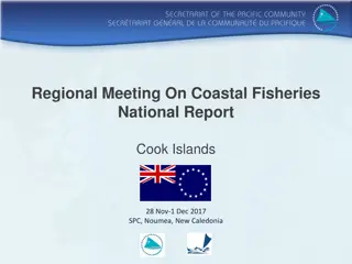
17thMeeting of the South West Pacific Hydrographic Commission National Report by Marshall Islands South West Pacific Hydrographic Commission
Main achievements during the year Technical Visit (TV) to the Marshall Islands in September 2019 by the US-NGA and IHO US-NGA and IHO completed the TV Met various Marshall Islands Government Agencies Discussed the need for Hydrographic Survey and Governance is needed Discussed the need for updated Charting and Bathymetric Discussed the need for Satellite Imagery in Disaster Response and Preparedness 2 South West Pacific Hydrographic Commission
Main challenges and/or obstructions The Marshall Islands Government has not appointed an agency responsible for Hydrography, although the Ports Authority is handling in the interim. There is no central data collection and maintenance by the Government of the Marshall Islands. Such data are scattered in various agencies of the Government There is no Government Regulation governing Hydrography, Charting, and other Information 3 South West Pacific Hydrographic Commission
Progress on surveys, charting and MSI Surveys: NOAA Ship Rainier is scheduled to be dispatched to the Territory of Guam, and the CNMI this year 2020 (source: Crescent Moegling Navigation Manager). We are requesting that NOAA consider re-routing the Rainier to the Marshall to conduct hydrographic survey in the Marshall Islands after the completion of Guam and CNMI Hydrographic Surveys Charting: The US NGA has provided current Charts of the Marshall Islands during their visit along with IHO in August 2019. The Ports Authority has started working with relevant Government agencies to commence updating the Charts, as necessary MSI: MSI Training of Staff conducted in Jakarta Indonesia around September 2019. Thanks to Indonesia and IHO 4 South West Pacific Hydrographic Commission
Contributions to the IHO DCDB and GEBCO The Marshall Islands participated in SeaBed 2030 workshop in Wellington, New Zealand around September 2019 The Marshall Islands contribution to the IHO DCDB will be evaluated pending further discussion with the US-NGA concerning specific and new data that needs to be released 5 South West Pacific Hydrographic Commission
Progress on MSDI Still in discussion phase, as to the type of data that must be collected and shared 6 South West Pacific Hydrographic Commission
Plans that affect the region SeaBed 2030 is still in discussion phase, especially with more sensitive data US-NGA and IHO September 2019 Visit to the Marshall Islands puts the Marshall Islands on advise to commence working on Rules and Regulations for the establishment or updates to GeoSpatial and MSI September 2020 the IMO will conduct Coastal State Audit in the Marshall Islands. Thanks to the 2019 NGA and IHO TA Visit the Marshall Islands is now in a better position to responding to the IMO Audit 7 South West Pacific Hydrographic Commission
Lessons learned to share The Marshall Islands has not participated in Hydrography with relevant organizations, with the exception of the South Pacific Community (SPC) The SPC has coordinated efforts in MSI, SOLAS- Regulations, and Aid to Navigation (AToNs) Since the 16th SWPHC held in Niue 2019, the Marshall Islands has engaged with NAVAREA 11 Coordinator relative to MSIs, etc.. 8 South West Pacific Hydrographic Commission
Success stories to share We are requesting that NOAA consider re-routing the Rainier to the Marshall Islands to conduct hydrographic survey in the Marshall Islands after the completion of Guam and CNMI Hydrographic Surveys Charts will be updated once hydrographic survey of the Marshall Islands are conducted 9 South West Pacific Hydrographic Commission