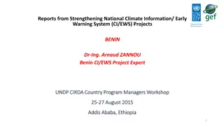
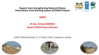
Strengthening National Climate Information & Early Warning System Project in Uganda
This report highlights the progress made, key partners involved, organizational structure, future plans, and challenges faced in strengthening Uganda's climate information and early warning system. The project aims to enhance weather monitoring capabilities and improve response to extreme weather events for effective climate change adaptation.

Download Presentation

Please find below an Image/Link to download the presentation.
The content on the website is provided AS IS for your information and personal use only. It may not be sold, licensed, or shared on other websites without obtaining consent from the author.If you encounter any issues during the download, it is possible that the publisher has removed the file from their server.
You are allowed to download the files provided on this website for personal or commercial use, subject to the condition that they are used lawfully. All files are the property of their respective owners.
The content on the website is provided AS IS for your information and personal use only. It may not be sold, licensed, or shared on other websites without obtaining consent from the author.
E N D
Presentation Transcript
analyze the effects of physical and human geographic patterns and processes on the past and describe their impact on the present, including significant physical features and environmental conditions that influenced migration patterns and shaped the distribution of culture groups today.[WGS.1A] October 2014 WORLD GEOGRAPHY
trace the spatial diffusion of phenomena such as the Columbian Exchange or the diffusion of American popular culture and describe the effects on regions of contact.[WGS.1B] October 2014 WORLD GEOGRAPHY
describe the human and physical characteristics of the same regions at different periods of time to evaluate relationships between past events and current conditions.[WGS.2A] October 2014 WORLD GEOGRAPHY
explain how changes in societies have led to diverse uses of physical features.[WGS.2B] October 2014 WORLD GEOGRAPHY
explain weather conditions and climate in relation to annual changes in Earth-Sun relationships.[WGS.3A] October 2014 WORLD GEOGRAPHY
describe the physical processes that affect the environments of regions, including weather, tectonic forces, erosion, and soil- building processes.[WGS.3B] October 2014 WORLD GEOGRAPHY
examine the physical processes that affect the lithosphere, atmosphere, hydrosphere, and biosphere.[WGS.3C] October 2014 WORLD GEOGRAPHY
explain how elevation, latitude, wind systems, ocean currents, position on a continent, and mountain barriers influence temperature, precipitation, and distribution of climate regions.[WGS.4A] October 2014 WORLD GEOGRAPHY
describe different landforms and the physical processes that cause their development.[WGS.4B] October 2014 WORLD GEOGRAPHY
explain the influence of climate on the distribution of biomes in different regions.[WGS.4C] October 2014 WORLD GEOGRAPHY
analyze how the character of a place is related to its political, economic, social, and cultural elements.[WGS.5A] October 2014 WORLD GEOGRAPHY
interpret political, economic, social, and demographic indicators (gross domestic product per capita, life expectancy, literacy, and infant mortality) to determine the level of development and standard of living in nations using the terms Human Development Index, less developed, newly industrialized, and more developed.[WGS.5B] October 2014 WORLD GEOGRAPHY
locate and describe human and physical features that influence the size and distribution of settlements.[WGS.6A] October 2014 WORLD GEOGRAPHY
explain the processes that have caused changes in settlement patterns, including urbanization, transportation, access to and availability of resources, and economic activities.[WGS.6B] October 2014 WORLD GEOGRAPHY
construct and analyze population pyramids and use other data, graphics, and maps to describe the population characteristics of different societies and to predict future population trends.[WGS.7A] October 2014 WORLD GEOGRAPHY
explain how political, economic, social, and environmental push and pull factors and physical geography affect the routes and flows of human migration.[WGS.7B] October 2014 WORLD GEOGRAPHY
describe trends in world population growth and distribution.[WGS.7C] October 2014 WORLD GEOGRAPHY
examine benefits and challenges of globalization, including connectivity, standard of living, pandemics, and loss of local culture.[WGS.7D] October 2014 WORLD GEOGRAPHY
compare ways that humans depend on, adapt to, and modify the physical environment, including the influences of culture and technology.[WGS.8A] October 2014 WORLD GEOGRAPHY
describe the interaction between humans and the physical environment and analyze the consequences of extreme weather and other natural disasters such as El Ni o, floods, tsunamis, and volcanoes.[WGS.8B] October 2014 WORLD GEOGRAPHY
evaluate the economic and political relationships between settlements and the environment, including sustainable development and renewable / non-renewable resources.[WGS.8C] October 2014 WORLD GEOGRAPHY
identify physical and / or human factors such as climate, vegetation, language, trade networks, political units, river systems, and religion that constitute a region.[WGS.9A] October 2014 WORLD GEOGRAPHY
describe different types of regions, including formal, functional, and perceptual regions.[WGS.9B] October 2014 WORLD GEOGRAPHY
describe the forces that determine the distribution of goods and services in free enterprise, socialist, and communist economic systems.[WGS.10A] October 2014 WORLD GEOGRAPHY
classify where specific countries fall along the economic spectrum between free enterprise and communism.[WGS.10B] October 2014 WORLD GEOGRAPHY
compare the ways people satisfy their basic needs through the production of goods and services such as subsistence agriculture versus commercial agriculture or cottage industries versus commercial industries.[WGS.10C] October 2014 WORLD GEOGRAPHY
compare global trade patterns over time and examine the implications of globalization, including outsourcing and free trade zones.[WGS.10D] October 2014 WORLD GEOGRAPHY
understand the connections between levels of development and economic activities (primary, secondary, tertiary, and quaternary).[WGS.11A] October 2014 WORLD GEOGRAPHY
identify the factors affecting the location of different types of economic activities, including subsistence and commercial agriculture, manufacturing, and service industries.[WGS.11B] October 2014 WORLD GEOGRAPHY
assess how changes in climate, resources, and infrastructure (technology, transportation, and communication) affect the location and patterns of economic activities.[WGS.11C] October 2014 WORLD GEOGRAPHY
analyze how the creation, distribution, and management of key natural resources affects the location and patterns of movement of products, money, and people.[WGS.12A] October 2014 WORLD GEOGRAPHY
evaluate the geographic and economic impact of policies related to the development, use, and scarcity of natural resources such as regulations of water.[WGS.12B] October 2014 WORLD GEOGRAPHY
interpret maps to explain the division of land, including man- made and natural borders, into separate political units such as cities, states, or countries.[WGS.13A] October 2014 WORLD GEOGRAPHY
compare maps of voting patterns or political boundaries to make inferences about the distribution of political power.[WGS.13B] October 2014 WORLD GEOGRAPHY
analyze current events to infer the physical and human processes that lead to the formation of boundaries and other political divisions.[WGS.14A] October 2014 WORLD GEOGRAPHY
compare how democracy, dictatorship, monarchy, republic, theocracy, and totalitarian systems operate in specific countries.[WGS.14B] October 2014 WORLD GEOGRAPHY
analyze the human and physical factors that influence the power to control territory and resources, create conflict / war, and impact international political relations of sovereign nations such as China, the United States, Japan, and Russia and organized nation groups such as the United Nations (UN) and the European Union (EU).[WGS.14C] October 2014 WORLD GEOGRAPHY
identify and give examples of different points of view that influence the development of public policies and decision-making processes on local, state, national, and international levels.[WGS.15A] October 2014 WORLD GEOGRAPHY
explain how citizenship practices, public policies, and decision making may be influenced by cultural beliefs, including nationalism and patriotism.[WGS.15B] October 2014 WORLD GEOGRAPHY
describe distinctive cultural patterns and landscapes associated with different places in Texas, the United States, and other regions of the world and how these patterns influenced the processes of innovation and diffusion.[WGS.16A] October 2014 WORLD GEOGRAPHY
describe elements of culture, including language, religion, beliefs and customs, institutions, and technologies.[WGS.16B] October 2014 WORLD GEOGRAPHY
explain ways various groups of people perceive the characteristics of their own and other cultures, places, and regions differently.[WGS.16C] October 2014 WORLD GEOGRAPHY
compare life in a variety of urban and rural areas in the world to evaluate political, economic, social, and environmental changes.[WGS.16D] October 2014 WORLD GEOGRAPHY
describe and compare patterns of culture such as language, religion, land use, education, and customs that make specific regions of the world distinctive.[WGS.17A] October 2014 WORLD GEOGRAPHY
describe major world religions, including animism, Buddhism, Christianity, Hinduism, Islam, Judaism, and Sikhism, and their spatial distribution.[WGS.17B] October 2014 WORLD GEOGRAPHY
compare economic, political, or social opportunities in different cultures for women, ethnic and religious minorities, and other underrepresented populations.[WGS.17C] October 2014 WORLD GEOGRAPHY
evaluate the experiences and contributions of diverse groups to multicultural societies.[WGS.17D] October 2014 WORLD GEOGRAPHY
analyze cultural changes in specific regions caused by migration, war, trade, innovations, and diffusion.[WGS.18A] October 2014 WORLD GEOGRAPHY
assess causes, effects, and perceptions of conflicts between groups of people, including modern genocides and terrorism.[WGS.18B] October 2014 WORLD GEOGRAPHY
identify examples of cultures that maintain traditional ways, including traditional economies.[WGS.18C] October 2014 WORLD GEOGRAPHY