The Art of Surveying - Measuring Earth's Surface
Surveying involves measuring distances, angles, and positions on Earth's surface, utilizing mathematical techniques to ensure accuracy and efficiency in obtaining optimal results for a variety of surveying problems. Surveyors study both plane and geodetic surveying methods to determine relative positions and address the curvature of the Earth, leading to various types of surveys like topographic, hydrographic, and route surveys.

Download Presentation

Please find below an Image/Link to download the presentation.
The content on the website is provided AS IS for your information and personal use only. It may not be sold, licensed, or shared on other websites without obtaining consent from the author.If you encounter any issues during the download, it is possible that the publisher has removed the file from their server.
You are allowed to download the files provided on this website for personal or commercial use, subject to the condition that they are used lawfully. All files are the property of their respective owners.
The content on the website is provided AS IS for your information and personal use only. It may not be sold, licensed, or shared on other websites without obtaining consent from the author.
E N D
Presentation Transcript
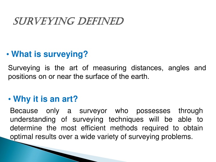
What is surveying? Surveying is the art of measuring distances, angles and positions on or near the surface of the earth. Why it is an art? Because only a surveyor who possesses through understanding of surveying techniques will be able to determine the most efficient methods required to obtain optimal results over a wide variety of surveying problems.
Why it is scientific? Because the use of mathematical techniques to analyze field data, accuracy and reliability depends on understanding scientific principles underlying measurement. and affecting survey Why should I study surveying? Why should I study surveying? You may be required to perform simple surveying operations (particularly if you're employed in construction company and Local Gov.), or you will need to discuss your needs with surveyors. Every Engineer needs surveying skills
Plane base for fieldwork and computations are assumed to be a flat horizontal surface. Generally within a 12 mile radius the pull of gravity is very nearly parallel to that at any other point within the radius and thus horizontal lines can be considered straight. Geodetic determine relative positions of widely spaced points, lengths, and directions which require the consideration of the size and shape of the earth. (Takes the earth s curvature into account.) Plane Surveying Surveying surveying with the reference Geodetic Surveying Surveying surveying technique to
Geoid surface Geoid surface 4 3/6/2025
- - to Decimal Degrees 1 degree = 60 minutes 1 minute = 60 seconds 32 15 24 24 = 24/60 = 0.4 15 24 = 15.4 = 15.4/60 = 0.2567 32 15 24 = 32.2567 Most calculators do trig calculations using decimal degrees - CONVERT!
Geometry of a Circle 23 18 Total angle = 360 4 quadrants - NE, SE, SW, NW - each total 90 NW NE SW SE Angles typically measured East from North or East from South Clockwise (CW) and Counterclockwise (CCW) angles add to 360 360 - 23 18 = 336 42
Geodde plan eleps 7 3/6/2025
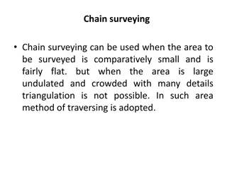
1- Topographic survey: preliminary surveys used to tie earth surface features. 2- Hydrographic survey: preliminary surveys tie underwater feature to surface control line 3- Route surveys: preliminary, layout and control surveys that range over a narrow but long strip of land (highways, railroads, electricity transmission lines and channels).
4- Property surveys: preliminary, layout and control surveys determine boundary locations for a new map. 5- Aerial survey:preliminary and final surveys convert aerial photograph into scale map using photogram metric tech. 6- Construction survey: layout of engineering work. 7- Final (as built) survey: preliminary surveys tie in features that just have been constructed
PHASES OF SURVEYING 1- Field Work Data procurement phase Field Work 2 2- - Office Office Work: Work: data are Analyzed Reduced to useful form by mathematical calculations Adjusted Frequently converted to graphical mode of Expression 10 3/6/2025
Parts of Surveyor Decision making (selecting techniques, equipments, etc.) Fieldwork (data acquisition) Data processing (calculations to give locations, areas, volumes, etc.) Mapping (maps, plans, charts) Reporting (conclusion of the task) Parts of Surveyor s work: s work: 11 3/6/2025
1- Transit and theodolite: Establish straight or curved lines, horizontal and vertical angles. 2- The level and rod: measure difference in elevations. 3- Steel tape: measure horizontal and slope distances. 4- Total station. 5- GPS (global positioning system) receivers.
Steel tape Level ( stadia principle ) Total station Thedilite GPS
- No measurement (except count) can be free of error. -True value is determined statistically (mean) to calculate error. Systematic error: error whose magnitude and algebraic sign can be determined and eliminated (temp. error). Random Error: - Error due to surveyor skill. - Tend to cancel each other. - Little significance except for high precision survey. - Unskilled or careless surveyor can make problem. - Large random error doesn t result in accurate work even if they cancel.
There are many mistakes that cold be happened to surveyors. - Blunders made by survey personnel e.g. 68 instead of 86. - Miscounting tape length, measuring from wrong point. - Mistakes will occur and must be discovered and eliminated by verifying the measurement (Repeat Geometry analysis, etc.). - Every measurement should be repeated to eliminate mistakes and improved precision.
ACCURACY & PRECISION ACCURACY & PRECISION Accuracy :closeness between measurement and "true value. Precision :closeness to one another of a set of repeated observations 16 3/6/2025
Direct measurement Applying a tape to a line Applying a protractor to a line Turning an angle with a transit Indirect Secured measurement is not possible. Always will be in relation to some other measured quantity. Thus some knowledge of math functions are necessary when direct
Four kinds of measurements form the basis for all plane surveying Distance Horizontal Slop distance Vertical Horizontal distance Slop distance Vertical distance distance distance
Angles Horizontal angles Vertical angles 19 3/6/2025
Horizontal angles Vertical angels Horizontal angles Vertical angels 20 3/6/2025
Distance Basic units are for length and The Foot King Edward I proclaimed that one inch was equal to three corns of barley laid end to end. The meter Is defined as one wavelength of the element Krypton by an international committee that worked 19 years to come to consensus on October 1960.
UNITS OF UNITS OF LENGTH LENGTH mperial units (feet): Usually subdivided into decimal units in Surveying, use of inches. Defined 1 Yard = 0.9144 meter (exact) 1 ft = 0.3048 m (exact) 1 inch = 25.4 mm (exact) Did not change relationship established by Congress kept for surveying and called U.S. Survey foot 22 3/6/2025
SI units (meters): Le System International d Unites (International System of Units Normally subdivided into decimeter, centimeter, millimeter NORMAL PREFIXES FOR METER ? exa (E) 10^18 ? peta (p) 10^15 ? tera (t) 10^12 ? giga (g) 10^9 ? mega (m) 10^6 ? kilo (k) 10^3 ? hecto (h) 10^2 ? deka (da) 10^1 ? Ex: kilometer = 1,000m ? deci (d) 10^-1 ? centi (c) 10^-2 ? milli (m) 10^-3 ? micro ( )10^-6 ? nana (n) 10^-9 ? pico (p) 10^-12 ? femto (f) 10^-15 ? atto (a) 10^-18 ? Ex: millimeter = 0.001m 23 3/6/2025
- - to Decimal Degrees 1 degree = 60 minutes 1 minute = 60 seconds 32 15 24 24 = 24/60 = 0.4 15 24 = 15.4 = 15.4/60 = 0.2567 32 15 24 = 32.2567 Most calculators do trig calculations using decimal degrees - CONVERT!
Geometry of a Circle 23 18 Total angle = 360 4 quadrants - NE, SE, SW, NW - each total 90 NW NE SW SE Angles typically measured East from North or East from South Clockwise (CW) and Counterclockwise (CCW) angles add to 360 360 - 23 18 = 336 42


 can be free of error.")


:")