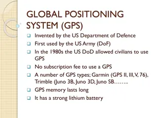
The Global Positioning System (GPS)
Explore the history, satellite constellation, and motivations behind the Global Positioning System (GPS). Learn about how GPS plays a crucial role in navigation, its military origins, and the technological advancements that led to its development and deployment. Discover how GPS has evolved from its inception during World War II to becoming a vital tool for location tracking and mapping today.

Download Presentation

Please find below an Image/Link to download the presentation.
The content on the website is provided AS IS for your information and personal use only. It may not be sold, licensed, or shared on other websites without obtaining consent from the author. If you encounter any issues during the download, it is possible that the publisher has removed the file from their server.
You are allowed to download the files provided on this website for personal or commercial use, subject to the condition that they are used lawfully. All files are the property of their respective owners.
The content on the website is provided AS IS for your information and personal use only. It may not be sold, licensed, or shared on other websites without obtaining consent from the author.
E N D
Presentation Transcript
Lecture 14.01 The Global Positioning System (GPS) LaACES Student Ballooning Course
What is GPS? GPS (Global Positioning System) is a constellation of satellites that orbit the Earth Each satellite completes two orbits a day in one of six orbits Orbits designed so there are 6 satellites in view from most places on Earth A GPS device allows a user determine his/her position by receiving the signals from multiple satellites LSU rev20211031 L14.01 2
GPS Satellite Constellation GPS Satellite Constellation There are currently 31 operational satellites in the 24-slot constellation (6 orbits x 4 slots) These satellites orbit in 1 of 6 orbital planes These planes have an altitude of ~ 20,200 km Each satellite orbits the Earth twice a day In 2011, the Air Force completed the Expandable 24, a constellation expansion. 3 planes expanded to allow an extra satellite became part of the constellation baseline. GPS is now, effectively, a 27 slot constellation Figure 1: Shown is 24-slot satellite constellation. This configuration ensures that GPS users can view 4+ satellites from almost any point on the planet LSU rev20211031 L14.01 3
Motivations Behind GPS Motivations Behind GPS World War II and the Cold War provided the justification for countries to research, develop, and deploy various navigational systems Some predecessors to our current GPS include: LORAN, Decca, Sputnik 1, TRANSIT, SECOR, Timation satellite, and OMEGA Development of these systems were driven by the military. Better systems were needed for missile accuracy and navigation for ships, submarines, and aircrafts LSU rev20211031 L14.01 4
GPS History GPS History 1973: GPS project launched Created/owned by the United States government, operated by the Air Force Cold War arms race justified the billions of dollars to research, develop, deploy, and operate a constellation of navigational satellites Ballistic missile submarines needed accurate fixes of their positions before launching. Intercontinental ballistic missiles and strategic bombers required a more accurate and reliable navigational system Inventors: Roger L. Easton (Naval Research Laboratory), Ivan A. Getting (Aerospace Corporation), Bradford Parkinson (Applied Physics Laboratory) 1978: First satellites launched into orbit 1995: Full constellation of satellites in orbit LSU rev20211031 L14.01 5
Selective Availability Selective Availability In the 1990s, the US government degraded GPS accuracy for civilians on a global scale (Selective Availability) President Clinton turned off Selective Availability in May 2000 According to the US government, they have no intention to ever use Selective Availability again Civilian Restrictions Receivers capable of operating above 18 km and 515 m/s or that are designed / modified for use with missiles require a State Department export license These devices are classified as weapons Disabling operations above the limits exempts the receiver from a weapon classification LSU rev20211031 L14.01 6
Non Non- -US Positioning US Positioning Systems Systems Russia GLONASS (Global Navigation Satellite System) Global coverage since 2000s. Currently being restored to full availability European Union GALILEO 30-satellite system to be completed by 2020 China BeiDou Navigational Satellite System Global coverage since December 27, 2018 Japan QZAA (Quasi-Zenith Satellite System) Currently only 4 satellites in orbit regional coverage India NAVIC (Navigation with Indian Constellation) Currently 7 satellites in orbit regional coverage Different countries systems can be added to GPS devices Multi-Constellation devices are called GNSS More available satellites = quicker and more accurate fixes LSU rev20211031 L14.01 7
How Does GPS Work? Trilateration used by GPS receivers to calculate their position GPS satellites broadcast radio signals that include their location and time Satellites time is very accurate due to atomic clocks onboard GPS devices receive these signals and use the arrival time to calculate the distance between themselves and a satellite D = speed of light * (t received t transmitted) Figure 2: Shown are three satellites. For the trilateration example, we will assume these are the satellites observed by a GPS receiver LSU rev20211031 L14.01 8
Trilateration Trilateration All of the possible points from a single location create a circle For satellite 1, we can draw a circle with radius D1 around it. The GPS receiver must be somewhere on the circle Same process for satellites 2 and 3 Since the GPS receiver must be somewhere on each circle, the intersection of these circles is the receiver s position D3 D1 D2 Figure 3: Shown are the circles that represent the distance from each satellite. The intersection of the three circles, as shown by the red arrow, is the location of the GPS receiver LSU rev20211031 L14.01 9
Trilateration Continued Trilateration Continued We live in a 3D world, so each satellite is actually in the center of a sphere, not a circle The intersection point of all spheres is the position of the GPS receiver, but there are 2 intersection points with 3 spheres To achieve a fix in all dimensions, a GPS receiver must be receiving information from 4 satellites Figure 4: Top The intersection of 3 spheres is two points, not one point. This means 3 satellites are not enough to obtain a 3D fix Bottom Shown are the spheres that represent the distance from each satellite. It is the intersection of 4 spheres that give a GPS receiver its position LSU rev20211031 L14.01 10
Finding Your Position Summary GPS receivers get time and location information from satellites. By calculating the distance from themselves to each satellite, a receiver can find their position With 3 satellites in view, a GPS receiver can determine its latitude and longitude. This is called a 2D fix With 4 satellites, a GPS receiver can find its latitude, longitude, and altitude This is called a 3D fix Figure 5: A GPS receiver needs 4+ satellites in view in order to calculate its latitude, longitude, and altitude. Once the receiver knows its position, it can calculate other information like speed or distance to destination LSU rev20211031 L14.01 11
GPS Accuracy GPS Accuracy Although GPS satellites are required to broadcast their signals with a certain accuracy, a device s accuracy depends on a variety of factors Clock Errors Atmospheric Conditions Satellite Geometry Signal Blockage Receiver Quality Most smartphone GPS are accurate to within 4.9m (16ft). This accuracy gets worse near large objects, such as buildings and trees High precision GPS receivers can be accurate to within a few centimeters LSU rev20211031 L14.01 12
Clock Errors Clock Errors Satellite clock errors: GPS satellites have atomic clocks on board. These are extremely accurate but can drift. This drift produces errors The errors are minimized by calculating clock corrections at monitoring stations. These monitoring stations transmit their corrections + the GPS signal to GPS receivers Receiver clock errors: GPS receivers don t have atomic clocks; they have quartz crystal clocks. These are less stable and less accurate The error from this clock is eliminated by comparing the arrival times of two satellites whose transmission times are known exactly. LSU rev20211031 L14.01 13
Atmospheric Conditions Atmospheric Conditions Changes in atmospheric conditions affect the speed of GPS signals as they pass through different layers of the atmosphere The transmission can slightly bend like light trough a prism These speed changes result in errors in position and time When a satellite is directly overhead, these errors are minimized. Satellites near the horizon have a longer atmospheric path for their signals, so these errors are greater Figure 8: Shown is an exaggerated view of the GPS signal path. Traveling through the atmosphere causes delays and deflections of the GPS signal LSU rev20211031 L14.01 14
Atmospheric Conditions: Atmospheric Conditions: Ionosphere Ionosphere In the ionosphere(layer of charge particles in atmosphere), GPS signals are both deflected and delayed. Due to the varying density of the ionosphere, the delays and deflections aren t consistent over the signal s path Based off ionosphere models, GPS monitoring stations calculate and transmit corrections to satellites. This removes about 75% of ionosphere errors The ionosphere delay of a signal depends on the signal s frequency. By measuring the delay in multiple frequency bands, the dispersion error can be calculated LSU rev20211031 L14.01 15
Atmospheric Conditions: Atmospheric Conditions: Troposphere Troposphere The delay caused by the troposphere depends on temperature, pressure, humidity, and the locations of the receiver and transmitter It is not frequency dependent. This means, unlike ionosphere errors, using multiple frequencies cannot remove this error Hydrostatic component Dry gases in the troposphere cause errors. The error varies with temperature and pressure, but can be calculated using ideal gas laws Wet component Water vapor and clouds also cause delays. The delay is small (10s of cm) but varies fast and is harder to model LSU rev20211031 L14.01 16
Satellite Geometry Satellite Geometry Geometric Dilution of Precision (GDOP) is error caused by viewing satellites that are too close together Figure 6 shows an example of this principle In A, someone has measured their distance from two landmarks, and then drawn circles with corresponding radii around the landmarks. Their position is the intersection of the circles In B, they have included error bounds in their circles. Their position is anywhere within the green shaded region C is the exact same as B, but the landmark positions have changed. Because of the landmarks positions, the error of the user s position has increased drastically Figure 6: Shown is an example of DGOP. A user knows the distances between themselves and two landmarks (red and blue dots) A) By drawing circles around the landmarks corresponding to the known distances, the user can pinpoint their location as the circles intersection B) There are errors associated with the distance measurements. This means there is uncertainty in the user s position. The user s position is somewhere in the green shaded area C) With poorly positioned landmarks, the area containing the user s position in can grow. This is Geometric Dilution of Precision LSU rev20211031 L14.01 17
Signal Blockage Signal Blockage Satellite signals can be blocked by buildings, bridges, trees, etc. Using GPS underground or indoors can also degrade the signal Having difficulty inside? Move the receiver closer to a window Reflected signals also cause errors; this is called multipath. The original signal is blocked, but the receiver receives a reflected signal Less common signal degradation culprits: radio interference, solar storms, satellite maintenance Figure 7: Shown is an example of multipath. The real GPS signal is blocked from the receiver by a tall building. Another GPS signal is reflected off a second building and is then received by the user. Using this signal would result in incorrect position information for the receiver LSU rev20211031 L14.01 18
Receiver Quality Receiver Quality GPS receivers that use more than one frequency result in more accurate positions than receivers only utilizing one frequency Military receivers use dual-frequency Most civilian receivers only utilize one frequency for GPS signals Dual-frequency GPS receivers are available for civilian use, but they are expensive. This has the effect of limiting the civilian use of dual-frequency GPS receivers to mostly professional applications LSU rev20211031 L14.01 19
Differential GPS (DGPS) Differential GPS (DGPS) DGPS is a system that provides corrections to position data. By using a fixed, known position of a GPS base station, a receiver can adjust real time GPS signals to eliminate errors This can result in accuracies on the centimeter level DGPS corrections are only applicable for positional data Useful for surveying work Figure 9: Shown is a caricature of DGPS. A receiver uses the normal 4 satellites to calculate its position. Then, signal from a beacon with a fixed, known location is used to help eliminate errors LSU rev20211031 L14.01 20
GPS Applications Location Navigation Tracking Mapping and Surveying Time Synchronization LSU rev20211031 L14.01 21
GPS Communication GPS signals encode data for receivers. A receiver can request specific types of information. The standard format for the transmitted information is a National Marine Electronics Association (NMEA) sentence NMEA Sentences are text strings with predefined data in a certain order separated by commas There are multiple NMEA sentences. The main 6 are: RMC, GGA, GLL, VTG, GSA, and GSV LSU rev20211031 L14.01 22
NMEA Sentences: NMEA Sentences: Information provided Information provided RMC Recommended Minimum Time, status, latitude, longitude, speed, track angle, data, magnetic variation GGA Essential data Time, latitude, longitude, fix quality, number of satellites being tracked, HDOP, altitude, height of geoid, time since last DGPS update, DGPS station ID number GLL Geographic Latitude and Longitude Latitude, longitude, time, status VTG Velocity Made Good True track, magnetic track, ground speed GSA GPS DOP and active satellites Fix status, PRNs of satellites used for fix, PDOP, HDOP, VDOP GSV Satellites in View Number of satellites in view, satellite PRN number, elevation, azimuth, SNR LSU rev20211031 L14.01 23
NMEA Sentence: NMEA Sentence: GGA Layout GGA Layout $GPGGA,hhmmss,llll.ll,a,yyyy.yy,a,x,xx,x.x,x.x,M,x.x,M,x.x,xxxx*hh 0 , 1 , 2 ,3, 4 ,5,6,7, 8, 9,10,11,12,13,14 15 1. hhmmss.ss Time of fix hh:mm:ss UTC 2. llll.ll Latitude: ll degrees 07.038 minutes 3. a Direction. N = North. S = South. 4. yyyy.yy Longitude: 11 degrees 31.000 minutes. 5. a Direction. E = East. W = West. 6. x Fix quality: 0 = no fix. 1 = GPS fix. 2 = Differential GPS fix. 4 = Real-Time Kinematic (RTK) fixed integers. 5 = RTK float integers. 6 = Dead reckoning. 7 = Manual input mode. 8 = Simulator. 9 = WAAS. 7. xx Number of satellites being tracked 8. x.x Horizontal dilution of position 9. x.x Altitude 10. M Meters (units for 9) 11. x.x Relationship between geoid and WGS84 ellipsoid 12. M Meters (units for 11) 13. x.x Time (seconds) since last DGPS update 14. xxxx DGPS station ID number 15. *hh Checksum LSU rev20211031 L14.01 24
NMEA Sentence: NMEA Sentence: RMC Layout RMC Layout $GPRMC,hhmmss,A,llll.ll,a,yyyy.yy,a,x.x,x.x,ddmmyy,x.x,a,A*hh 1. 2. 3. 4. 5. 6. 7. 8. 9. 10. 11. 12. hhmmss.ss A llll.ll a yyyy.yy Longitude: 11 degrees 31.000 minutes a x.x x.x ddmmyy Date of fix x.x a A valid. *4A Checksum Time of fix hh:mm:ss UTC Signal status. A = Active Signal. V = Void, no signal. Latitude: ll degrees 07.038 minutes Direction. N = North. S = South. Direction. E = East. W = West. Speed over ground, knots Track angle (degrees, True) Magnetic variation 20.3 degrees Magnetic variation direction Positioning system mode indicator. A = autonomous. D = differential. E = estimated. M = manual input. N = data not 13. LSU rev20211031 L14.01 25


")